• Hello, please take a minute to check out our awesome content, contributed by the wonderful members of our community. We hope you'll add your own thoughts and opinions by making a free account!

Pattern Ninovember

Got into the low 70's this afternoon, and I'm wearing a long sleeved shirt to keep the dirt off my arms, and my hands are just chewed up by Tiger mosquitos. Had to come in for deet. We need a Little Ice Age. Let me see those suckers come back after the Flint froze all winter, and the Hooch.
 
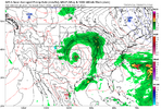
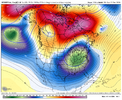
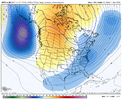
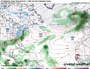
No snow up here, but impressive storm out this way next week!!View attachment 199159
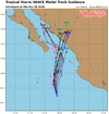
Yeah supposedly it's related to the Pacific again like Polo and Simon

22E_tracks_latest.png

Now it's a lot weaker than Polo and Simon was but Simon caused a huge flood west of me a couple weeks ago. Funny how there's been zero weather ever since

It'll be interesting to see if we get a moisture flow off the Pacific again. That was the thing with Simon that everyone was noticing. You could trace it back
 
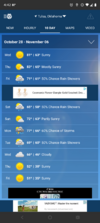
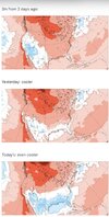
Yeah looking at the wunderground forecast, maybe there’s some hope that this warm up will only be around a week before it’s back to normal temps.

Only thing that sucks is the rain situation but goodness the past couple of weeks has really been terrific weather. Wish I could’ve spent even more of it outside.
 
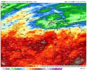
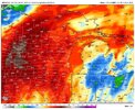
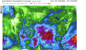
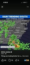
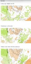
Well lets see where this ends up 1 month from today. Looking at the ensembles and Ops out through mid month on the qpf charts, that pesky doughnut hole is still very noticeable. If you are in carolina's /Ga east of apps your lucky if you get painted with 1.0 over the next 15 days.

How November unfolds will tell us a lot. Got to confess I'm getting this uneasy feeling that things are not gonna shake out as what should be expected with a strong el nino. Im not talking about winter wx/ cold wise. Ive learned from past couple el nino's to run the other direction from them as a catalyst for Cold which is needed for frozen. But this would be the first I will expierence if it doesnt deliver on the qpf goods. This thing is so strong its gonna behave some how some way out of the parameters in some regions that one would normally expect. My fear ( which is low for now) is we dont get the qpf goods over next 5 months. It's still early, but when we flip the calendar to December 1st, if things haven't changed and models 15 days out look like they do this morning. That fear factor of mine is gonna be elevated. You would think we should be in store for some qpf/ even convective fronts during November. Things change in modelology on a dime, but we should start seeing some eveidence of the stj coming to life as we roll through November.

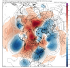
Good news is, we are going to have stellar weather all month. Great time to be outdoors no doubt. Those Omega Blocks are nice to look at on the 500mb charts. But blocking / blocks warm pac originated air from escaping just as easily as it does cold polar air.
 
Gonna go with seasonal temps for Nov for my area. If i Had to tip the scale, it would be toward +1.
Qpf Im going below normal again. If we can scratch out 1.50-2.0 by Nov 30th it will be a win. Just dont see any evidence yet of the pattern shaking out of the funk its been in.
The pv getting stretched disrrupted should deleiver some chilly air perhaps but not artic air. Will be fantastic outdoor wx this month. Bummer is working from dark to dark during the week. Have to take some lunchtime walks
 
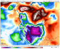
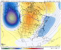
Todays Modelology Highlight comes from the CFS. Delivers a double punch for some Thanksgiving week. Second blow would be lights out ice and several of us cooking that bird off a smoker or deep fryer cause the ole stove wouldnt have any juice to it. Entertaining to look at.

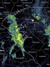
Caught about 10 or so drops on the windshield coming in to work this a.m. Looks like foothills mtns got a nice shower. Congrats.
 
If we are going to sneak in some cold id favor Thanksgiving into early December
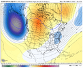
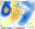
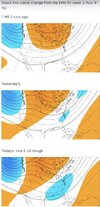
Agree SD. AAM momentum surge into the subtropics / momentum sink in high latitudes during mid-late Nov. That combines with downward drip of the strat weakening / SSW - leads to -AO/-NAO blocking later Nov / early Dec with Pac jet stream dropping south - wetter along California into the SE, cooler temps
 
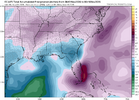
12z Euro Op breaks the doughnut hole curse by mid month. Ways out, but finally a euro op run showing some qpf light at the end of the tunnel. El nino is getting it done out in the west and south Florida today. Epic flooding. saw like 22 inches somewhere down in south Florida
 
12z Euro Op breaks the doughnut hole curse by mid month. Ways out, but finally a euro op run showing some qpf light at the end of the tunnel. El nino is getting it done out in the west and south Florida today. Epic flooding. saw like 22 inches somewhere down in south Florida

937b6528e0ff99444646233e39d94410.gif

Fire hose on the east coast of FL today, low NW of Havana doing some work.


Sent from my iPhone using Tapatalk
 
Agree SD. AAM momentum surge into the subtropics / momentum sink in high latitudes during mid-late Nov. That combines with downward drip of the strat weakening / SSW - leads to -AO/-NAO blocking later Nov / early Dec with Pac jet stream dropping south - wetter along California into the SE, cooler temps
Griteater, will that matter for most other than higher elevations for any chance at wintry weather since its still so early in the season during that time frame?
 
Back
Top