• Major software update has been applied. Please let us know if you run into any problems.
  • Hello, please take a minute to check out our awesome content, contributed by the wonderful members of our community. We hope you'll add your own thoughts and opinions by making a free account!

Pattern NC Only Thread

Yeah man the last 13-14 months have been about as bad as it gets, I thought missing the big snow in Jan was going to be the peak but no no we were just getting started.
Yeah 92 on Oct. 14th, extreme drought rolls on.... we've reached next level suckage for sure. I'm not 100% sure this super el Nino is gonna deliver the precip as expected either, only because no one and no models have really ever dealt with one of this nature before.
 
Last edited:
Parking this offshore for days is bad for erosion good for our weather. Backing it SW or west or a time would make things really spicy but I dont think the pattern has the umph to drive that.
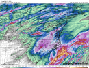
Euro slid a little more east but still better than the 16 day no qpf models were showing. Let's just hope it doesn't sit there just out of reach and spin for days, I might just lose it
 
I'd assume MHX and ILM will start hoisting marine advisories with the afternoon package, rapid refresh is Gale conditions for the sounds late Saturday in to Sunday, and pushing Storm criteria for offshore waters. It's a sustained onshore fetch as the low just kind of sits there off Lookout, which isn't going to bode well for Hwy 12.
 
I'm guessing it stays too far offshore to really affect many of us outside coastal sections.

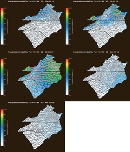
You forgot the "it has to rain on the weekends" pattern that started this month. Pattern just wants to rain on WNC on Saturdays now. It would be hilarious if this weekend was modeled to be clear and beautiful, but then a subtropical system pops up at the last second and dumps an inch of rain on us on Saturday. 🤣
 
The AI Euro sure hasn't seemed to give up on the system this weekend

Indeed Shaggy although the 12Z UKMET and Icon have it much further offshore than 0Z. And the 12Z CMC has an E coast storm for the first time. Also, the 12Z Euro is the 3rd 0Z/12Z run in a row with it (6Z/18Z still have never had it anywhere near E coast oddly enough…they go out far enough to be able to tell).
 
Looks like My "last weekend" of King Fishing will be a GAIL wipe-out on the pier, Might have too "Old Drum" fish this weekend..

**
Pattern starts to change late
Friday, as gradient winds increase ahead of a cold front. Front
moves through very early Sat morning, allowing the winds to
quickly veer from SW to the N, gradually veering even more to
the NNE through the day Saturday into Sunday. Seas will ramp up
in increasing winds ahead of the front through late Fri and
will peak late Saturday into Sunday, ranging from 4-8 ft over
the coastal waters out to 20 nm, to 8-13 ft over the offshore
waters out 60 nm.**

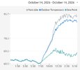
Woomp Woomp.. Currently..

78F at Da pier..

SSW At 8mph..
Humidity 86%
Pressure 30.25 in
Dew Point 73°

For the Swamp assed Coast, (It's actually pleasant) If your on the Pier..
 
Indeed Shaggy although the 12Z UKMET and Icon have it much further offshore than 0Z. And the 12Z CMC has an E coast storm for the first time. Also, the 12Z Euro is the 3rd 0Z/12Z run in a row with it (6Z/18Z still have never had it anywhere near E coast oddly enough…they go out far enough to be able to tell).
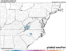
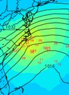
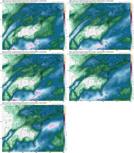
EPS is quite active and close to shore

Screenshot_20261015_170307_Chrome.jpg
 
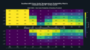
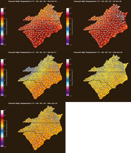
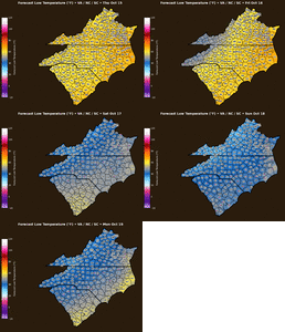
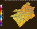
RDU set a record high today but only got to 89 (unless there's a late update like yesterday). Forecasted high tomorrow is 91, so one more shot at the latest 90 degree day. Then the 30 degree drop, which means everyone sensitive to sudden wx changes won’t be having a good time this weekend.
 
Back
Top