• Hello, please take a minute to check out our awesome content, contributed by the wonderful members of our community. We hope you'll add your own thoughts and opinions by making a free account!

Pattern NC Only Thread

I was at the top of Beech Mountain for 6 hours on Friday and observed the following conditions
- Drought - extremely dry
- Timber was stressed - leaf litter everywhere, some color - mostly brown
- Air was stagnant - and not moving - distance identification was hard (looking directly south - could barely see Sugar Mountain resort)
- Was hot at 5000' - temp on the property read 84
- Creeks, rivers, small ponds were still wet but down quite a bit - clearly a water issue in the area

We left at 4pm and went to eat at the Daniel Boone Inn in Boone and the bottom fell out with heavy rain. Nice drive back to CLT and saw half a dozen rainbows alone the way. This heat dome really showed its muscle in the mountains.
 
Last edited:
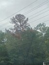
Extreme sw wake is struggling. Whole trees starting to die. Mostly loblollies. But also seeing tulip poplars maples river birch and sweet gum starting to drop leaves early.

When stressed (pine) will extrude sap, and then attract beetles which can injure the tree - but if they are mature and deep rooted they should be ok and recover. As I said to SD earlier this summer - each t-storm brought more leave litter and broken limbs than anytime that I can remember. We have had .30 of rain in 20 days, while the temps were blazing.
 
Today was supposed to be Patchy fog before 9:00 a.m. then Sunny with a high of 87 the rest of the day and it has been sprinkling for the last 4 hours with some heavier rain down there with the coast they can't get a forecast right this year
 
Last edited:
When stressed (pine) will extrude sap, and then attract beetles which can injure the tree - but if they are mature and deep rooted they should be ok and recover. As I said to SD earlier this summer - each t-storm brought more leave litter and broken limbs than anytime that I can remember. We have had .30 of rain in 20 days, while the temps were blazing.
I hope that’s the case. In Cary I drove through and noticed some loblollies recovering. But they’ve had more rain there. In my area whole pines have died which is sad.
 
When stressed (pine) will extrude sap, and then attract beetles which can injure the tree - but if they are mature and deep rooted they should be ok and recover. As I said to SD earlier this summer - each t-storm brought more leave litter and broken limbs than anytime that I can remember. We have had .30 of rain in 20 days, while the temps were blazing.
The pines down here have dropped their needles and and many many more are still brown. Some hardwoods following suit despite a good bit of rain over the last monthScreenshot_20260920_154736_Gallery.jpg
 
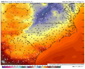
The latest 0z EPS has RDU hit 91 today and 83ish for a high tomorrow. Then it never gets higher than 77 out through the remainder of its run well into the 1st week of October.

The Euro Op is a little more toasty . Has Nashville at 91 and low 80's for RDU the day 10-15 period.

One thing that's glaring watching the ensembles and Ops is how much we avoid the heat east side of Apps verse the west side, TN especially and up and down Miss River territory.

Counted 4 Noreasters on the latest cfs. This winter may end up huge MA into NE, have some real big ticket storms if the Atlantic can help out a bit
 
Last edited:
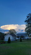
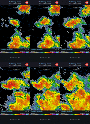
Headed into work this morning a little after 5:00 the Eastern Horizon was littered with cauliflower heads and lightning flashes from storms that were about a hundred miles out to my East
 
Sunny hot, sunny hot, sunny hot, sunny hot, sunny hor, missed rain chance hot, cold front but still above normal, sunny hot, sunny hot, sunny hot, sunny hot, missed rain chance hot
At least you threw a hor in there to break up the monotony
 
Like the CU field getting going from near Albemarle to Henderson, the mountain convection, and the differential heating boundary in southern va today. Chances are anyone south and east of those features is dry today but convection there today should push an OFB SE and leave behind a lot of stratus/fog tomorrow and that boundary seems to be the initiation point for tomorrows storms. No doubt that some folks between today and tomorrow walk away with plenty of rain but it's hard to be enthusiastic about areas along and east of US1 right now.
 
We could really go low on lows Friday and saturday morning but the proximity to the low offshore makes me hesitant. If we can avoid clouds and a breeze widespread upper 40s to around 50 look good with some low to mid 40s possible
 
Indefinite Summer Extension will be allowed to expire overnight Tues night/Wed AM. Bout friggin time.
Yeah today is just as bad as any lately, good grief I'm so over this
 
Back
Top