Avalanche
Member
We need the tropical airmass back here at the coast. No storms since.


Hey side note, what's best website to find accurate up to date info on wildfires or control burns in NC? Very smoky here and I can see a the plume of smoke originating out of Northampton Co on satellite but can't find anything online anywhere
Yeah that's what I was using but has nothing on it yet for that area. Not that big of deal I'm sure, seems relatively small too, but vis sat shows the area in the circle. When you run the loop you can see the smoke drift s/sw right over mby
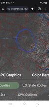
If its recent, it may not have been updated, not sure how the site operates.Yeah that's what I was using but has nothing on it yet for that area. Not that big of deal I'm sure, seems relatively small too, but vis sat shows the area in the circle. When you run the loop you can see the smoke drift s/sw right over mby
View attachment 198109


Hottest first half of September on record.I'll look at the data later this month to verify, and I'm sure we've had worse years in September heatwise. But this year just seems worse for whatever reason on heat. 90 something half the days. Had some cooler ones yea, but basically just a tease making you want more. Looking forward to brisk, breezy days that make you wish you put on another layer. Fall can't get here soon enough.
Doesn't surprise me. Was wondering if it was hotter than 2019. But either way, it's been a miserable month.Hottest first half of September on record.
It didn't make the top 10 first halves we are +4 warmer.Doesn't surprise me. Was wondering if it was hotter than 2019. But either way, it's been a miserable month.
Amazing that we had a major flooding rain 10 days ago and the grass is browning out already. Soil type for the loss!!Ground is dry again. Hope SD is right!!
I looked and yea I see it now. Looks like 2019 was more notable for the 2nd half of the month. Forgot about that. First half was above normal but not crazy..It didn't make the top 10 first halves we are +4 warmer.
You look to be in a great spotCAMs developing a common cold pool today makes things a little more spicy. If you want heavy rain best places to be are at the initiation point to about 30-50 miles south. Seems like once these storms mature they are going to shoot OFB's south pretty quickly which means we likely start seeing storm depth and duration decrease as the pop on the OFB then quickly spread out and lose intensity. Along the sides of the ofb if we get the CCP might be another place for some heavier rain as cell motion is SE and that part of the OFB may not be getting undercut by the stable cooler air and the SSE to SE cell motion may provide a little training. Should end up with a decent area of stratiform later this afternoon behind the main line.
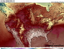
Nice to see the higher rain totals on the models, at this point there are numerous models with more rain that I have seen in the last 60 days some of the CAMs beat my 60 day total in the next 24 hours. At models are trying to show weather weathering in the next couple of weeks instead of the ridge doldrums we have had for 3 months
I hopeYou look to be in a great spot
They must have not looked at the radar. Something is legitimately preventing it from raining
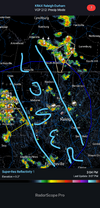
Yes. Most of Triad caught a good one/ got nailed. Depends on perspectiveWas that 69 mph gust at GSO legit? Appears so.
Guilford/Randolph getting rocked. You near Randleman?Yes. Most of Triad caught a good one/ got nailed. Depends on perspective
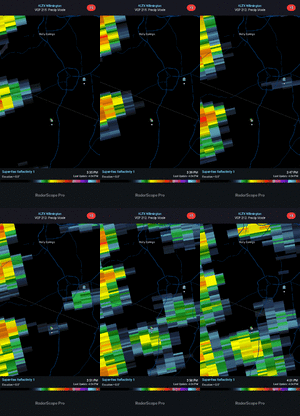
Another day, another swing and a miss. Honestly - what's the atmospheric reason behind this, or is it just coming up snake eyes again and again?They must have not looked at the radar. Something is legitimately preventing it from rainingView attachment 198137


Maybe for you 0% chance it gets herePatience the stuff that is in Henderson is heading our way just be patient
Sent from my iPhone using Tapatalk