• Hello, please take a minute to check out our awesome content, contributed by the wonderful members of our community. We hope you'll add your own thoughts and opinions by making a free account!

Pattern NC Only Thread

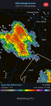
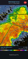
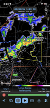
Not sure if you'll reap the benefits or not, but you called it. Watch issued and radar starting to get interesting. 👀
Lets see what the ofbs do and what happens with the stuff in Central va. Better support is coming but this isn't July so we are racing losing instability this evening
 
giphy.gif
 
You can't ask for a much better setup than we have. The old mcv and ofb are going to hold off until after 18z, not much debris ahead, sb cape over 3k already , ml cin eroding. Dcapes over 1100 today, if this starts getting linear and organized it's going to have a heck of an ofb ahead of it and we should get a few higher end wind gusts. Wouldn't be surprised to see it a little similar to last night where the ofb kicks S or even SW while cell motion is to the SE and maybe a little bit of training with a few 3+ inch rain totals
 
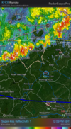
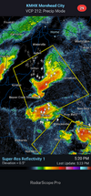
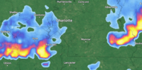
There’s not a chance in hell that line holds together all the way through Rowan county.
It always breaks apart and reforms south of Salisbury.IMG_0426.png
 
I don't like what I'm seeing at all. Crazy that it's 100 degrees and cape to the moon and this is just going to do nothing.

Guess its hoping for some miraculous hail Mary tomorrow. Lol sad
 
There’s not a chance in hell that line holds together all the way through Rowan county.
It always breaks apart and reforms south of Salisbury.View attachment 197883
.01” it can’t get anymore absurd. No meaningful rainfall since August 21st and August 6th before that and been fringed over a dozen or more times this year.
 
It's legit. Just had a tree branch fall outside my apt taking out part of a gutter. 🤣
So the pre front line was greater than actual event. Fizzled out. Shocker!

Branch no big deal. Just clipped gutter and no roof damage. Not a dead one but not healthy. Probably would have come down soon with a well placed gust or if actually got some ice accrual this winter.
 
Sharing in the frustration from yesterday’s event—it broke two more 4-inch DBH branches, left a mess, and I barely got 100 raindrops out of it. What I don’t understand is how the Charlotte urban heat island (UHI) wasn't a major factor here. Another user brought up the 'classic split,' which is fine, but how does that actually work in practice? I’m not buying the idea that there wasn't enough atmospheric energy to fuel that incoming line of storms. From what I saw, the line was moving incredibly fast and completely outran the actual front, which might explain some of it. Still, the heat island effect was practically non-existent. I’ve researched this for years, and while science documents the UHI effect as a proven fact, I rarely see it play out like that in reality. I have also in parallel - AI'ed the schit out of this subject, and the variables are endless with never ending possibilities.

Just another pissed off customer of this weather pattern

 

Attachments

  • Screenshot 2026-09-06 075511.png
    Screenshot 2026-09-06 075511.png
    2 MB · Views: 7
Last edited:
Back
Top