• Hello, please take a minute to check out our awesome content, contributed by the wonderful members of our community. We hope you'll add your own thoughts and opinions by making a free account!

Pattern May-hem

Confusion over watch coverage area shown in two images above.

One is for the entire state: https://s16.postimg.org/3p51e27et/Screen_Shot_2017-05-24_at_10.58.18_AM.png

One is for middle to south GA: https://pbs.twimg.com/media/DAmbpIDXoAAn1Gw.jpg

Which one is accurate? The second one doesn't have a watch # or timestamp, so.. ?
Look at this page: http://www.spc.noaa.gov/ - the upper right; click watches; looks like 2 different watches but between them covering GA.
 
Confusion over watch coverage area shown in two images above.

One is for the entire state: https://s16.postimg.org/3p51e27et/Screen_Shot_2017-05-24_at_10.58.18_AM.png

One is for middle to south GA: https://pbs.twimg.com/media/DAmbpIDXoAAn1Gw.jpg

Which one is accurate? The second one doesn't have a watch # or timestamp, so.. ?
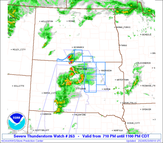
Both are valid watches, and go to the same time. Here is the matching image for the other watch.
ww0263_radar.gif
 
Enhanced Risk area expanded north and west and now includes much of NC.
Edit: ^ Ninja'd! :)
 
Looks like things should be rocking here starting around 6:00.

FB_IMG_1495643160213.jpg
 
Both are valid watches, and go to the same time. Here is the matching image for the other watch.
ww0263_radar.gif
I believe you said earlier this covers every county but one in Ga, looks like a tiny little county in the NW section..... unreal.
 
Guarantee that gusts are reaching this alert level:

... Significant weather advisory for Alachua... Bradford... west central
Putnam... southern Baker and Union counties until 100 PM EDT...

At 1217 PM EDT, Doppler radar was tracking strong thunderstorms along
a line extending from near Palestine community to 7 miles northeast
of Williston. Movement was northeast at 40 mph.

Wind gusts of 40 to 50 mph can be expected along with possible minor
wind damage.

Locations impacted include...
Gainesville, Starke, Lake Butler, Keystone Heights, Raiford, Melrose,
Worthington Spring, Alachua, Hawthorne and Glen St. Mary.
 
That line is moving very slowly. It is probably going to have time to develop into something worse, or not. Also on another note, our lake here has gone up a foot since the system started, so good news on the drought relief. I expect a downgrade in the drought across the upper Southeast. Too bad the areas that need it aren't getting too much.

The sun is starting to come out now, so here we go with the instability building.
 
At 1217 PM EDT, Doppler radar was tracking strong thunderstorms along
a line extending from near Palestine community to 7 miles northeast
of Williston. Movement was northeast at 40 mph.

Wind gusts of 40 to 50 mph can be expected along with possible minor
wind damage.

Locations impacted include...
Gainesville, Starke, Lake Butler, Keystone Heights, Raiford, Melrose,
Worthington Spring, Alachua, Hawthorne and Glen St. Mary.

Hoping you are getting some much needed rainfall with all of the storms passing through.
 
It's downright chilly in Raleigh right now.
Well per the NWS morning update you are south of the wedge front so you shouldn't be chilly ;) Details below give you a sense of just why this is such a complex scenario

Three noteworthy features can be seen on the latest surface
analysis: a roughly west-east wedge/CAD frontal zone across the
northern Piedmont, a warm front lifting into southeastern NC, and a
cold front to our west through the W Ohio Valley and lower Miss
Valley. The latest high-res models take the wedge front northward
gradually this morning, with expectations that the warm/maritime
tropical front will rapidly retreat and potentially merge with the
wedge front across the central/western piedmont this afternoon. And
finally, the west-to-east passage of the cold/occluded front
(featuring a triple point low tracking near or just NW of the Triad)
very late evening through the overnight hours.
It's always a complex scenario around here now when it comes to any type of severe weather and winter storms.
 
Is the AN temp streak gonna come to an end this month?

Based on projections I've seen, the best chance for the AN streak to end is in W AL, MS, and W TN. Most of the posters here, especially E GA, SC, and NC, should end up in the 0 to +2 area thus continuing the streak of AN even though this will end up as a near normal month. But with still a week to go, there's room for enough error to cool things enough to get some barely BN.

Aside: nice steady rains here with rumbles of thunder. Nothing severe so far. Congrats to Phil on his heavy rains.
 
Based on projections I've seen, the best chance for the AN streak to end is in W AL, MS, and W TN. Most of the posters here, especially E GA, SC, and NC, should end up in the 0 to +2 area thus continuing the streak of AN even though this will end up as a near normal month. But with still a week to go, there's room for enough error to cool things enough to get some barely BN.
:cool::D:p - Great point, Larry!
 
You think the wedge will scour out as forecast or will it possibly hinder development? Looks to be hanging tough up this way....
Honestly it always seems in this scenario the cooler air wins so I would guess that's what happens again. Then again we are in need of an extreme amount of cape

Sent from my SM-G928V using Tapatalk
 
RAH said the storms should be in central NC between 3 and 8.
 
Back
Top