SuperNET
Member
75° dewpoint is coming after you

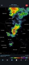
It looks like we get left out today. Everything is to our east and west and moving north. Locally, Greenville gets soaked while Spartanburg, Gaffney, and Union stay dry. Chester and York also wet.should get some decent storms over this way today. half inch last night, nearly 3" in the last 7 days. 2.79" in 2 hours up on Bearwallow Mtn last night


Yep..between comer and Crawford, which isnt shown here, they had to have between 6 and 10 inches yesterday. Gsp Radar estimates more than 14 inches in spots since the 20th. Getting some more today too. Nothing like yesterday with increased storm motion but picked up another 0.12 with storms trying to line up to the south. Incredible turn around here from the past few months of being bone dry.Athens and east as well as the W part of Augusta metro had some of the heaviest amounts overall in GA for the 24 hours ending at 7AM this morning per Cocorahs reports:
Athens and east: 1.5-5”
View attachment 196160
W part of Augusta metro: 2-4”
View attachment 196161


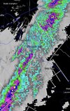

Nothing much down here in Jonesville yet and storms may just stay to my south.Dumped again should have more coming. It was incredibly humid today

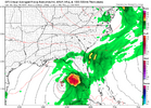
Don't give them any ideas. It spins there for the next 40 hours.If I didn’t know any better I’d think a weak TD or TS parked itself over the gulf, it won’t stop raining

Big difference up here. I don't have a rain gauge. Got a station west of me .01''. Another station to my east says .00'', so I guess I'll split the difference and say .005'' here. My math says you got 100 times more than me..Another half inch in the bucket this afternoon


You should live up here! After 3” plus of rain last week, we are headed to a Shetley drought relief monitor of “ only a stalling tropical system can save us” mode!Well tomorrow is not going to be wet. Our chance of rain is down to 20%.

I've only received 4.5" for the entire month of May. Every day I see big rain storms to our east and west. So frustrating!!
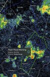
When you can get the slugs of moisture to train, like today, you can make up ground in a hurry. I was in them while you were getting missed. I'm glad they finally found you!Extreme rates of rain! Up to 1.35" today. Make that 1.52".

I feel like this always happens after a dry period, which is why I don’t sweat them anymore.This is one of the greatest drought comeback stories of all time. We were in dire straights a week ago. Now my grass is a foot high and the creek below my house is overrunning the dam again
Up to 2.55" for the week, 4.29" for the month. More to come?When you can get the slugs of moisture to train, like today, you can make up ground in a hurry. I was in them while you were getting missed. I'm glad they finally found you!

I feel like this always happens after a dry period, which is why I don’t sweat them anymore.


Things could be worse. At my residence I've received 1.86 inches of rain and RDU has measured only 1.00 inches. Throw in the snowhole that wiped out what could have been one of the most significant snow accumulations in years and many folks around RDU are about to write off 2026.may 20-26 yielded 4.24
not great for 6 days, ew
Things could be worse. At my residence I've received 1.86 inches of rain and RDU has measured only 1.00 inches.
That seems pretty darn good to me. That’s 3 times as I got the entire month.may 20-26 yielded 4.24
not great for 6 days, ew
Thought we weren't going to get there (and we were probably there early morning, so it was already 5), but now I can say it's the 5th straight day of a period of heavy rain at the house and more might be coming if the stuff to my south doesn't rain out.

Picked up an inch last night with the sub severe tstorm.RDU has missed the boat as far as alleviating the drought with the recent rainfall. RU has only recorded 1.00 inches of rain since last Thursday and is 8.31 inches below normal since January 1st. This puts RDU in practically the same spot it was before this event began.


Areas to the south of Raleigh like your neck of the woods and even my residence towards Southern Wake County have been picking up higher amounts of rain than RDU. Fayetteville received around 2.5 inches while Raleigh only received 1.00 inch.Picked up an inch last night with the sub severe tstorm.