lexxnchloe
Member
Lets hope March ends on a cool note

The 12z Euro was close to a miracle with that system.

It’s a ladyJust use the CONUS view man we don't need to see the entire atlantic
It's been nice, got a few rounds of golf in this week down at Edgewater in Lancaster and here locally at Eagle Chase. Felt good to knock the rust off. Only a fool would have thought the cold wouldn't return. No disrespect intended.Full -nao at the end of the eps, hope everyone enjoyed the recent warmth
April has a shot at being colder than this insanely hot March. It happened in 2012 and 1907. Why not again?Full -nao at the end of the eps, hope everyone enjoyed the recent warmth
I was at Eagle Chase Wednesday afternoon and the wind made me feel like I was playing at Pebble BeachIt's been nice, got a few rounds of golf in this week down at Edgewater in Lancaster and here locally at Eagle Chase. Felt good to knock the rust off. Only a fool would have thought the cold wouldn't return. No disrespect intended.
I think it'll be close, not much warm signal that I can find in the majority of April. Interesting both of those years were transitions from cold to warm ensoApril has a shot at being colder than this insanely hot March. It happened in 2012 and 1997. Why not again?
March 2012 was wild. By March 20 it was summerlike, even with pop up storms. Then a monster heatwave in late June into July and that severe derecho that sent high winds into eastern NC.April has a shot at being colder than this insanely hot March. It happened in 2012 and 1997. Why not again?
I don't remember 2012 much for some reason, but I remember 1997 being the coldest April I've ever experienced around here. It literally felt like winter at times. (without the wintry precip) It was actually kinda dreary. This was near GSO back then, but I would bet the majority of the SE experienced this as well.April has a shot at being colder than this insanely hot March. It happened in 2012 and 1997. Why not again?


On St. Patrick's Day, the leprechaun had better ditch the funny hat and shorts and bring his parka, gloves and toboggan. It will be another dramatic temperature drop from highs in the seventies this weekend to highs in the mid forties by Tuesday. There will be a hard freeze Tuesday night in the RDU area.


 And that's probably with no storms!


It would be nice to see it falling if nothing else. A nice finale before we go hotter than hell until October.21z RAP went nuts...plenty of snow to go around...but looks like accumulations will be hard to come by due to soil temps, near surface air temps, and daytime insolation,
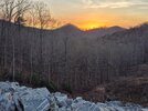
View attachment 195024
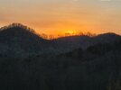
View attachment 195025
After this winter, I cannot believe how easily dry air gets rid of NW flow type snow from sticking, after so many years of dealing with thermal issues and good moisture to this year a lot of dry air with minimal moisture and plenty cold air. While this initial wave looks to be too warm for accumulations, I would watch those post-frontal snow showers coming in around sunset with temps approaching 32 and this time, a lot more moisture than the previous setups (rh of 75-85 percent) with the low cloud cover really socking in that temp/dew point close together. This looks like the type of event that could produce convective snow showers in nature (MUCAPE briefly >100j/kg in some spots off the latest HRRR), and when thinking back to some recent events where I thought the potential was there for these convective post frontal snow showers, the limiting factor was usually very dry air and limited moisture (prevented accumulation) which appears to not be present this time. Something to watch for sure, even as far south as northern AL/GA but especially TN/NC.21z RAP went nuts...plenty of snow to go around...but looks like accumulations will be hard to come by due to soil temps, near surface air temps, and daytime insolation,
View attachment 195024
View attachment 195025
strong winds, hail, tornadoes and snow on the back end. what a finaleIt would be nice to see it falling if nothing else. A nice finale before we go hotter than hell until October.

Interestingly, FFC has removed snow from the grid forecast for my area with this morning's package after advertising it for several cycles. I bet novelty flakes get added back in this evening.Somebody’s getting a coating of snow on top of their hail View attachment 195029
LOL, they did another typo like that during the mauler storm as well. Called for wind gusts of 2535 mph. Punctuation is important.
I bet AI slop has something to do with it.I told you guys those afds are underwhelming now. I know RAH guys lurk, please fix

I think somebody outside the mountains has a nonzero chance of getting a brief coating tomorrow afternoon that is rate driven. Perhaps not from the cold chasing moisture section, but the convective snow shower potential that follows might be able to locally cool the air more and work with low level moisture/some instability. It would be really crazy if some spots could get all 4 main precip types tomorrow (rain/hail/sleet/snow) with hail in the convective storms early and sleet on the transition zone between rain and snow, and perhaps some graupel mixing in with the convective snow showers (if they do manifest).This is just funny. Cold chasing moisture but it actually catches up
View attachment 195051
For folks west of the Apps, that's a real possibility. For us east of the Apps, not so much. The mountains provide us with our beloved CAD but curse us on post frontal changeover situations.This is just funny. Cold chasing moisture but it actually catches up
View attachment 195051