Carolina Fever
Member
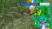
Sorry, tornado warning is for Hoke and Cumberland County. NWS has noticed "robust rotation."


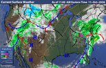
That line of convection that has extended from NC to FL and came through this area as thunderstorms around dawn-sunrise has been just ahead of a cold front pushing E to the S of Isaias’ remnant low (see image below). That’s what was needed to finally bring dewpoints here back down from the 24 hour long oppressive mid to upper 70s to the current low 60s as winds shifted from S to SW to a drier W:
View attachment 198794

Rotation in Cumberland is tighter.


me tooMy phone went off for the tornado warning, but it looks like MBY is not technically in it, a few miles north fortunately.
not here luckily enough. just a lil rain n windWake county cell looks decent
Plenty of time for things to wrap up!not here luckily enough. just a lil rain n wind
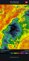
Same here, nothing...Its crazy man I've never seen anything like this is like a damn dome built over my house....sorry thought this was the nc thread my bad View attachment 198800