The hot spot in North Carolina today among regularly reporting stations according to the NWS was Charlotte with a high of 101. I'm surprised that KRDU didn't reach 100 degrees. The highest reading I saw was 98 there.
-
Hello, please take a minute to check out our awesome content, contributed by the wonderful members of our community. We hope you'll add your own thoughts and opinions by making a free account!
You are using an out of date browser. It may not display this or other websites correctly.
You should upgrade or use an alternative browser.
You should upgrade or use an alternative browser.
Pattern JUULY 2025 Smokin Heat Thraad
- Thread starter SD
- Start date
The hot spot in North Carolina today among regularly reporting stations according to the NWS was Charlotte with a high of 101. I'm surprised that KRDU didn't reach 100 degrees. The highest reading I saw was 98 there.
Charlotte evidently hit 102 per this:
CLT :CHARLOTTE : 102 / 78
Link:
Assuming the 102 in that table is accurate:
-that’s the hottest at Charlotte since way back on 7/1/2012!
-there have been only 11 days since 1960 of 102+
-But there were 11 days of 102+ in just the 1950s!
-That link says RDU hit 99 today.
Last edited:
It's hard to heat up such a moist air mass to 100+. Heatwave doing work.
Brent
Member
It's hard to heat up such a moist air mass to 100+. Heatwave doing work.
Yeah that's why we haven't been close yet but the official dewpoint this morning was 77
This is rare for us to not hit 100 yet. Only about 25 July's with zero
Iceagewhereartthou
Member
GSP hit 100 for the second straight day, that doesn't happen often. CLT indeed hit 102 per NWS after 101 yesterday. CAE hit 100 but they have not gotten the brunt of this; normally if GSP is 100 they'll be 103 to 105.
GeorgiaGirl
Member
It did end up hitting 100 at KAGS late in the day. Pretty happy that I went swimming before I left the hotel to erase a day of being outside in this.
101 predicted tomorrow, but if the HRRR is right, clouds might try to bail me out in the evening (or who knows, I might choose to not go outside at all because of storms or heat).
101 predicted tomorrow, but if the HRRR is right, clouds might try to bail me out in the evening (or who knows, I might choose to not go outside at all because of storms or heat).
Wow, that's impressive for Charlotte! My numbers were coming from the hourly observation tables at the NWS website.Charlotte evidently hit 102 per this:
CLT :CHARLOTTE : 102 / 78
Link:
Assuming the 102 in that table is accurate:
-that’s the hottest at Charlotte since way back on 7/1/2012!
-there have been only 11 days since 1960 of 102+
-But there were 11 days of 102+ in just the 1950s!
-That link says RDU hit 99 today.
96, 99, 103, 101 so far
No rain yesterday imby so nothing to hold today under 100, maybe enough CU tomorrow to stop at 98/99, easy 100 on Wednesday, Thursday shouldn't be 100 but probably will be
No rain yesterday imby so nothing to hold today under 100, maybe enough CU tomorrow to stop at 98/99, easy 100 on Wednesday, Thursday shouldn't be 100 but probably will be
Based on hourlies, it’s possible that either or both of Augusta and Columbia had lows of 80. If so (we should know later this morning) and if convection doesn’t bring lower temps than 80 the rest of today, this would mean:
-at Augusta (Bush) it would tie the warmest low for any date since 1945 and would be the warmest July low since 80 in 1990
-at CAE it would tie for the warmest July low since 1893
Edit: CAE’s low was 80 but Augusta-Bush was 78.
-at Augusta (Bush) it would tie the warmest low for any date since 1945 and would be the warmest July low since 80 in 1990
-at CAE it would tie for the warmest July low since 1893
Edit: CAE’s low was 80 but Augusta-Bush was 78.
Last edited:
Shaggy
Member
We are 6 degrees cooler at 9:45am than we were yesterday.
KATL running 3-4 degrees ahead of yesterday so far this morning. Would put 98-99 in range maybe. We will see
Large corn and soybean crops in the Midwest have for the Midwest increased avg RH, kept avg highs from being as high as they’d otherwise be, lead to higher avg lows, and have helped to prevent widespread longlasting summer drought for the last 30 years.
Last edited:
Same here haven't hit 90 yet, might need a jacketWe are 6 degrees cooler at 9:45am than we were yesterday.
Last edited:
Does the GFS usually overplay 2m temps?
Does the GFS usually overplay 2m temps?
Yes in the summer in the SE US even sometimes as much as 5-7 degrees on day 1 of the forecast!
At 10AM today, Tampa is 2 F cooler than 24 hours ago and the wind is light from the S instead of from the seabreeze pinning rare N. Both of those along with climo point to very little chance of another 100 F high there today.
GFS and HRRR both say we have 103 high today
NAM and Euro have it closer to 97
It's currently 88F at 11am here
NAM and Euro have it closer to 97
It's currently 88F at 11am here
Shaggy
Member
You know it's a rough stretch when mixing Out means going from a dew point of 79 to a dew point of 75
6 days ago was warmer and more humid at the same time as today here. Not looking terrible here, but tbf the models did greatly back off the heat here in the past five days.
Shaggy
Member
We may have started off cooler then yesterday early this morning but we are now only one degree off of this same time yesterday
Its hot today but this ain't what it has been
1:30PM ob at KATL was 97/72- heat index of 106.
95.2 is the hottest I've seen so far. Meh.
GeorgiaGirl
Member
The low at KAGS was definitely 81 apparently (and I can correlate and say my thermometer was at 80). The high was 98, but storms do appear as if they'll block it from hitting 100, down to 90.
We'll see though, as I lost track yesterday and it did apparently get to 100.
We'll see though, as I lost track yesterday and it did apparently get to 100.
96 and drizzle
99 at KATL at 3:15PM
JHS
Member
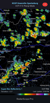
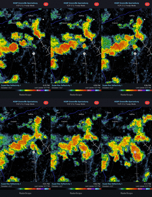
This area is cursed. Yesterday everything was east and today it's to the south and west. I would not be shocked if we stayed completely dry here right through the next so called rain event.
Avalanche
Member
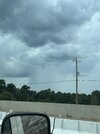
That storm was terrific!!! Not going to lie that initial wind as it approached put some fear in meBig line moving in @Avalanche hope you are watching all this rising scud on the outow. Looks awesome
JHS
Member
Still nothing of note here. Had a storm get within 2 miles before it weakened. Then it reformed off to the south and east. Maybe got .01 while places within 2-3 miles ger 1 inch+.
JHS
Member
Yes, it did. We got little to nothing out of them. Maybe .01.
broken025
Member
Probably last rain you see until JanuaryYes, it did. We got little to nothing out of them. Maybe .01.
Ouch. I thought I had bad luck with stormsYes, it did. We got little to nothing out of them. Maybe .01.
JHS
Member
If the HRRR is right GSP will have to take chances of precip out of the forecast tomorrow outside of the mountains and also raise high temps. The 60% pops now should be 0% if that model is right. We may be going right back to the high temps we had on Sunday in the Carolinas too.
100.1 before getting missed today

