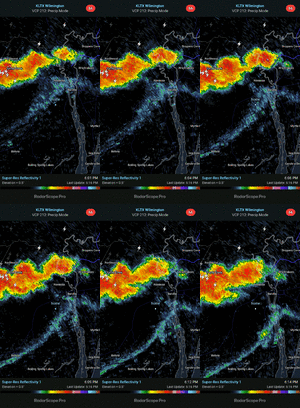
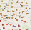
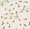
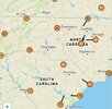
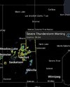
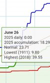
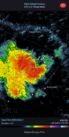
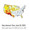
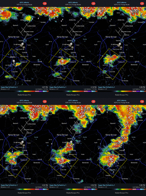
I got home from work and have no power. No wind damage was noticed in my neighborhood so the problem must be damage in another area. I have .71 inches of rain in the gauge. I’m thankful this happened after we got some rain to cool things off.
-
Hello, please take a minute to check out our awesome content, contributed by the wonderful members of our community. We hope you'll add your own thoughts and opinions by making a free account!
You are using an out of date browser. It may not display this or other websites correctly.
You should upgrade or use an alternative browser.
You should upgrade or use an alternative browser.
Pattern June’s Drought Dialogues
- Thread starter SD
- Start date
snowc
Member
73/71 here 10 mins awayAnd just like that it is now 75F, very welcome drop!
Shaggy
Member
.9 of rain here, I'll take it ! Squash plants in garden are blown sideways, leaves everywhere from the hail but no real wind damage.
kennedybb6
Member
My grandmother was cutting my aunts stove off while babysitting my two cousins, lightning struck the oven and she lived but her health deteriorated quickly afterwardsLightning is far scarier than a tornado to me. If you see the flash, it's too late.
Avalanche
Member
Man I’ve missed out on the action. At least it’s cloudy thus cooler.
Shaggy
Member
I did finally get .3 but it had me under bright reds and it was Barely raining. Very strangeMan I’ve missed out on the action. At least it’s cloudy thus cooler.
Avalanche
Member
Agree. I was even marginally under the cauliflower head of that first storm and nothing. Same thing radar had me under the yellow too. Those storms we had two weeks ago I got dumped on. I guess it was my turn to give back to the people.I did finally get .3 but it had me under bright reds and it was Barely raining. Very strange
Avalanche
Member
Congrats to those who got rain and cooler temps. It certainly was earned
Shaggy
Member
Yeah was weird but man it feels nice out there now. Some more showers headed our way and I've been seeing some good CGs off in the distanceAgree. I was even marginally under the cauliflower head of that first storm and nothing. Same thing radar had me under the yellow too. Those storms we had two weeks ago I got dumped on. I guess it was my turn to give back to the people.
Never know. Mine is calibrated every year and was showing 100/81 right before the anvil tops blotted out the sun.Think my tempest is overcooking the dew a bit if it's not its 97.7/84.5 HI 131
- Joined
- Jan 23, 2021
- Messages
- 4,595
- Reaction score
- 15,183
- Location
- Lebanon Township, Durham County NC
Headed to Philly tomorrow for the annual American Library Conference. There’s gonna be a backdoor cold front on Friday. NAM keeps it in the 60s!
If 80 were to be the 24 hour low for today at RDU and GSO, it would tie the all-time high record low for any date for both locations. It would also obliterate the previous high June low for GSO of 77.
However, any thunderstorms today or this evening should easily get it below 80, even if they’re only in the general vicinity and not right at these locations. Also, per RDU:
THE ALL-TIME RDU RECORD WARMEST OVERNIGHT LOW IS 80 DEGREES, AND THERE IS SOME MODEL GUIDANCE THAT IS SUGGESTING TEMPERATURES MAY REMAIN ABOVE THE MARK OVERNIGHT. HOWEVER, EVEN IF
TEMPERATURES DO REMAIN THAT WARM OVERNIGHT, THE CURRENT FORECAST
DOES PREDICT THAT TEMPERATURES WEDNESDAY EVENING WOULD LIKELY FALL
BELOW 80 BEFORE MIDNIGHT. EXPECT WIDESPREAD LOWS ONCE AGAIN IN THE
70S.uu
Well, PM thunderstorms did bring down RDU’s temp. sharply from 99 to 81 in the evening. However, the temp then stabilized. Based on hourlies, alone, the evening lowest was 80. But I have to see whether or not it slipped under 80 between the hourlies this evening. If not, the 6/25 low will turn out to be 80, which would tie the warmest low at RDU on any date in recorded history.
A gust front (outflow boundary) moved SW into this area at midnight. Then at ~12:45AM, a small area of thunderstorms well to the E of the main area moved SW into this area producing only a few rumbles of thunder and light rain, which continues. Oddly enough, after blinking off and on ~20 times, my power finally went out ~1AM despite my not noticing any big gust of wind nor any CTG lightning nearby.
Edit: Power came back on just before 1:55AM.
Edit: Power came back on just before 1:55AM.
Last edited:
It turned out that it did drop to 79 between hourlies at RDU last evening. So yesterday’s low was 79. But that was still a record high low for the date beating the old record of 77.Well, PM thunderstorms did bring down RDU’s temp. sharply from 99 to 81 in the evening. However, the temp then stabilized. Based on hourlies, alone, the evening lowest was 80. But I have to see whether or not it slipped under 80 between the hourlies this evening. If not, the 6/25 low will turn out to be 80, which would tie the warmest low at RDU on any date in recorded history.
BHS1975
Member
Is TT down?
snowc
Member
What's TT?Is TT down?
Tropical Tidbits, met. Levi Cowan’s website.What's TT?
Last night's storms hopped over us here in Athens then picked back up over towards Covington. Maddening. We need some rain.
Looks like another run at upper 90s to low 100s right after the 4th. That one is going to be the classic western heat release though so it's likely have a big EML and disturbed NW flow.
About to have a banger of an ofb collision
Brent
Member
Out here we've only hit 95 one day the river is insanely high like I've never seen it before and there's a rain chance everyday for the next week and the 4th of July is next weekend with the weeks just flying by
Quite a start to summer... We had already hit 100 every year since 2022 by now
Quite a start to summer... We had already hit 100 every year since 2022 by now
Flash drought inbound
Shaggy
Member
Dang @Shaggy, I got 2/3 of your total in May, alone.Droughts been with us for over a year now. View attachment 173266
snowc
Member
Another day, same storms, same 'tude.


JHS
Member
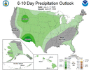
This could mean that the very worst of the heat stays to the west of us at least for now. I would not want to be in t5he 4 corners though.
I like seeing the above precip for the great plains. This is the critical growth period for wheat, and corn farther east.
snowc
Member
MULTIPLE SVRs ISSUED FOR WAKE AND GRANVILLE.
WUUS52 KRAH 272138
SVRRAH
NCC063-077-183-272215-
/O.NEW.KRAH.SV.W.0179.250627T2138Z-250627T2215Z/
BULLETIN - IMMEDIATE BROADCAST REQUESTED
Severe Thunderstorm Warning
National Weather Service Raleigh NC
538 PM EDT Fri Jun 27 2025
The National Weather Service in Raleigh has issued a
* Severe Thunderstorm Warning for...
Southern Granville County in central North Carolina...
North central Wake County in central North Carolina...
Durham County in central North Carolina...
* Until 615 PM EDT.
* At 537 PM EDT, a severe thunderstorm was located near Falls Lake,
or 7 miles north of Raleigh, moving north at 10 mph. Other severe
thunderstorms were developing over Durham.
HAZARD...60 mph wind gusts and nickel size hail.
SOURCE...Radar indicated.
IMPACT...Expect damage to roofs, siding, and trees.
* Locations impacted include...
Raleigh, Durham, Creedmoor, Wake Forest, Butner, Rougemont, Lake
Michie, Falls Lake State Rec Area, Gorman, and Bahama.
PRECAUTIONARY/PREPAREDNESS ACTIONS...
Straight line winds can blow down trees, power lines, and damage
mobile homes and other buildings. Seek shelter in a sturdy structure
until the storm has passed. Stay away from windows as flying debris
generated by damaging winds can be deadly.
&&
LAT...LON 3615 7851 3608 7854 3602 7855 3600 7851
3587 7853 3596 7900 3623 7895
TIME...MOT...LOC 2137Z 182DEG 9KT 3593 7862
HAIL THREAT...RADAR INDICATED
MAX HAIL SIZE...0.75 IN
WIND THREAT...RADAR INDICATED
MAX WIND GUST...60 MPH
$$
Badgett
snowc
Member
I get storm anxiety and all and I grew up close to Erwin and went to Triton. Maybe see a doc and get some meds to help!

