packfan98
Moderator
Barely! I have to make hay while the sun is shining as the old saying goes.It's actually been dry enough for you to mow?
Barely! I have to make hay while the sun is shining as the old saying goes.It's actually been dry enough for you to mow?

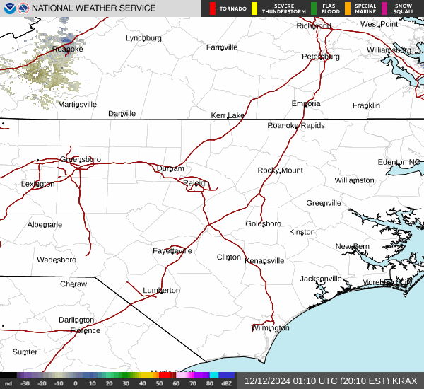
Normal radar

0.46”, not bad for about a 45min showerView attachment 173048
Yeaaahhhh buddy lightweight


WUUS52 KRAH 111851
SVRRAH
NCC083-111915-
/O.NEW.KRAH.SV.W.0127.250611T1851Z-250611T1915Z/
BULLETIN - IMMEDIATE BROADCAST REQUESTED
Severe Thunderstorm Warning
National Weather Service Raleigh NC
251 PM EDT Wed Jun 11 2025
The National Weather Service in Raleigh has issued a
* Severe Thunderstorm Warning for...
Northeastern Halifax County in central North Carolina...
* Until 315 PM EDT.
* At 250 PM EDT, a severe thunderstorm was located near Garysburg,
moving east at 10 mph.
HAZARD...60 mph wind gusts and quarter size hail.
SOURCE...Radar indicated.
IMPACT...Hail damage to vehicles is expected. Expect wind damage
to roofs, siding, and trees.
* Locations impacted include...
Halifax, Weldon, and South Weldon.
PRECAUTIONARY/PREPAREDNESS ACTIONS...
For your protection move to an interior room on the lowest floor of a
building.
&&
LAT...LON 3644 7762 3643 7759 3642 7759 3642 7755
3637 7755 3635 7758 3634 7759 3632 7757
3630 7754 3632 7744 3629 7741 3626 7741
3624 7738 3622 7738 3631 7766 3646 7766
3646 7763
TIME...MOT...LOC 1850Z 286DEG 9KT 3638 7755
HAIL THREAT...RADAR INDICATED
MAX HAIL SIZE...1.00 IN
WIND THREAT...RADAR INDICATED
MAX WIND GUST...60 MPH
$$
np
...Mid Atlantic vicinity...
A moderately unstable and weakly capped environment is also expected
from parts PA southward into the Mid Atlantic and Carolinas Friday.
Scattered storm development is expected during the afternoon. A
modest westerly mid/upper-level flow regime could support a few
strong cells/clusters. Poor midlevel lapse rates and weak flow below
700 mb may tend to limit a more organized severe threat, but
localized instances of wind damage will be possible.

WWUS82 KRAH 112000
SPSRAH
Special Weather Statement
National Weather Service Raleigh NC
400 PM EDT Wed Jun 11 2025
NCZ042-077-078-088-089-112045-
Johnston NC-Sampson NC-Harnett NC-Wayne NC-Cumberland NC-
400 PM EDT Wed Jun 11 2025
...STRONG THUNDERSTORMS WILL IMPACT SOUTHWESTERN WAYNE...SAMPSON...
SOUTHEASTERN HARNETT...CENTRAL CUMBERLAND AND SOUTH CENTRAL JOHNSTON
COUNTIES THROUGH 445 PM EDT...
At 359 PM EDT, Doppler radar was tracking a cluster of strong
thunderstorms along a line extending from 8 miles south of Godwin to
12 miles southeast of Dunn. Movement was east at 25 mph.
HAZARD...Wind gusts up to 40 mph and half inch hail.
SOURCE...Radar indicated.
IMPACT...Gusty winds could knock down tree limbs and blow around
unsecured objects. Minor hail damage to vegetation is
possible.
Locations impacted include...
Fayetteville, Clinton, Dunn, Godwin, Erwin, Eastover, Roseboro,
Stedman, Newton Grove, and Wade.
PRECAUTIONARY/PREPAREDNESS ACTIONS...
Torrential rainfall is also occurring with these storms and may lead
to localized flooding. Do not drive your vehicle through flooded
roadways.
&&
LAT...LON 3506 7888 3538 7861 3524 7810 3518 7813
3519 7816 3512 7817 3483 7833
TIME...MOT...LOC 1959Z 281DEG 21KT 3510 7867 3521 7844
MAX HAIL SIZE...0.50 IN
MAX WIND GUST...40 MPH
$$
np
 Its gonna sting like a bee...
NOUS42 KRAH 111849
PNSRAH
NCZ007>011-021>028-038>043-073>078-083>086-088-089-122000-
PUBLIC INFORMATION STATEMENT
National Weather Service Raleigh NC
249 PM EDT Wed Jun 11 2025
...Computer System Upgrade at NWS Raleigh from June 16th
through 18th...
The National Weather Service Raleigh Weather Forecast Office
in Raleigh will be conducting a required, scheduled update
to our Advanced Weather Interactive Processing System (AWIPS)
computer system. NWS offices use AWIPS to display and integrate
weather and water information, and to send life-saving
information, such as weather and water warnings, to the public.
AWIPS is updated periodically, but this update is comprehensive
and requires that the system be taken completely offline for
approximately three days, from the morning of Monday, June 16th
through the afternoon hours of Wednesday, June 18th. During that
time, NWS Raleigh forecasters will produce and disseminate
products for the area using the AWIPS system at one of our
backup offices at NWS Blacksburg, VA. No impacts to our core
services of forecast products and weather watches, warnings
and advisories are expected during this period.
A few of our services will be impacted as they originate only
from AWIPS facilities at NWS Raleigh, namely:
* NOAA Weather Radio broadcast: The following NOAA Weather Radio
transmitters, programmed by NWS Raleigh, will be off the air
during most of the AWIPS update:
Buck Mountain (WWF 60 - 162.500 mhz)
Chapel Hill (WXL 58 - 162.550 mhz)
Ellerbe (WNG 597 - 162.400 Mhz)
Garner (WNG 706 - 162.450 mhz)
Henderson (WNG 586 - 162.500 mhz)
Tarboro (WXL 59 - 162.475 mhz)
Winston-Salem (WXL 42 - 162.400 mhz)
* Climate: Data will be updated in a limited fashion from Monday
afternoon, June 16th through Wednesday, June 18th. Climate
graphs for the Raleigh Forecast Area at
https://www.weather.gov/rah/climatePlots will not be updated.
* Graphical Hazardous Weather Outlook images normally at
www.weather.gov/erh/ghwo?wfo=rah will not be updated.
* The Weather Story available at
https://www.weather.gov/rah/weatherstory will not be updated.
* Water level forecast services will be degraded due to a less
frequent update cycle. Forecasts will remain at
https://water.noaa.gov/wfo/rah through this period.
* NWS Raleigh will remain operational and staffed while AWIPS
is offline, taking public and partner phone calls, communicating
via social media, and performing other functions that can be
completed without AWIPS.
We apologize for any inconvenience. Please direct any questions
to Jonathan Blaes at [email protected]
$$

AR to TN to NC north heat wave lookView attachment 173064
Any derecho potential with that? Just moved to Wilmington so won’t be an issue here.AR to TN to NC north heat wave lookView attachment 173064
Ouch!Lovely weather we’re having. 84 with a dewpoint of 75.
WWUS82 KRAH 121818
SPSRAH
Special Weather Statement
National Weather Service Raleigh NC
Issued by National Weather Service BLACKSBURG VA
218 PM EDT Thu Jun 12 2025
NCZ040-041-076-077-121915-
Lee NC-Chatham NC-Harnett NC-Wake NC-
218 PM EDT Thu Jun 12 2025
...A STRONG THUNDERSTORM WILL IMPACT
NORTH CENTRAL HARNETT...NORTHEASTERN LEE...SOUTHWESTERN WAKE AND
SOUTHEASTERN CHATHAM COUNTIES THROUGH 315 PM EDT...
At 218 PM EDT, Doppler radar was tracking a strong thunderstorm 9
miles northeast of Sanford, moving northeast at 15 mph.
HAZARD...Wind gusts up to 40 mph.
SOURCE...Radar indicated.
IMPACT...Gusty winds could knock down tree limbs and blow around
unsecured objects.
Locations impacted include...
Apex, Holly Springs, New Hill, Harris Lake Boat Launch, Moncure,
Shearon Harris Reservoir, and Duncan.
PRECAUTIONARY/PREPAREDNESS ACTIONS...
If outdoors, consider seeking shelter inside a building.
&&
LAT...LON 3550 7909 3557 7916 3572 7895 3569 7878
3551 7885
TIME...MOT...LOC 1818Z 239DEG 12KT 3556 7906
MAX HAIL SIZE...0.00 IN
MAX WIND GUST...40 MPH
$$
AB
Would be a good pattern for itAny derecho potential with that? Just moved to Wilmington so won’t be an issue here.


Yeah its dumped here overnight as well. Haven't heard of much flooding luckily thoughSome absolutely crazy rain totals coming out of South Park area
NVM reading some flash flooding reports, cars getting stuck. Overall nothing all that crazy though luckilyYeah its dumped here overnight as well. Haven't heard of much flooding luckily though