• Hello, please take a minute to check out our awesome content, contributed by the wonderful members of our community. We hope you'll add your own thoughts and opinions by making a free account!

Pattern July Fry

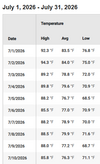
Still 88 degrees at 10:15 with the seabreeze having come through. If we don't revert the winds tonight we may blow past our all time record high minimum which is 81 at the closest official station.

Scary to think about an extended power outage with a HI over 100 this late at night.
 
PRELIMINARY LOCAL STORM REPORT
NATIONAL WEATHER SERVICE CHARLESTON SC
947 PM EDT THU JUL 09 2026

.TIME... ...EVENT... ...CITY LOCATION... ...LAT.LON

.DATE... ....MAG.... ..COUNTY LOCATION..ST.. ...SOURCE.

..REMARKS..

0848 PM MARINE TSTM WIND 4 NW TYBEE ISLAND 32.04N 80.91W
07/09/2026 M52 MPH CHATHAM GA OTHER FEDERAL

FT PULASKI GUSTED TO 45 KNOTS.

Hopefully no small boats were hit by this, but it’s hard to avoid although this was pretty late (during twilight).
 
If I can just make it through the next two weeks without a rainout to finish and win our softball championship it can rain all it wants from there on out! Then it can snow as much as it would like in Winter!!


Sent from my iPhone using Tapatalk
 
1783690514093.png

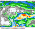
ecmwf-aifs-all-conus-total_precip_inch-1783663200-1784030400-1784030400-20.gif

Believe Hang In There GIF
 
View attachment 196740
Need to smoke a cig after this
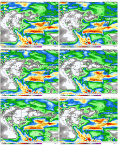
If that map even comes close to verifying it will be shocking to say the least. I have a better chance of winning the lottery. Looking at the area of heaviest rainfall, it is a mirror image of what has been happening for the past week or so. I wouldn't be heartbroken if this were to actually happen.
 
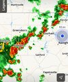
Quite the storm on radar at home yesterday as I was flying back from DC, when I pulled into the neighborhood there was debris everywhere. Another one just rolled through, not quite as intense. 1.2" between them both. The past week has not been that bad with the overall heat.

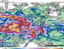
1783709571717.png
 
I think we are now literally at 3 inches of rain or so seemingly in parts of Richmond County over the last couple of weeks, while my house is at well under an inch (these storms will miss too).

This is getting comical. This storm round put my dad in a major mess as we were leaving the Y.
 
I think we are now literally at 3 inches of rain or so seemingly in parts of Richmond County over the last couple of weeks, while my house is at well under an inch (these storms will miss too).

This is getting comical. This storm round put my dad in a major mess as we were leaving the Y.

Probably not likely we got too much tbh, but my complaint worked and my house did catch some of a storm that was severe warned while I was away.

Not likely it was intense as what I found myself in, thankfully not behind the wheel with this case. Wind-blown rain, it was windy enough that there was some debris on the road.
 
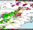
🌪️ Tornado Warning for... Western Catawba County in the Piedmont of North Carolina... Northwestern Lincoln County in the Piedmont of North Carolina... North central Cleveland County in the Piedmont of North Carolina... Southeastern Burke County in western North Carolina...

* Until 730 PM EDT.

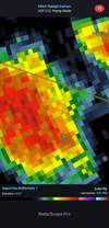
* At 651 PM EDT, a severe thunderstorm capable of producing a tornado was located 13 miles southeast of Morganton, or 4 miles northeast of Casar, moving northeast at 35 mph.

HAZARD...Tornado.

SOURCE...Radar indicated rotation.

IMPACT...Flying debris will be dangerous to those caught without shelter. Mobile homes will be damaged or destroyed. Damage to roofs, windows, and vehicles will occur. Tree damage is likely.

* This dangerous storm will be near... Mountain View around 710 PM EDT. Hickory, St. Stephens, and Conover around 720 PM EDT.

Other locations impacted by this dangerous thunderstorm include Cooksville, Propst, Pleasant Grove, and Startown.
 
Back
Top