BufordWX
Member
Right, like I implied that it would be bad, but not historicIf those #s were to verify, they might not be historic. However, that would still be the worst icestorm by a good margin since 2005 for downtown, Dunwoody, Alpharetta, Marietta, Stone Mtn, and Lawrenceville and would be enough to cause widespread tree damage and outages.
That Gainesville is a coin flip to see .75” is insaneHeres an updated list of cities and ice accumulation probabilities from FFC. Going to put both the newest one and the previous one for sake of comparison if anyone is curious.
NEW:View attachment 187874
OLD:
View attachment 187873

My hope here in North Forsyth is we get enough sleet to cut down on the ZR totals. I’m not optimistic that’s going to happen. It indeed is fascinating to see all this come together: the wedge, the amount of moisture, the long duration, the winds, the cold to follow.I’m in South Forsyth for this one. First time I’ve ever been in an Ice Storm Warning. Saddens me that there is property loss coming, but the weather geek in me is fascinated by it all. Hope everyone seats safe and there is no loss of life!

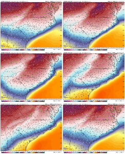
Now that's a wedge.... wow. Notice the area encompassed by the -10C isotherm. That is going to be some strange precip. You will have ice pellets and some small needles or sectored plates mixed in for good measure. Going to look foggy. Much better than freezing rain for sure.That 06z hrrr run was stupid. Look at these 925s at 1am sunday, and they were still getting colder.
View attachment 187884
yeah this is unfortunate. They are forecasting the worst ice event in recorded history for the upstate. Also those totals up toward Cashiers, Highland, Brevard. Never seen it. Never thought it was doable
I’ll happily take anything over super cooled water dropletsNow that's a wedge.... wow. Notice the area encompassed by the -10C isotherm. That is going to be some strange precip. You will have ice pellets and some small needles or sectored plates mixed in for good measure. Going to look foggy. Much better than freezing rain for sure.
Now that's a wedge.... wow. Notice the area encompassed by the -10C isotherm. That is going to be some strange precip. You will have ice pellets and some small needles or sectored plates mixed in for good measure. Going to look foggy. Much better than freezing rain for sure.
We don't know. Sure hope so, but NWS and other meteorologist are still calling for a lot of freezing rain.So more sleet and snow now?
Even for ATL? Was it getting colder?That 06z hrrr run was stupid. Look at these 925s at 1am sunday, and they were still getting colder.
View attachment 187884
Model precip outputs do account for dry air and saturating the column.Question, does the precip the NAM show reflect how much actually hits the ground or total that falls? Wondering if it is dryer because it is factoring in on the extremely dry dew points?
Euro had me in to the low 50s when a similar final band came through in 2015. I verified at 31 when it hit.
I think your area is much different than Raleigh…we never have that problem. I think west of here where you are is in rough shape.Euro had me in to the low 50s when a similar final band came through in 2015. I verified at 31 when it hit.

