-
Hello, please take a minute to check out our awesome content, contributed by the wonderful members of our community. We hope you'll add your own thoughts and opinions by making a free account!
You are using an out of date browser. It may not display this or other websites correctly.
You should upgrade or use an alternative browser.
You should upgrade or use an alternative browser.
Wintry January 23rd-27th 2026
- Thread starter SD
- Start date
LongRanger
Member
But what if half of that .50" QPF is Sleet that still makes it a major Winter storm?Fact is, if .5 precip falls and all is frozen, that's a major winter storm around here (I know you know this) and there will be areas with much more than that. He's just trolling or being stupid, not sure which
iGRXY
Member
The NAM is useless outside of 24 hours.You guys want to be realllllllllllllllly careful using NAM outputs outside of CAD and thermal boundaries.
Sent from my iPhone using Tapatalk
Yeah, .5” as sleet would be nice event.Fact is, if .5 precip falls and all is frozen, that's a major winter storm around here (I know you know this) and there will be areas with much more than that. He's just trolling or being stupid, not sure which
WxBlue
Meteorologist
This is really banter at this point so my last comment on this, but a lot of us are house owners and do not want to deal with headaches we get from major ice storms. Frozen, bursting pipes... power loss/heat loss... broken trees... and go on. It's expensive and miserable to go through it.Why ? Bc I want an actual event ? God Forbid we get to live through something historic
Sent from my iPhone using Tapatalk
lusting4Adusting
Member
And yet the low stayed along the coast... just not meant to be this time apparently, crazy.For context, Feb 2014s high was 10 mb weaker as well.
View attachment 187799
Makeitsnow
Member
Probably also why they can often be mixed together for extended periods as wellThis is what grok says about it. but google's ai says it will only be supercooled. interesting.
correction if you ask google's ai without mentioning it being super cooled (if it will just refreeze) it will say it refreezes. So who knows? lol
Thresholds for Sleet vs. Supercooled/Freezing RainFrom meteorological guidelines (NWS training materials, sounding analyses, and research like Zerr 1997, Cys et al.):
In short: Yes, shallow cold layer → supercooled liquid drop (freezing rain on contact) instead of frozen sleet pellet. The difference often comes down to just a few hundred feet of extra cold air depth — that's why sleet and freezing rain can switch quickly over short distances in the same storm.
- Sleet favored when the subfreezing layer near the ground is deeper/thicker — commonly ~500–1,000+ feet (sometimes cited as 750–2,000+ feet or ~200–600+ meters) thick, and often colder (e.g., mean layer temp well below 0°C).
- Freezing rain (supercooled drops) dominates with a shallow cold layer — typically <500–1,000 feet (often just a few hundred feet), especially if the layer isn't cold enough or the drops are larger.
- Borderline cases can produce mixes (sleet + freezing rain), and the exact cutoff varies with:
- Drop size (larger drops take longer to freeze).
- How cold the layer is (colder = faster freezing).
- Warm layer details aloft (affects how fully melted the original precipitation is).
27 web pages
beanskip
Member
One note on the 0z runs is that they seem to be coming in slower by a few hours. Keep that in mind as you compare runs, as the mods wisely pointed out yesterday.
No because there will be areas that will be devastated by this storm, I'm sorry it will not destroy your property, better luck next timeWhy ? Bc I want an actual event ? God Forbid we get to live through something historic. I pay my own mortgage, bought my own groceries ect so no I don’t live at home, yea it would effect me still want it
Sent from my iPhone using Tapatalk
LongRanger
Member
Hopefully no areas are devastated, Hope everyone is proved wrong and get cold rain. That's my hope anywayNo because there will be areas that will be devastated by this storm, I'm sorry it will not destroy your property, better luck next time
iwantsouthernsnow123
Member
You want a catastrophic ice storm? .5 QPF is still rather significant with this.Why ? Bc I want an actual event ? God Forbid we get to live through something historic. I pay my own mortgage, bought my own groceries ect so no I don’t live at home, yea it would effect me still want it
Sent from my iPhone using Tapatalk
Yeah that would be 1.5” of sleet. The NWS winter storm criteria for sleet is a half inchYeah, .5” as sleet would be nice event.
beanskip
Member
I don't know what the heck the WRF-NSSL is, but its 0z run has accumlating freezing rain all the way down near Statesboro, Ga., Saturday night, well outside any Winter Storm Watch boxes. That model is cold as heck!
And the coldest run since the ICON in CAD regions as posted above. More on the way, too.
View attachment 187802
Is that the convection in the Gulf stealing robbing the moisture intended for the Carolinas?
rburrel2
Member
No there’s convection in the Gulf on the fv3 that steals moisture from the Midwest and delivers it to us.Is that the convection in the Gulf stealing robbing the moisture intended for the Carolinas?
Stormsfury
Member
Love to see the maps. I believe that's the National Severe Storms Laboratory WRFI don't know what the heck the WRF-NSSL is, but its 0z run has accumlating freezing rain all the way down near Statesboro, Ga., Saturday night, well outside any Winter Storm Watch boxes. That model is cold as heck!
We can only hope. Front end sleet bomb then dry slot before kidney bean ZR would be the best outcome for the entire board. And would still be a sick stormIs that the convection in the Gulf stealing robbing the moisture intended for the Carolinas?
beanskip
Member
Love to see the maps. I believe that's the National Severe Storms Laboratory WRF
That makes me curious about the fv3 run. You can see the convection induced energy drive that precip blob. It might be right be certainly worth noting and pauseNo there’s convection in the Gulf on the fv3 that steals moisture from the Midwest and delivers it to us.
MichaelJ
Member
It is the old WRF which is no more accurate than a dart boardI don't know what the heck the WRF-NSSL is, but its 0z run has accumlating freezing rain all the way down near Statesboro, Ga., Saturday night, well outside any Winter Storm Watch boxes. That model is cold as heck!
oh wow that’s a significant shiftICON finally catching onto where the AI models have been for a number of runs now.
Exocet it to continue.
View attachment 187808
Makeitsnow
Member
lol c'mon now..you might want to include the next panels. 1.5 to 2 inch liquid is not nuisanceThe ICON has been moving northward with the precipitation shield all day. The trend continues. Slower, too. Approaching nuisance event around Atlanta.
View attachment 187807
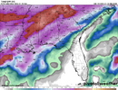
NWG_WX14
Member
It’s not done at that point. RDU finished with 1.4 totalICON finally catching onto where the AI models have been for a number of runs now.
Exocet it to continue.
View attachment 187808
Mpirone12
Member
Guys you have to remember the onset is pushing back.
Sent from my iPhone using Tapatalk
Sent from my iPhone using Tapatalk
ChattaVOL
Member
just like the GFS 18zThe future NAM is starting to show a little more snow on the front end View attachment 187810
Webberweather53
Meteorologist
Ha, yes, this is complex. And I will never claim to have all the answers. For this scenario, if the snowflake melts completely in that warm layer, it can't refreeze as sleet in the cold layer because at that point, it doesn't have ice nuclei to attach to after if fully melts. Instead, it would remain as supercooled water droplets. However, the part about the sounding going back into the dendrite growth zone in the lower level that Cad Wedge mentioned (and I know you've brought it up too recently Webb), it may be possible that it could turn back to ice if it picks up ice nuclei in that lower DGZ and has time to then refreeze before it lands....maybe like what Chazwin was talking about
View attachment 187790
Yeah the latter point is valid and the research I skimmed across showed that cold layers with peak temperatures <-5C and depths of 700m or greater led to sleet
NAM has that as rain, it will warm up as the coastal transfers. So only focusing on the overrunning as it has best cold temps.It’s not done at that point. RDU finished with 1.4 total
Webberweather53
Meteorologist
Tbh, the more I look into this event, the more failure modes I see for big (0.5”+) ZR potential over the Piedmont of NC. I definitely am leaning more towards proportionally more sleet than I was this morning
LongRanger
Member
What about upstate same thing?Tbh, the more I look into this event, the more failure modes I see for big (0.5”+) ZR potential over the Piedmont of NC. I definitely am leaning more towards proportionally more sleet than I was this morning
Mpirone12
Member
Tbh, the more I look into this event, the more failure modes I see for big (0.5”+) ZR potential over the Piedmont of NC. I definitely am leaning more towards proportionally more sleet than I was this morning
Webber is it possible to get the air aloft cool enough for snow to make a come back in central NC? I have a feeling it will be sleet but I haven’t seen much on how much would be needed to create snow
Sent from my iPhone using Tapatalk
Webberweather53
Meteorologist
What about upstate same thing?
Around the 85 corridor and north to the SC-NC border especially there’s definitely room for more IP. Someone in the upstate into NE Georgia will probably be where the real ice max is
So this is going to be a magic Miller B Extreme CAD apparently. Super cold, dry classic CAD strong well-placed high where a magic low runs up the apps and drags a cold front through the entire Southeast with a line of thunderstorms and bumps temps into the 40s. Cool.

