ChattaVOL
Member
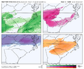
I think how your forecast distributes ice is very well done. Will I am still questioning the location, I think the verification signature will look like something exactly like thisSleet:View attachment 187780
Ice:
View attachment 187781
I feel the least confident in the sleet forecast. I think the upstate could actually end up with less sleet than this potentially. The ZR I feel confident in. The 85 corridor is going to be a war zone IMO.
Don't know if it was mentioned today, but a lot of that sleet showing up on the RDPS maps is freezing rain. Sounding here is from the Greensboro area - that's a +5 deg warm nose...should be freezing rain, not sleet...and it gets warmer aloft from here
View attachment 187767
View attachment 187768
That is wetbulbs in the low to mid teens in NC to near 20/low 20s in scUghh….. the hrrrr was gonna be ridiculously cold. Holy smokes. Cross your fingers it’s off on dew points
View attachment 187782View attachment 187783
Hopefully we can weaken the Baja low to stay more flat instead of more amped as it comes across. And with the better NS we could see lower heights out in front and temps falling moreWhat does this mean downstream ?
Not so sure about that to be honest. That cold nose is very strong and deep.
That is wetbulbs in the low to mid teens in NC to near 20/low 20s in sc
yepMore recon data in 00z GFS and Euro?
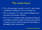
Yea, I was wondering if there was a magic formula like: Warm nose xx feet deep at xx temp needs cold boundary layer at xx feet deep and xx temp to refreeze back to sleet. Seems like the possibilities are almost infinite though. Maybe there are likelihoods looking at a sounding but reality might just be seeing if the raindrops bounce?Honestly I’m not trying to be mean or anything I just don’t know either way, this is a rather impressive inversion. I would like to see what a subset of observed similar soundings to this actually verified as p type wise
Could potentially be somewhat rate dependent until the warm layer gets deeper? Eg Could see -ZR in places under lighter precipHonestly I’m not trying to be mean or anything I just don’t know either way, this is a rather impressive inversion. I would like to see what a subset of observed similar soundings to this actually verified as p type wise
supposedly you need around 1000 to 1500 feet of sufficiently subfreezing air for it to refreeze. But i'm sure that is rate dependent too.Yea, I was wondering if there was a magic formula like: Warm nose xx feet deep at xx temp needs cold boundary layer at xx feet deep and xx temp to refreeze back to sleet. Seems like the possibilities are almost infinite though. Maybe there are likelihoods looking at a sounding but reality might just be seeing if the raindrops bounce?
No, that is most definitely sleet! .... With 925's that cold, hydrometers cannot reach the ground before re-freezing. Matter of fact, that is cold enough for a second dendric growth layer. Trust me it will be sleet 100% of the time with a sounding that cold below 850.
But it falls into a surface temps in the teens with a minimum temp of around 10 off the surface and a subfreezing layer that is thousands of feet deep. No way that is freezing rain.
Serious question. That sounding shows the temp going sharply back freezing at 850mb down to a 2m temp of 17. Is that not enough time for a rain drop to refreeze? I ask this seriously because I remember in January 2004 during that Super CAD, at my house in Concord with daytime temps right around 20 with ZR forecasted. Instead what fell was this frozen mist that accumulated more like sleet and didnt accrue on trees
Not so sure about that to be honest. That cold nose is very strong and deep.
Honestly I’m not trying to be mean or anything I just don’t know either way, this is a rather impressive inversion. I would like to see what a subset of observed similar soundings to this actually verified as p type wise

NAM running off old 18z Data. I dont know about the RGEM....What a ------- headache man. Big differences between the NAM and RGEM on ptype maps this evening.
View attachment 187788View attachment 187789
Assume areas east of Athens is sleet? Do you have that view handy?Here’s where the 3K NAM has ZR accumulations as of early Sunday. To be clear, it’s razor thin inside Atlanta. Literally 31/32 in the city View attachment 187793
That front still has to swing thru right?Nice…by Sunday afternoon central NC could be done with the worst.
Up north looks brutal
View attachment 187795
NAM cutting back on amounts could be a life saver in some areas in NC especially
View attachment 187797
Augusta to barnwell area got got 1 - 1.25 inchs of Ice in 2014 in multiple spot measured by the NWS and there were 2 events between 1949 and 1952 that brought 2 inches plus in the southeastLook, tbh this will anger some ….. this may be a “dangerous” potential event. But we’ve all seen this time and time again, these earth shattering amounts modeled that have never been recorded and never will, bc it’s impossible. I’d bet my left you know what no one from GA - VA ends up more than 1” FRZN. Yes that’s dangerous, but that’s never happened in 150yrs of records if I’m not mistaken and this weekend will be no different. My forecast at worst would be “UP TO 3/4”” even in the worst spot no more, ever. No matter what I saw on any model. This will not become some 1000yr event, be realistic we’ve all been here.
Sent from my iPhone using Tapatalk
Well don't be surprised, That's usually how it works nowadaysI swear if all this hype was for .5” QPF I’m gonna be a little irritated
Sent from my iPhone using Tapatalk
This is what grok says about it. but google's ai says it will only be supercooled. interesting.Ha, yes, this is complex. And I will never claim to have all the answers. For this scenario, if the snowflake melts completely in that warm layer, it can't refreeze as sleet in the cold layer because at that point, it doesn't have ice nuclei to attach to after if fully melts. Instead, it would remain as supercooled water droplets. However, the part about the sounding going back into the dendrite growth zone in the lower level that Cad Wedge mentioned (and I know you've brought it up too recently Webb), it may be possible that it could turn back to ice if it picks up ice nuclei in that lower DGZ and has time to then refreeze before it lands....maybe like what Chazwin was talking about
View attachment 187790
I mean, I'd be okay with less ice.I swear if all this hype was for .5” QPF I’m gonna be a little irritated
Sent from my iPhone using Tapatalk
You know how dumb this statement is, right?I swear if all this hype was for .5” QPF I’m gonna be a little irritated
Sent from my iPhone using Tapatalk
Almost as dumb as this one. What do you get from trolling this thread, just curiousWell don't be surprised, That's usually how it works nowadays
Does the FV3 have a cold bias that we know of? I feel like it might but I don't have a solid example to bring up.The fv3 is the opposite of the nam with the precip… also, holy smokes. It’s cold. One inch of liquid has already fallen at this point in the upstate.
View attachment 187800
Look at how far south that sleet is…The fv3 is the opposite of the nam with the precip… also, holy smokes. It’s cold. One inch of liquid has already fallen at this point in the upstate.
View attachment 187800

Fact is, if .5 precip falls and all is frozen, that's a major winter storm around here (I know you know this) and there will be areas with much more than that. He's just trolling or being stupid, not sure whichI mean, I'd be okay with less ice.
Yeah…hopefully we can get some front end sleet and then miss most of the freezing rain. Would be a nice event.I mean, I'd be okay with less ice.
