Blue_Ridge_Escarpment
Member
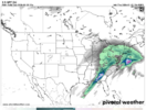
RRFS just said reversed course on that. Much more precip.I mean that’s the precip track on the NAM, RRFS, and FV3. So at least they all think there’s something to it. Surprised the globals mostly disagree.
RRFS just said reversed course on that. Much more precip.I mean that’s the precip track on the NAM, RRFS, and FV3. So at least they all think there’s something to it. Surprised the globals mostly disagree.
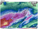
ICON v/s Euro Sunday morning. This is the initial overrunning when temps are at the coldest....big difference with precip. I don't know which model is right...but Euro is a superior model but then again ICON could be onto something.
ICON would be great deal of more sleet and much bigger deal, I would like to see some sleet so rooting for the ICON.
View attachment 187528


Isn't that usually in the Charlotte area?I do think we will end up seeing a some kind of a dry slot in the usual areas as the surface low fills and reforms. That seems reasonable. How much that is is TBD. No way to know right now.
The caveat is that if the fill/reform occurs farther south, which I do think is still within the scope of possibility.
Yeah...this isnt' our first miller b...not sure why dry slot is such a unimaginable thought.I do think we will end up seeing a some kind of a dry slot in the usual areas as the surface low fills and reforms. That seems reasonable. How much that is is TBD. No way to know right now.
The caveat is that if the fill/reform occurs farther south, which I do think is still within the scope of possibility.
It's budged some if you look at the contours over NC and precip type. It's a "warm" model isn't it? Gives me some hope.Yep icon is nearly identical to it's previous runs. It's been impressive at it's consistency.
RGEM is most trusted shorter range model according to AI I read. But that is at 24-48hr outputs2.3” QPF and counting at GSO on the 12z RGEM, all-frozen, at the end of its run, and it’s not over yet.
Watch the position of the low pressure that will form off the coast. If it hugs the coast, chances are that dry slot might materialize for many of us.I do think we will end up seeing a some kind of a dry slot in the usual areas as the surface low fills and reforms. That seems reasonable. How much that is is TBD. No way to know right now.
The caveat is that if the fill/reform occurs farther south, which I do think is still within the scope of possibility.
No, the Icon isn’t a “warm” model. Where is this coming from?It's budged some if you look at the contours over NC and precip type. It's a "warm" model isn't it? Gives me some hope.
Compared to the other models it's been the most steady imo.It's budged some if you look at the contours over NC and precip type. It's a "warm" model isn't it? Gives me some hope.

Geez, bring out the icenadoes with this look.
So snow in the next 10 daysGeez, bring out the icenadoes with this look.
Serious note, if this remotely verifies out, there will be potential for thunder freezing rain.
Be nice if it's a fast mover at that point and temps rising
Gandy knows his stuff. When he talks, pay attention.for those not in the know; gandy has been doing this for many many many many years, he did well with hugo before we had all this computer crap like we do now, and it really set his on air career off
if he says the wedge erodes too quickly on modeling and is looking towards the icon, pay attention along and just south of i-20. hes usually very conservative. one of the only on air mets that i actually believe in, so i will be buying fuel today
hes basically saying the low should dance around the high, not plow into it
It’s also showing a climatologically correct wedge..right or wrong.. it’s consistent!Yep icon is nearly identical to it's previous runs. It's been impressive at it's consistency.
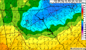
More ip than freezing rain ? Hoping we can stick with sleet for as long as we can in cltRRFS with thunderstorms entering the wedge and 20s for most of the wedge areas in NC, has about 14-15 hours of sleet bomb for CLT from onset onwards View attachment 187541
There’s a shot for a longer sleet duration, but there’s also just as much as a shot for damaging ice and an earlier onset of it. Probably would put CLT right near a .75 contour of ZRMore ip than freezing rain ? Hoping we can stick with sleet for as long as we can in clt
i love the weather forums but the downside is that somebody will say something that sounds right and it will be canonized for years despite it having not scientific backingNo, the Icon isn’t a “warm” model. Where is this coming from?
As if the ice wouldn't be enough to nuke the trees, now lets add a squall line!Geez, bring out the icenadoes with this look.
Serious note, if this remotely verifies out, there will be potential for thunder freezing rain.
Was sure I read it but maybe I'm confusing it with another model. I'll have to go back and look at which ones trend more towards a "warmer thermal look" than actual proven fruition. For goodness sakes don't canonize a general comment like that. Certainly not on this forum anyway.i love the weather forums but the downside is that somebody will say something that sounds right and it will be canonized for years despite it having not scientific backing
The people who were saying "OMG WE ARE GOING TO LOSE ALL QPF" or "Georgia is only getting a cold rain" were making me so mad. They just take one model and run with it. I feel like good forecasters held onto the ice and sleet threat the whole time.i love the weather forums but the downside is that somebody will say something that sounds right and it will be canonized for years despite it having not scientific backing
I’ve definitely heard from AmericanWX about the ICONs “warm bias” but it was probably a coopium thing because it came in worse. I’m pretty sure I’ve also seen it struggles a lot with P-Type depictions though.Was sure I read it but maybe I'm confusing it with another model. I'll have to go back and look at which ones trend more towards a "warmer thermal look" than actual proven fruition. For goodness sakes don't canonize a general comment like that. Certainly not on this forum anyway.
He's also not an attention -----. He's all business.Gandy knows his stuff. When he talks, pay attention.
Sleet has saved the day more often than not in Charlotte since 2002. I’m hoping and praying that’s the case this time around, or we get dry slotted. My family living in what some would consider the inner city, there are repercussions of long term power outages that probably aren’t even being considered at the moment, similar to when a hurricane hits a major city (looting, etc.) This could get bad on many levels.More ip than freezing rain ? Hoping we can stick with sleet for as long as we can in clt
This may be banter, but I stated last night that he nailed the January '88 storm as well. He knocked it, and as you stated Hurricane Hugo, out of the park. Gandy is extremely credible and a good listen.for those not in the know; gandy has been doing this for many many many many years, he did well with hugo before we had all this computer crap like we do now, and it really set his on air career off
if he says the wedge erodes too quickly on modeling and is looking towards the icon, pay attention along and just south of i-20. hes usually very conservative. one of the only on air mets that i actually believe in, so i will be buying fuel today
hes basically saying the low should dance around the high, not plow into it
Unfortunately, when it comes to weather (and this isn't directed to you), people get all emotional - emotional because they don't get the kind of weather they want, emotional about weather forecasters being wrong, emotional that the models are trending wrong, emotional when someone has a different idea, emotional about people posting 384 maps, etc.The people who were saying "OMG WE ARE GOING TO LOSE ALL QPF" or "Georgia is only getting a cold rain" were making me so mad. They just take one model and run with it. I feel like good forecasters held onto the ice and sleet threat the whole time.
Are we looking at the same GFS because the GFS buries N/NE GA and Upstate SC with ZR.GFS 12z much much warmer and eroding that CAD in GA much quicker. Less crazy apocalyptic ice for ATL + just rain on the backend after *warmer* ZR (not as bad to have ZR at 30 than at 26)
