• Hello, please take a minute to check out our awesome content, contributed by the wonderful members of our community. We hope you'll add your own thoughts and opinions by making a free account!

Wintry January 23rd-27th 2026

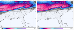
The AI Euro keeps most of central NC in the 20-25 degree range for the duration while the regular Euro scours away the wedge in the course of a few hours (RDU warms 4 degrees between one hourly panel and the next towards the end of the storm). Huge differences between the AI and non-AI model.

The Euro op has a bad habit of doing that with cad events. Erodes way too quickly
 
Yeah...I was very concerned even yesterday with all the snow being modeled that frzn would be bad...but now I expect this to be a nuisance event for Raleigh. Now for points n-w I would expect it to be bad still...

Sorry Kylo I think that the euro being the only model to really erode the cad like that it’s probably wrong especially since it’s going against the EuroAI


Sent from my iPhone using Tapatalk
 
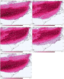
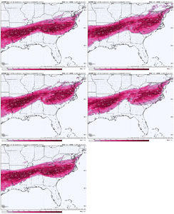
aifs ensembles are a hair colder and ticked southward. generally pleasing to see a small improvement

the op euro is still concerning but i was flummoxed that it didn't end up flatter around our way. it's a bit of an outlier there.

it brings a long string of convection up through Tennessee and i wonder if there's any convective feedback issues with that line of storms
 
At least the sleet amounts are sinking south....

Not sure what we need here. PV shifting east, loses our cold press, but it shifting west makes it more likely to pick up the baja low. Either way we lose.
Agreed. Looks like the line has moved marginally south in MS and is beginning to creep into west central Alabama.
 
aifs ensembles are a hair colder and ticked southward. generally pleasing to see a small improvement

the op euro is still concerning but i was flummoxed that it didn't end up flatter around our way. it's a bit of an outlier there.

it brings a long string of convection up through Tennessee and i wonder if there's any convective feedback issues with that line of storms
Appears The transfer should have went up of obx tidewater, not NJ. Im looking 6 hour panels, but that is weird to steep NE angle imo.
 
You positive tilt the firehouse, just one tick right. its 2.0 + on euro. Trend at 12z was for ukmet, euro to do this

Completely agree which is my concern I would much rather have a sleet bomb than freezing rain but others saying if wasn’t as bad is not logical or right


Sent from my iPhone using Tapatalk
 
Is there a chance that the data issue the euro was having caused it to have bad data and a bad output?
 
I'm not trying to be a homer, because I don't want ice. But I don't think the Euro Op is right with how amped and warm it is, particularly east of the Apps.

Anyway, after the EPS, it's time for a nap.
I think the way it does the transfer, is what is screwing with it. Could be wrong
 
didn't bouncycorn basically say this is the best we got right now?
yeah...that's what I had thought I remember. I don't see how you don't get 12-20" out of this...if I could pick anywhere it would be between Richmond/Fredrecksburgh.

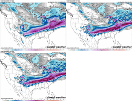
Right now...the AIFS is only about 50 miles north of GFS. But dang, that 50 miles is everything for most of us.


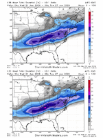
models-2026012112-f132.sn10_acc-imp.conus.gif
 
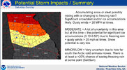
NO WAY the CAD erodes that quick as the EURO depicts. Unfortunately, I think RDU to CLT to ATL and points south are looking at a major ice storm. Let's hope it is mainly sleet and not as much freezing rain. These points will most likely not get above freezing for the duration and if it is freezing rain, then lights out. I still think the snow/sleet/FZRN will push a bit south as the strength of the CAD is picked up better.
 
yeah...that's what I had thought I remember. I don't see how you don't get 12-20" out of this...if I could pick anywhere it would be between Richmond/Fredrecksburgh.

Right now...the AIFS is only about 50 miles north of GFS. But dang, that 50 miles is everything for most of us.


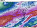
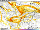
View attachment 187029
Look at that posotive tilt trend.
 
yeah...that's what I had thought I remember. I don't see how you don't get 12-20" out of this...if I could pick anywhere it would be between Richmond/Fredrecksburgh.

Right now...the AIFS is only about 50 miles north of GFS. But dang, that 50 miles is everything for most of us.


View attachment 187029
you shove the sleet line 30 miles north of this forecast and i get 5 inches of dipping dots. you have much more confidence than i do. will come down to the thump
 
Look at that posotive tilt trend.
thats the most disappointing about this...I thought for sure we would front end thump 2-3" of snow and then let the mixing begin but now with heights rising in the east we lose that and left with nothing good. Congrats Virginia
 
Back
Top