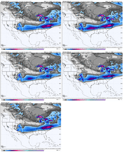
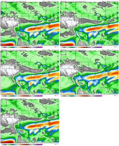
I mean the QPF does like to come in faster then modeled.I do vividly remember in the Feb 2014 the overrunning came in a lot quicker than modeled, I remember because I was at work and had to panic rush home. Maybe GFS is onto something with the quicker onset.
-
Hello, please take a minute to check out our awesome content, contributed by the wonderful members of our community. We hope you'll add your own thoughts and opinions by making a free account!
You are using an out of date browser. It may not display this or other websites correctly.
You should upgrade or use an alternative browser.
You should upgrade or use an alternative browser.
Wintry January 23rd-27th 2026
- Thread starter SD
- Start date
rburrel2
Member
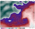
This run was quite about colder at the surface for everyone during the storm. Really insane numbers, but I honestly think they're going to be underdone when it's all said and done.
- Joined
- Nov 29, 2021
- Messages
- 42
- Reaction score
- 144
To answer your question more thoroughly (earlier today my 1 word response got deleted) Yes. I do think the ~1045 high will verify. This doesn’t mean the freezing line will move as far north (or really much at all) as the precip shield. I think models showing the broader expansion of precip (as fluffy powder) over central KY and the lower Ohio valley states will verify a good bit more than the much more suppressive models (like the GFS). Considering how the GFS did at this same range with Jan 17-18th’s system I am not putting much stock in the GFS at all. We are dealing with a lot of precip and a lot of cold here. The heaviest snow (due to the Kutchera effect) will be around and above the TN/KY & VA/NC state line. This doesn’t mean, however, that the freezing line will be anywhere near here, due south for 100-120 miles the snow rates will be less (closer to 10:1 or 8:1) and even further south sleet and eventually zr will be very serious over north central GA & central AL.Will there truly be much of a NW trend if this high verifies as 1045+ hpa?
i cant help but have this pit in my stomach alongside the excitement of tracking this storm -- because the potential for such immensely widespread harm with the notion of record breaking low wind chills across towns that might end up almost entirely lights out is just.... yeah. i cant shake it.Wind chills well below 0F... with likely millions without power.
View attachment 186543
Snowflowxxl
Member
Atlanta is beyond screwed for weeks if it’s ZR instead of IP. Major safety concerns
Makeitsnow
Member
coldspringsfarm
Member
You folks that like to make call maps need to pay attention to this sleet/ZR line. For whatever reason the I-20 corridor has been a popular transition point in past storms.
Hey whos that guy and what's he doing stealing my posts???
wow
Member
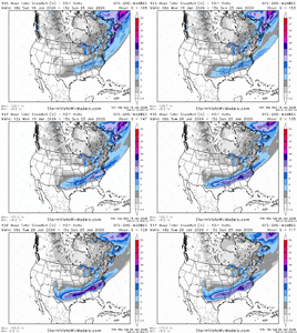
No sir we will not. Too bad this isn't starting tomorrow.@wow @SnowNiner welp …. We will never see a more brilliant map than this. Star of the show here
Sent from my iPhone using Tapatalk
- Joined
- Nov 29, 2021
- Messages
- 42
- Reaction score
- 144
The GFS looks very pretty on the map but it’s not to be trusted. While it did catch the Jan 23, 2016 winter storm NW trend when the Euro didn’t, the GFS is not the same model as then. The GFS is not to be trusted with this system. It’s track record so far hasn’t been good this year. We need to stick to the Euro Icon, AIFS Ens mean, and even the Canadian may do better than the GFS here.@wow @SnowNiner welp …. We will never see a more brilliant map than this. Star of the show here
Sent from my iPhone using Tapatalk
It’s also counting ZR. How do I know? Columbus, GA gets only ZR and this map shows them with 5.5”.Got to be counting snow and sleet accumulations. Still remarkable!
I pulled up our soundings and we are so borderline sleet/snow. My guess is that it would be probably 6 inches of sleet sandwiched in between a couple inches of snow to start and another couple inches to finish. BTW that run gives us a low of 1 on Tuesday morningLol. I probably get 6 inches of sleet from this.
View attachment 186519
The way the heights over the SE turn SSW before the Baja wave even kicks out makes this about as good as it gets overrunning wise. Supreme long fetch. But it’s the GFS. I suspect we won’t end up quite as much west to east with everything come game time (I believe there will be a bit more tilt to the NE unfortunately). Time will tell thoughI wonder if something like this is even synoptically possible. I mean, it isn't going to happen, but still...
@Ross getting his proof of concept in spades.

LukeBarrette
im north of 90% of people on here so yeah
Meteorology Student
Member
2024 Supporter
2017-2023 Supporter
Might want to delete this...Bouncycorn is Andrew...What the heck. That’s low to just copy and paste what you said in the thread into his verified twitter account. What a bozo.
Showmeyourtds
Member
Definitely love a more visible sleet solution for my area. Even after just looking at the soundings, it still reflects as "sleet/snow" for my coordinates. I didn't look at the upper level dynamics, but I would have to assume that the upper levels would be colder to print out those crazy sleet totals
This is probably gonna be the most significant winter storm we've seen in years. I wasn't alive for the January 2000 storm but looking at these model runs when they come in and reading through the thoughts I can imagine this is what that storm must have felt like. And then include the potential for ice? Very dangerousi cant help but have this pit in my stomach alongside the excitement of tracking this storm -- because the potential for such immensely widespread harm with the notion of record breaking low wind chills across towns that might end up almost entirely lights out is just.... yeah. i cant shake it.
Had absolutely no idea that was you bahahaha. Love your stuff man. Keep it up!Hey whos that guy and what's he doing stealing my posts???
LukeBarrette
im north of 90% of people on here so yeah
Meteorology Student
Member
2024 Supporter
2017-2023 Supporter
Tokenfreak
Member
Do we think this is going to get more amped or it could get suppressed more? Just curious everyone’s thoughts.
iGRXY
Member
I went through my soundings and again, the pretty maps show sleet, the sounding is snow until Sunday morning at 1 am.
- Joined
- Nov 29, 2021
- Messages
- 42
- Reaction score
- 144
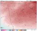
Yes, especially over the TN valley and western NC.View attachment 186553
Comparison of the runs, looking a bit more amped
wow
Member
Sky86
Member
That warm nose has to be stout for it to be mainly ice in far NE Georgia
yes, it must have been a crazy time. even crazier is that the 2000 storm didn't even show up on the models until the GFS (I believe) showed it the night before. the rates were crazy on that one.This is probably gonna be the most significant winter storm we've seen in years. I wasn't alive for the January 2000 storm but looking at these model runs when they come in and reading through the thoughts I can imagine this is what that storm must have felt like. And then include the potential for ice? Very dangerous
What is interesting to me and scary is if the Baja energy comes out later, so that we get the tremendous SSW overrunning, followed by some amping of the system with more tilt to the NE, but then additional strengthening with a bombing Atlantic low with more snow to end. 18Z GFS hints at this with the backside snow, along with a few other models.The way the heights over the SE turn SSW before the Baja wave even kicks out makes this about as good as it gets overrunning wise. Supreme long fetch. But it’s the GFS. I suspect we won’t end up quite as much west to east with everything come game time (I believe there will be a bit more tilt to the NE unfortunately). Time will tell though
View attachment 186551
I’ll take my 18.5”. So wake on the line for sure.
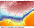
Have a map of this for the Triangle?GFS takes much of Northwest Georgia below 0 View attachment 186547
NEGaweather
Member
Tuesday, Jan. 20 5:30 PM - Thoughts from NWS Atlanta
----------------
Some things to talk about with this event. This is shaping up to be
a potentially high impact event with moderate to major impacts. With this amount of model consistency in the overall setup we are gaining confidence that this could be a long duration event as well. With initiation as early as Saturday afternoon and wintry precip looking to extend into Sunday evening and potentially into Monday.
The WPC reconnaissance flight should give us a better picture into the duration of this event. At this point (almost 4 days out) we are confident that wintry precip will affect north Georgia in areas north of I-20. The area south of I-20 to Macon and Columbus are a little more uncertain but models are consistently forecasting wintry precip for this area as well.
A few factors into how much/what type of wintry precip we receive are the influence of the wedge expected to take shape and then how far north the front pushes.
When it comes to the wedge, the ensembles were having a tough time over the past two days resolving the wedge but the ECMWF ensembles are beginning to depict it better as of 06z and 12z.
Current thinking is that snow will be the main precip type for far north Georgia and wintry mix/freezing rain will become the main concern for the remainder of the north Georgia area. There is still a decent shot that we see this freezing rain transition to more of a snow event as we get into late Sunday and Monday but that is a bit more uncertainty.
Focusing on the probabilistic information for now.
--> 40-50% chance for 0.5" or greater of ice accumulation through
the weekend for the areas north of I-20.
--> 25-30% chance for 0.75" or greater of ice accumulation through
the weekend for the areas north of I-20.
--> 15-20% chance for 1" or greater of ice accumulation through the weekend for the areas north of I-20.
--> 30-45% chance for 2" or greater of snow accumulation through the weekend for the areas north of I-20.
Please take note of how this has ramped up from yesterdays
discussion. What we want you to focus on is being prepared for a
potentially high impact event this weekend. We will likely see more
changes over the coming days but please make sure you have a plan to endure this event which could include power outages.
-------------------
Sent from my iPhone using Tapatalk
Yeah I went back and looked at mine a second time and honestly a lot of what was showing as sleet should have been snow. Obviously a bit to far out to give much credence to that kind or detail but still interestingI went through my soundings and again, the pretty maps show sleet, the sounding is snow until Sunday morning at 1 am.
wow
Member
Cad Wedge NC
Member
That's only through 7am Sunday.....
If we do see a strengthening low pressure off shore, I would think we start seeing other models show a flip back to snow like that GFS run just did. It would tap into that cold air on the backside and could set up a heck of a deformation bandWhat is interesting to me and scary is if the Baja energy comes out later, so that we get the tremendous SSW overrunning, followed by some amping of the system with more tilt to the NE, but then additional strengthening with a bombing Atlantic low with more snow to end. 18Z GFS hints at this with the backside snow, along with a few other models.
SnowNiner
Member
Well, summarizing in my mind, last nights runs had less interaction with the Baja low, shifted south and colder. This afternoons runs reversed it.
What will tonight’s runs do?
What will tonight’s runs do?
wow
Member
that's mostly all of it for us. It only gets deeper in VA.That's only through 7am Sunday.....
UNCSC
Member
Baja lows are stubborn and take their time. I don’t think it’s gonna be jumping in time to create a large amped bomb. Could be very wrong, but they are hard to forecast

