-
Hello, please take a minute to check out our awesome content, contributed by the wonderful members of our community. We hope you'll add your own thoughts and opinions by making a free account!
You are using an out of date browser. It may not display this or other websites correctly.
You should upgrade or use an alternative browser.
You should upgrade or use an alternative browser.
Wintry January 23rd-27th 2026
- Thread starter SD
- Start date
MRKEVIN7575
Member
Ive personally never ever seen weather.com show 14-18 inches snow in my area. Could verify if we don't get sleet/ice to mix in
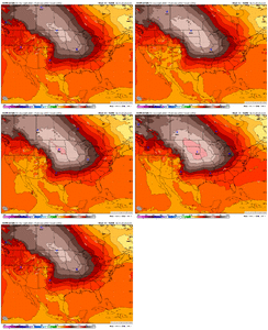
Still looks more like its dad (CMC) Higher heights in the SE.End of the 12Z RGEM. She's coming, y'all.
View attachment 186268
wow
Member
Completely blows my mind to see the HPs strengthening as we get closer. I can only assume it would push things further south but I am not nearly as smart as many on this site. I will start making preparations if 12z continues this trend.
I completely agree. It’s funny because the NWS will officially record sleet as snowfall for the record books and I’m convinced there’s gonna be an area just south of the snow line that is buried in sleetIn my honest opinion I think this might be the first winter storm I’ll ever have to make a map for sleet accumulation, maybe even up to 3-6” of it
Ice is closing in on the Gulf on the icon
Stormsfury
Member
She's still too warm! We'll see if the CMC 12z still shows it's biases shortly.Still looks more like its dad (CMC) Higher heights in the SE.
im in shelby co. ive got firewood delivered today and getting plenty of propane as well. our generator hook up has bit the dust somehow and cant get it fixed until after this passesCompletely blows my mind to see the HPs strengthening as we get closer. I can only assume it would push things further south but I am not nearly as smart as many on this site. I will start making preparations if 12z continues this trend.
iGRXY
Member
The icon actually would turn into ZR in the CAD regions of Georgia and SC. 700 and 850’s are very warm.
Brandon10
Member
I am going to need modeling to shove this thing farther south. I do not like that ice look in southern NC. That low popping too close to the coast.
On to the GFS...
On to the GFS...
GeorgiaGirl
Member
Widespread low to mid 20's during the majority of the precip. An absolute disaster brewing presuming it's true.
iGRXY
Member
3” QPF in Georgia and upstate. That’s a monster and a lot of it is actually ZR. Not sleet
- Joined
- Jan 23, 2021
- Messages
- 4,602
- Reaction score
- 15,197
- Location
- Lebanon Township, Durham County NC
One of the wildest realizations just hit me in that these ensemble means are 10:1. We will do better than 10:1 I think.
packfan98
Moderator
I've thought the same for several storms that we would be getting cold dry powder, but with these big systems it never works out that way. I usually end up praying that I stay sleet and stave off the Freezing Rain.One of the wildest realizations just hit me in that these ensemble means are 10:1. We will do better than 10:1 I think.
It’s really not about this “going north” what we’re dealing with is an expansion of the precip shield due to the northern stream ingesting the Baja low into the system as a whole. This is a country wide storm@Webberweather53 be honest. Are the northern solutions valid at all or can we flatten this with the high right up to go time
SimeonNC
Member
JP152
Member
The ICON spits out 15+ inches from Fredericksburg to Winchester, VA.
NBAcentel
Member
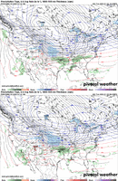
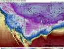
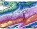
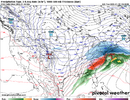
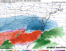
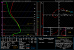
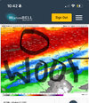
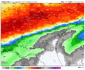
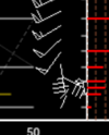
yeah that'll do itSleet in the mid teens is absolutely wild. Can also see the secondary growth zone below the warm nose View attachment 186281View attachment 186282View attachment 186283
rburrel2
Member
JP152
Member
Yep, all the way to Richmond it looks like. This looks like its turning into a Nor'easter.ICON brings ZR all the way up to Virginia..
What’s it gonna take to cool those off?The icon actually would turn into ZR in the CAD regions of Georgia and SC. 700 and 850’s are very warm.
That map clearly shows the massive warm nose just by looking at the mountains. What a beast with upwards of 4 inches of liquid in places!
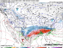
of course in general ZR is the bigger concern for downing power lines/trees falling/etc. but if we get multiple inches of sleet on top of many inches of snow, would that end up having a similar effect? im just imagining power lines being covered in snow that by itself is light enough to not be an issue, but then a thick layer of ice OR sleet could weigh everything down...Icon went Ham on the qpf. Drives ice on top of 7+ inches of snow up here. really wound up beast. I get over an inch of sleet after 7 inches of snow. Least I hope its all sleet
View attachment 186277
sackjalding
Member
Forgive me if banter, but looking at those ICON maps, it is so interesting to see how much warmer the smokies are compared to the rest of the piedmont, etc. Really gives you a sense of the level of the warm layer.
some way by hook/crook/ladder. The hwy 64 corridor/ north across most, if not all NC should approach/ get 10 inch accum at a minmum.. This is going off 1.5 qpf + and worst case scenario, getting 1st half down as snow. Like the Icon just did.
AlabamaWxWatcher
Member
Central Bama looks to dodge a bullet with that look. Ice saving warm nose.
Makeitsnow
Member
- Joined
- Jan 23, 2021
- Messages
- 4,602
- Reaction score
- 15,197
- Location
- Lebanon Township, Durham County NC
Not with that 925 layer.ICON brings ZR all the way up to Virginia..
24 hours ago (Raleigh):
We are going to start with a mix then switch over to snow
Now (Raleigh):
Ok we will start off with some snow then get hammered by an ice and sleet storm
We are going to start with a mix then switch over to snow
Now (Raleigh):
Ok we will start off with some snow then get hammered by an ice and sleet storm
I opined in an earlier post that copious freezing rain that would typically run off before freezing won't with snow and sleet cover in place. This is uncharted territory for me.of course in general ZR is the bigger concern for downing power lines/trees falling/etc. but if we get multiple inches of sleet on top of many inches of snow, would that end up having a similar effect? im just imagining power lines being covered in snow that by itself is light enough to not be an issue, but then a thick layer of ice OR sleet could weigh everything down...


