• Hello, please take a minute to check out our awesome content, contributed by the wonderful members of our community. We hope you'll add your own thoughts and opinions by making a free account!

Wintry January 23rd-27th 2026

Who wants to admit they are tempted to stay up for the Euro even though it's still 5 days from starting after seeing the ICON, and especially the GFS and GEM output? My head is saying don't get the hopes up but man the consistency for DAYS already gets the blood flowing.
Agreed, did this with the last system ended up as a disappointment but this time we've got a real southernstream energy setup rather than some weak energy.
 
Who wants to admit they are tempted to stay up for the Euro even though it's still 5 days from starting after seeing the ICON, and especially the GFS and GEM output? My head is saying don't get the hopes up but man the consistency for DAYS already gets the blood flowing.
I am because i dont look foward going to work tomorrow outside when its 20 degrees gives me an excuse to be semi late
 
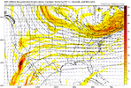
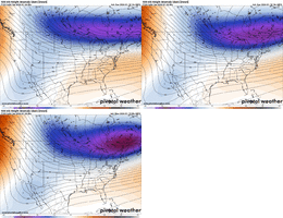
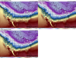
Overall not that different. Early lean is things will ultimately be on the progressive side in regards to the cutoff. Esp with the American model’s tendency to hold these back too long. And we’ve also seen it earlier this winter when it was trying to let that cutoff rot off the coast of Cabo for a week and put us under a death ridge. Things that didn’t happen for 500, Alex

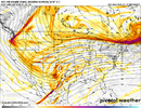
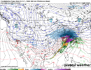
IMG_7684.pngIMG_7683.png
 
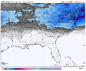
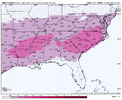
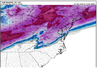
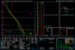
For ATL, I could definitely see this starting as rain before a changeover to ZR and then ending as snow.

This progression is typically high impact, depending on how cold temps get
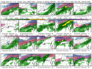
That's kind of how I imagined the 18Z Euro was going to play out. 12Z was just too west to east, and based on the GFS and CMC and then the precip orientation on 18Z with the cold press, it seemed very plausible to go through all 4 precip types over the whole storm.
 
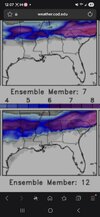
The CAD in Georgia seems rather anemic as depicted by the model. Just doesn't have that classic tongue of cold air sharply into Atlanta and points north and east. I'm still trying to get used to these new Al models. I presume details are smoothed a bit?
A good cad goes thru La Grange and into Alabama. Maps rarely show it until game time.
 
Oh yes it can
Yes if the high pressure is weaker like this and it is 200 miles north of course it could. But the theme for the winter has been suppression. I am looking at the glass half full not empty.

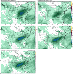
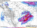
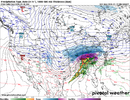
Ever heard the saying if you say something bad gonna happen. Sometime becomes true. ukmo_global-prateptype_ukmo-imp-conus-2026011900-144.png.
 
Thought I'd share since many ask routinely.
Based on recent analysis and historical performance, the ECMWF (Euro) is widely considered the highest-scoring and most accurate global weather model, maintaining a one-day accuracy advantage over its competitors, such as 6-day forecasts matching the 5-day accuracy of other models.
However, the "best" model depends on the specific region, time range, and weather phenomenon, with GFS, ICON, and GEM often outperforming the Euro in specific situations.
Here is a breakdown of how they compare:
  • ECMWF (Euro): Generally considered the top performer for medium-range forecasts (3–10 days) due to its superior resolution and handling of atmospheric dynamics.
  • GFS (American): Highly competitive, often faster to update (4 times daily), and sometimes superior for tropical cyclone tracking and severe weather in North America.
  • ICON (German): Considered highly accurate, particularly in Europe, often rivaling or exceeding the ECMWF in short-range, regional, and specific temperature/wind forecasts.
  • UKMET (UK): Similar accuracy to the ECMWF offshore and in the medium range, though sometimes slightly behind in land-based, short-term scenarios.
  • GEM (Canadian): A strong "dark horse" model, frequently used for specialized, high-resolution regional forecasting, particularly in North America.
Summary of Performance:
  • Overall Accuracy (Medium Range): Euro (ECMWF) > GFS > ICON/GEM/UKMET
  • Short Range (0–48 hrs): ICON and HRRR (not in your list, but relevant) are very strong, along with Euro
  • Hurricane/Tropical: GFS and Euro are generally considered top-tier, though AI models are currently challenging them
  • Europe/Topography: Euro and ICON tend to excel
ChatGPT
 
Thought I'd share since many ask routinely.
Based on recent analysis and historical performance, the ECMWF (Euro) is widely considered the highest-scoring and most accurate global weather model, maintaining a one-day accuracy advantage over its competitors, such as 6-day forecasts matching the 5-day accuracy of other models.
However, the "best" model depends on the specific region, time range, and weather phenomenon, with GFS, ICON, and GEM often outperforming the Euro in specific situations.
Here is a breakdown of how they compare:
  • ECMWF (Euro): Generally considered the top performer for medium-range forecasts (3–10 days) due to its superior resolution and handling of atmospheric dynamics.
  • GFS (American): Highly competitive, often faster to update (4 times daily), and sometimes superior for tropical cyclone tracking and severe weather in North America.
  • ICON (German): Considered highly accurate, particularly in Europe, often rivaling or exceeding the ECMWF in short-range, regional, and specific temperature/wind forecasts.
  • UKMET (UK): Similar accuracy to the ECMWF offshore and in the medium range, though sometimes slightly behind in land-based, short-term scenarios.
  • GEM (Canadian): A strong "dark horse" model, frequently used for specialized, high-resolution regional forecasting, particularly in North America.
Summary of Performance:
  • Overall Accuracy (Medium Range): Euro (ECMWF) > GFS > ICON/GEM/UKMET
  • Short Range (0–48 hrs): ICON and HRRR (not in your list, but relevant) are very strong, along with Euro
  • Hurricane/Tropical: GFS and Euro are generally considered top-tier, though AI models are currently challenging them
  • Europe/Topography: Euro and ICON tend to excel
This info is LLM-generated and is out of date.
 
Back
Top