My temp was pretty much held steady so yall might not move muchI have moved up .4 degrees to 30.6F. We will see what happens as this line moves through.
-
Hello, please take a minute to check out our awesome content, contributed by the wonderful members of our community. We hope you'll add your own thoughts and opinions by making a free account!
You are using an out of date browser. It may not display this or other websites correctly.
You should upgrade or use an alternative browser.
You should upgrade or use an alternative browser.
Wintry Jan 23-27 Winter Storm Obs
- Thread starter Rain Cold
- Start date
Watching you NE GA folks like a hawk since it may give those of us further NE an idea of how that line is going to look when it comes through. 
Snowflowxxl
Member
Wind is actually starting a bit now. Steady rain at 33
Windergawx
Member
Temps hanging around 26.8--27 here dewpoint 25 wind is pretty much nothing - 2mph I just dont believe it hangs on over the entire event
BufordWX
Member
Steady at 27.0 right now. Precipitation is about to crash into the colder temperatures NE of Atlanta. Gonna be fun to watch this unfold.
Roswellian
Member
Heavy downpour in Roswell.
For those of us in the southern piedmont it will be interesting to see upstream reports from NE Georgia and the GSP area.
- Joined
- Jan 23, 2021
- Messages
- 4,602
- Reaction score
- 15,197
- Location
- Lebanon Township, Durham County NC
31.5 with rain falling. I just came back from the roof and it’s a disaster area.


Sent from my iPhone using Tapatalk


Sent from my iPhone using Tapatalk
I would swear to you it's snowing right now but I dont even believe it
Stormsfury
Member
We're not done yet, but the trends have been for much colder at the surface. The temps just off the deck around 2400 were measured at 55 several hours ago. Huge inversion.We might get a 25 degree bust on highs in CHS today. Inland areas barely above 32, downtown at 40 when highs were supposed to be around 60 late evening
Sky86
Member
wating
Makeitsnow
Member
I've warmed ever so slight...25.5 on my elevated sensor and 26.5 on my other. It's going to be something to see what unfolds this afternoon. I am hoping for some sleet but if not it's going to get icy really really quick.27.1 in Buford, about an hour NE of Atlanta. This is gonna be wild
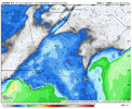
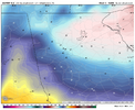
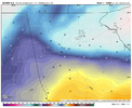
One last shot at the euro..even the 12z euro is on a different planet. By now it has most of us above freezing and by 4 way above freezing. And look at how far north it has the surface low vs what the higher res models show over south to south central ga. What a fail by the euro.
kennedybb6
Member
I’m in Waxhaw and so far it’s been pretty quietFor those of us in the southern piedmont it will be interesting to see upstream reports from NE Georgia and the GSP area.
MotoWeatherman
Meteorologist
31.2 here in Dahlonega with the big band about the plow through.
HailCore
Member
Can confirm that the squall brought some 25-35mph wind gusts which took down a few larger branches in my backyard, along with making the sky quite dark. There was a period of heavy rain mixed with sleet, so the dynamic cooling is a thing here. I am located 20 miles north of ATL on the Roswell/Milton border.
Showmeyourtds
Member
Precip has picked up here. 32.0 on the nose. Will be interesting to see if the wedge will hang on here
All rain in South Forsyth. 29 degrees
Ugafanofweather
Member
Rain starting to come down again here in downtown Cumming. 29degrees
disassociated_vort
Member
LukeBarrette
im north of 90% of people on here so yeah
Meteorology Student
Member
2024 Supporter
2017-2023 Supporter
This is hilarious. Good luck getting back up the hill
Rain. 31.7.
Sent from my iPhone using Tapatalk
Sent from my iPhone using Tapatalk
TigerSnow
Member
any melting of the ice you had already received?Rain. 31.7.
Sent from my iPhone using Tapatalk
any melting of the ice you had already received?
Not that I can tell. Still looks the same as earlier.
Sent from my iPhone using Tapatalk
Freezing rain or regular rain? This would still freeze at surface and accrete correct?All rain in South Forsyth. 29 degrees
HailCore
Member
Surprised that even after the initial leading edge came through, there is still a little bit of sleet mixing with the rain. Here are a few of the pingers on my back deck. Not a ton thoughCan confirm that the squall brought some 25-35mph wind gusts which took down a few larger branches in my backyard, along with making the sky quite dark. There was a period of heavy rain mixed with sleet, so the dynamic cooling is a thing here. I am located 20 miles north of ATL on the Roswell/Milton border.

Rain. 31.7.
Sent from my iPhone using Tapatalk
We’ll see whether much accrues as ice. Heavier rain often doesn’t accrue as well and can even help melt some of the preexisting from my experience. In this case 850s are boiling relatively speaking (way up near +12 to +13C or mid 50s F) vs ~50F this morning. One would think that would be a good thing and possibly raise the 2m temp up a little.
I’m much more concerned in places like Gwinnett County, Athens, Cumming, Dahlonega, etc.
SnizzleI would swear to you it's snowing right now but I dont even believe it
bud006
Member
29.1° and the freezing rain is here.
—30—
—30—
Little underwhelming on the QPF so far, the drier models might've been more correct in the end (surprise, surprise). Of course, the squall line has a chance to make that a moot point, especially if it's predominantly sleet (since it looked like it could even be rain according to modeling a day or two ago).
- Joined
- Jan 23, 2021
- Messages
- 4,602
- Reaction score
- 15,197
- Location
- Lebanon Township, Durham County NC
GSO sitting right .5 so far and will double it up this afternoon and wind up close to 1.0Little underwhelming on the QPF so far, the drier models might've been more correct in the end (surprise, surprise). Of course, the squall line has a chance to make that a moot point, especially if it's predominantly sleet (since it looked like it could even be rain according to modeling a day or two ago).
which is pretty close to what was forecasted by models. Several had over 1.25 ish. So we shall see
26 and ZR
Avalanche
Member
Yes sir buddy!! Got a glaze here in Leland as well. Just got above freezing so I’m sure schools will be open tomorrow. Hope it’s not our last shot!!@SENC @Avalanche
Some icing going on and I'm hearing bridges on MLK around wilmington are being closed due to black ice.
View attachment 189028View attachment 189028
I mean yes it’s freezing rain but it’s so heavy just running off. Up to 30 nowFreezing rain or regular rain? This would still freeze at surface and accrete correct?

