Sctvman
Member
I don't know about that lol. I am sitting at 34.5/28 and continue to fall fairly quickly toward 32 here in Midtown. We'll be below 32 well before 3AM at this rate.Timing is everything. Atlanta won't be at or below freezing until 3 am or so, at the rate of drop. The northern burbs will be there in an hour and a half. I'm now at 37.2/33.7, WB 35.8.
I take that back. Light ZR nowNot a lick of precip so far in South End Charlotte that I have seen
I am 16/11 west of Winston now so that corroborates the low bust.As of 11pm, GSO is 15 / 9 and RDU is 19 / 12. It is safe to say the models were generally too warm at the surface. Shocker!!
Yes. And the soundings on RDPS even showed it. RDPS is nailing temps on this. No one wanted to beleive we would be 14 and precip falling. But here we areIsn’t that what Webber was talking about? 2nd snow growth zone? Sure is happening here
Sent from my iPhone using Tapatalk


Yes, snowing here as well picked up a solid dusting in the last 30 minutes. Was not expecting this! .... 18 degrees and still dropping.It is like a snow globe, but with frozen drizzle like Pixie dust. Getting some big sleet pellets mixing back in. 15.8/12 WOW!!!
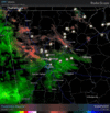
It's crazy to think that only 24-26 hours ago our area had 2 inch+ QPF. And yes, I've been watching that area now south of Montgomery since it formed off the Texas coast this AM.Really don't like that area of heavy precip down in southern AL headed straight for the ATL metro...if that stays as potent as it currently looks and it's below freezing here, might as well just lock down the half inch ice totals.
Finished with 2.25-2.5 inches of snow. Was an amazing finish with big time flakes. Mostly sleet now. Roads are just straight up awful here. View attachment 188799
This is US-460 and yes it’s a highway btw
Chatty really overperformed today. I recall their temps were supposed to be well above freezing by now.
It was supposed to end closer to midnight but snow started a few hours earlier than anticipated. So I guess it cancels out. 6-7 (ha) hours of snowWhen were you supposed to change to sleet? May portend to how I will do up here
Went out and took some photos of the snowflakes that had accumulated on my cartop and they are indeed small 6-sided dendrites along with some plates. Was able to see a few columns in the photos as well.Im convinced the light drops are trying to reform into dendrytes. They are falling again through minus 10 celsius air right after they come through the warm nose. Just a thought. Seeing some sharp pingers jet streak down as well in the flood light. This is as coldest at the surface ive ever seen it precip.

I am at Dallas GA specifically right at 35.0 and pretty much wet-bulbed from rain we have seen and about 36 miles from Cummings in a straight line we shall see if the CAD and when because if make it makes it by 1-2 am right around the heavy axis is knocking on our door it could overperform or of course if doesn't of course not much of nothing.Timing is everything. Atlanta won't be at or below freezing until 3 am or so, at the rate of drop. The northern burbs will be there in an hour and a half. I'm now at 37.2/33.7, WB 35.8.
Keep in mind also that right off the surface it's already below freezing. There will be accretion even at 32. With That cold air up to 950 to 925mb...temps will wetbulb easily well below freezing once precip starts in earnest.I don't know about that lol. I am sitting at 34.5/28 and continue to fall fairly quickly toward 32 here in Midtown. We'll be below 32 well before 3AM at this rate.

Agreed. I expect with this new batch of rain, it will switch everyone Atlanta north to freezing rain. It'll be a close call for me. HRRR initialize too warm over my location on the last run.Keep in mind also that right off the surface it's already below freezing. There will be accretion even at 32. With That cold air up to 950 to 925mb...temps will wetbulb easily well below freezing once precip starts in earnest.
As soon as that precip gets here we are changing overNot too far off…
What are you at Temp wise right now and wet blub? In Dallas we are right at Wet Bulb other then maybe .5 a degree will take CAD to do restAs soon as that precip gets here we are changing over
As soon as that precip gets here we are changing over