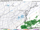
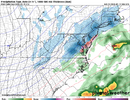
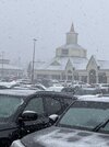
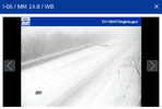
0z Nam snowing in NC east of apps hr 66,69
-
Hello, please take a minute to check out our awesome content, contributed by the wonderful members of our community. We hope you'll add your own thoughts and opinions by making a free account!
You are using an out of date browser. It may not display this or other websites correctly.
You should upgrade or use an alternative browser.
You should upgrade or use an alternative browser.
Jan. 18-19 Hors D'Oeuvres
- Thread starter RBR71
- Start date
Brent
Member
Eagles play in Philadelphia at 3pm Sunday btw
Hopefully
Hopefully
Probably not gonna happen but the 1" mean has crept back into North Central NC on the gefs
Downeastnc
Member
Hmmmmmmm this is new....
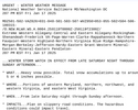
Sunday Night
A slight chance of rain showers, mixing with snow after 10pm, then gradually ending. Mostly cloudy, with a low around 25. Chance of precipitation is 20%.
Sunday Night
A slight chance of rain showers, mixing with snow after 10pm, then gradually ending. Mostly cloudy, with a low around 25. Chance of precipitation is 20%.
6z GEFS took it away but the GRAF still has a light band moving through as precip exitsProbably not gonna happen but the 1" mean has crept back into North Central NC on the gefs
- Joined
- Jan 23, 2021
- Messages
- 4,602
- Reaction score
- 15,197
- Location
- Lebanon Township, Durham County NC
3K NAM had a changeover line advancing through the triad at 18z in its 6z run
JP152
Member
I saw it’s expected to be the coldest inauguration since 1985.
JP152
Member
They are moving it inside now.I saw it’s expected to be the coldest inauguration since 1985.
The 1985 inauguration was moved inside, as well.They are moving it inside now.
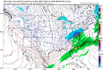
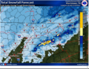
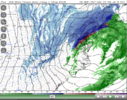
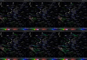
I live in central northern, Alabama, so we rarely get a good snow. This past weekend was the best we’ve had in a while, and it was about 2-3 inches deep. Our biggest snow in my lifetime was in March of 93. We had about one to two feet of snow, with 4-5 foot snow drifts. Might not ever see that again. I say all of that to ask this- what model is the most accurate? Right now I’m praying it’s the Canadian Model, because it show us getting the most snow. Just wondering if anyone can tell me which one is most accurate most of the time. TIA!Small potential for Mountains, Northern NC and Va with some wrap around moisture as system pulls away Sunday night.
View attachment 163541
View attachment 163542
View attachment 163543
JP152
Member
ForsythSnow
Moderator
Just for reference, the short range models are playing catch up with the snow in TN currently. They're not showing any while there are widespread reports.
John1122
Member
Moderate snow here, 1/2 inch down in the last hour. 31 degrees.
Storm5
Member
Snowing here in Grant
Second time in 8 days . Cars and roofs already white
Second time in 8 days . Cars and roofs already white
Playoff football
View attachment 011925.mp4
View attachment 011925.mp4
Moderate snow here in Gatlinburg. Should be a fun drive out in the morning.
LukeBarrette
im north of 90% of people on here so yeah
Meteorology Student
Member
2024 Supporter
2017-2023 Supporter
Lots of sleet and rain here in Bburg at 35
ghost1
Member
Driving in a flizzard in N MS right now. Ground white 10 miles W of Walnut
LukeBarrette
im north of 90% of people on here so yeah
Meteorology Student
Member
2024 Supporter
2017-2023 Supporter
Wet flakes now
LukeBarrette
im north of 90% of people on here so yeah
Meteorology Student
Member
2024 Supporter
2017-2023 Supporter
Graupel/Snow mix currently
We have flurries with temps just above freezing at 34f.
vsublazer
Member
Just took trash out and had a few flurries flying around.
JP152
Member
JP152
Member
If Wise gets 2-3 then the high country like High Knob is looking at 4-6. They've already had 30 inches just in January.
Nomanslandva
Member
The NAM 3k persisted in showing several hours of snow here, 15z-19z for many runs while all other models showed all rain. So for this one HRRR, and RGEM were much better with ptype than NAMs. I did see a few very slopy flakes hit the windshield during one of the heavier showers, but that was it.
JP152
Member
The favored NW flow locations around CHA and down to NGA should be seeing some light snow over the next several hours according to radar. Flurries to light snow here and not amounting to too much but nice to see. This appetizer will likely be the main course for this week I suppose. 
Flurries in Woodstock! Certainly don’t expect accums
LukeBarrette
im north of 90% of people on here so yeah
Meteorology Student
Member
2024 Supporter
2017-2023 Supporter
Didn’t get a lick of accums today. HRRR wins it.Graupel/Snow mix currently
Flizzard conditions. 29/flurries/wind gusts around 25mph. Very minor dusting here.
Getting some solid flurries here just south of Birmingham.
The appetizer before the appetizerGetting some solid flurries here just south of Birmingham.

