Deep tropics
-
Hello, please take a minute to check out our awesome content, contributed by the wonderful members of our community. We hope you'll add your own thoughts and opinions by making a free account!
You are using an out of date browser. It may not display this or other websites correctly.
You should upgrade or use an alternative browser.
You should upgrade or use an alternative browser.
Tropical Invest 98L
- Thread starter SD
- Start date
Gonna be a big problem for someone
Stormsfury
Member
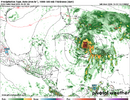
We're actually very close to a surface low cutting off very soon. Very strong southerly surge feeding into the Eastern side of 98L, into the very prominent mid level spin. The western Edge of 98L is where the surface is strongly trying to cut off
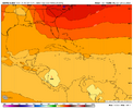
1. 12Z UKMET (goes to 168) maps once again have the low stay in the S Car and go west into Nicaragua; low is a bit stronger with it down to 1003 at strongest, which should easily be strong enough to be a TD although the textual output doesn’t show that:
Will UK for 98L be a miserable fail, the big winner, or in between? Stay tuned!
————
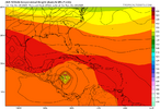
2. 12Z JMA (goes to 192): has a cat 1 hurricane headed due west to just offshore the Nicaragua/Honduras border:

Will UK for 98L be a miserable fail, the big winner, or in between? Stay tuned!
————
2. 12Z JMA (goes to 192): has a cat 1 hurricane headed due west to just offshore the Nicaragua/Honduras border:

NCSNOW
Member
Avalanche
Member
0Z runs: all major ops are out
-Icon cat 2 H W. Haiti
-CMC first moves W and then WNW/NW to Jamaica as a TS followed by SW and then abrupt turn to N and then NNE/NE over C Cuba/NC Bahamas as a cat 3 H followed by a turn back to the N with it ending on a heading toward Cape Cod as it gets caught on the E side of a strong trough/upper low
-GFS very consistently hits Hispaniola again (cat 2 H)
-Euro just W of Jamaica, EC Cuba to C Bahamas (MH)
-UKMET remains quite consistent with the track and this time the text has it as a TC through hour 156, after which it weakens on approach to the NE Nicaraguan coast. The direction of movement starts off mainly WNW (with the furthest N being only at 15.3N) followed by W and then WSW; strongest it gets is a minimal TS and lowest SLP 1004. At hour 156, the 0Z UKMET is a whopping 1,500 miles WSW of the 0Z GFS!
TROPICAL STORM 98L ANALYSED POSITION : 11.1N 69.0W
ATCF IDENTIFIER : AL982025
LEAD CENTRAL MAXIMUM WIND
VERIFYING TIME TIME POSITION PRESSURE (MB) SPEED (KNOTS)
-------------- ---- -------- ------------- -------------
0000UTC 21.10.2025 0 11.1N 69.0W 1009 30
1200UTC 21.10.2025 12 14.0N 71.5W 1008 35
0000UTC 22.10.2025 24 14.0N 73.6W 1006 31
1200UTC 22.10.2025 36 14.2N 74.3W 1005 34
0000UTC 23.10.2025 48 15.3N 75.2W 1004 31
1200UTC 23.10.2025 60 15.3N 75.8W 1005 33
0000UTC 24.10.2025 72 15.3N 76.8W 1005 28
1200UTC 24.10.2025 84 15.3N 77.3W 1005 27
0000UTC 25.10.2025 96 14.7N 78.0W 1005 25
1200UTC 25.10.2025 108 14.6N 79.1W 1006 26
0000UTC 26.10.2025 120 14.2N 80.6W 1004 23
1200UTC 26.10.2025 132 14.4N 81.8W 1005 25
0000UTC 27.10.2025 144 13.9N 82.5W 1004 20
1200UTC 27.10.2025 156 14.1N 82.8W 1005 18
0000UTC 28.10.2025 168 CEASED TRACKING
Last edited:
NCSNOW
Member
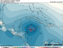
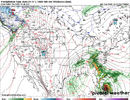
GFS and GEFS are so much further east / NE than everything else. Here's latest EPS. I see how UKMET ( Only one Gawx posted gets into Central America ). Can't be totally dismissed. If we had the right H5 Pattern late next week to capture this booger, we could have had a drought buster. Euro Op, still gives us some relief with the kicker for this thing


Brent
Member
Melissa probably coming today and it's gonna be a slow mover through the weekend at least
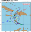
Caribbean Sea (AL98):
Satellite, radar, and surface observations indicate that the area
of low pressure over the central Caribbean Sea appears to be
developing a well-defined center, and is already producing winds up
to 45 mph. A tropical storm is expected to form later today while
it slows down over the central Caribbean Sea. Heavy rainfall and
gusty winds are possible over portions of the ABC Islands during the
next day or two. Interests in Puerto Rico, Hispaniola, Jamaica, and
Cuba should monitor the progress of this system as there is a risk
of heavy rain and flooding, strong winds, and rough surf later this
week. The Air Force Hurricane Hunters are scheduled to investigate
the system later today. For additional information on this system,
including Gale Warnings, please see High Seas Forecasts issued by
the National Weather Service.
* Formation chance through 48 hours...high...near 100 percent.
* Formation chance through 7 days...high...near 100 percent.

Last edited:
Stormsfury
Member
98L is literally a tropical storm. I located a pronounced area of rotation around 14.2°N, 70.8°W (my estimate)Melissa probably coming today and it's gonna be a slow mover through the weekend at least
Caribbean Sea (AL98):
Satellite, radar, and surface observations indicate that the area
of low pressure over the central Caribbean Sea appears to be
developing a well-defined center, and is already producing winds up
to 45 mph. A tropical storm is expected to form later today while
it slows down over the central Caribbean Sea. Heavy rainfall and
gusty winds are possible over portions of the ABC Islands during the
next day or two. Interests in Puerto Rico, Hispaniola, Jamaica, and
Cuba should monitor the progress of this system as there is a risk
of heavy rain and flooding, strong winds, and rough surf later this
week. The Air Force Hurricane Hunters are scheduled to investigate
the system later today. For additional information on this system,
including Gale Warnings, please see High Seas Forecasts issued by
the National Weather Service.
* Formation chance through 48 hours...high...near 100 percent.
* Formation chance through 7 days...high...near 100 percent.
View attachment 175601
6Z Euro 144: significant shift NE vs 0Z 150 and 12Z 162 (which were both 150-200 miles SSW to SW of Jamaica) with the 6Z 40 miles E of Jamaica. That’s a 200-250 mile NE shift from the 0Z/12Z!
Followup of 6Z Euro with 6Z EPS:
Whereas the 6Z Euro shifted 200-250 miles NE of the 0Z/12Z runs for that forecast time, keep in mind that the 6Z Euro op is near the NE most 6Z EPS members:
6Z Euro op 144: 40 miles E of easternmost point of Jamaica
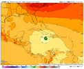
6Z EPS 144: large majority are 300-500 miles WSW to SW of the Euro op!
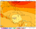
The 12Z position is estimated to be near 14.3N, 71.3W, per this:
AL, 98, 2025102112, , BEST, 0, 143N, 713W, 45, 1003, LO
Thus we now know with more confidence that the 6Z GFS’ 6 hour position near 14.3N, 70.4W is ~60 miles too far east.
AL, 98, 2025102112, , BEST, 0, 143N, 713W, 45, 1003, LO
Thus we now know with more confidence that the 6Z GFS’ 6 hour position near 14.3N, 70.4W is ~60 miles too far east.
Brent
Member
Here she comes
```AL, 13, 2025102112, , BEST, 0, 143N, 713W, 45, 1003, TS, 34, NEQ, 100, 70, 0, 40, 1009, 150, 35, 55, 0, L, 0, , 0, 0, MELISSA, M, 0, , 0, 0, 0, 0, genesis-num, 035, TRANSITIONED, alB82025 to al132025,```
```AL, 13, 2025102112, , BEST, 0, 143N, 713W, 45, 1003, TS, 34, NEQ, 100, 70, 0, 40, 1009, 150, 35, 55, 0, L, 0, , 0, 0, MELISSA, M, 0, , 0, 0, 0, 0, genesis-num, 035, TRANSITIONED, alB82025 to al132025,```
Here she comes
```AL, 13, 2025102112, , BEST, 0, 143N, 713W, 45, 1003, TS, 34, NEQ, 100, 70, 0, 40, 1009, 150, 35, 55, 0, L, 0, , 0, 0, MELISSA, M, 0, , 0, 0, 0, 0, genesis-num, 035, TRANSITIONED, alB82025 to al132025,```
Center is clearly on the W edge of the convection due to significant shear meaning nearly half naked as has been expected initially.
Noles1812
Member
All these systems this year don't want to hit the US. I love it.
All these systems this year don't want to hit the US. I love it.
This is near opposite of 2024’s US devastation. We still don’t yet know about Melissa for sure although the chances are very good that it will spare the US. If so, the FL real estate and home insurance industry will end up with a hugely needed break.
Edit: We shouldn’t forget Chantal which caused record flooding and deaths due to drowning in parts of C NC.
Last edited:
Brent
Member
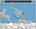
Tropical Storm Melissa Discussion Number 1
NWS National Hurricane Center Miami FL AL132025
1100 AM EDT Tue Oct 21 2025
Satellite images, regional Caribbean radar data, and surface
observations indicate that invest 98L has developed a well-defined
center and organized deep convection to be designated a tropical
cyclone. A ship report that recently passed near the center of the
system reported a minimum pressure of about 1003 mb. Satellite
imagery shows the system is asymmetric, with the low-level center
near the western edge of the central dense overcast. The initial
intensity is set at 45 kt, based on a blend of the latest satellite
intensity estimates, marking the formation of Tropical Storm
Melissa. An Air Force Hurricane Hunter aircraft is scheduled to
investigate the system this afternoon, and their data should provide
a better assessment of Melissa's strength and structure.
The system was moving very quickly westward over the past several
days, but it has slowed down significantly this morning, which has
likely helped Melissa form. The initial motion is estimated to be
280/12 kt. Melissa should continue to slow down and gradually turn
to the northwest and then north during the next couple of days
toward a weakness in the subtropical ridge. This motion will likely
take the storm very near the southwestern tip of Haiti and Jamaica
by Thursday. After that time, the guidance diverges significantly
with some models like the GFS and HWRF showing a motion to the
northeast into the weakness, while the other solutions show a stall
or a westward drift on the south side of a building ridge. An
examination of the GFS, ECMWF, and Google DeepMind ensemble suites
suggest that the majority of the members show Melissa not moving
into the weakness and remaining in the Caribbean Sea throughout the
week and into the weekend. The NHC official track forecast lies
between the Google DeepMind ensemble mean track and the correct
consensus aid, HCCA.
Melissa is expected to be over the very warm waters of the
Caribbean, but the models suggest that vertical wind shear will be
moderate with some dry air in the vicinity of the storm during the
next few days. Based on these mixed signals, the strengthening
trend is expected to be slow and steady, not rapid. However, the
future intensity of Melissa is linked to the track and since that is
quite uncertain beyond a couple of days, the strength of the storm
is also quite uncertain. The NHC intensity forecast is in best
agreement with the HCCA model.
Key Messages:
1. Melissa is expected to bring heavy rainfall and the risk of
significant flash flooding and the danger of landslides to portions
of Haiti and the Dominican Republic through the weekend.
2. A Hurricane Watch has been issued for the southern coast and
Tiburon peninsula of Haiti. A Tropical Storm Watch has been issued
for Jamaica. Preparations to protect life and property should be
completed by Thursday.
3. There is significant uncertainty in the track and intensity
forecast of Melissa. Interests elsewhere in Hispaniola and Cuba
should continue to monitor the latest forecasts.
FORECAST POSITIONS AND MAX WINDS
INIT 21/1500Z 14.3N 71.7W 45 KT 50 MPH
12H 22/0000Z 14.4N 72.8W 50 KT 60 MPH
24H 22/1200Z 14.8N 73.5W 55 KT 65 MPH
36H 23/0000Z 15.3N 74.2W 60 KT 70 MPH
48H 23/1200Z 15.7N 74.5W 60 KT 70 MPH
60H 24/0000Z 16.1N 74.6W 60 KT 70 MPH
72H 24/1200Z 16.5N 74.5W 60 KT 70 MPH
96H 25/1200Z 16.9N 74.5W 65 KT 75 MPH
120H 26/1200Z 17.2N 74.9W 70 KT 80 MPH
$$
Forecaster Cangialosi/Bucci
Man that thing is going to be crawling
Melissa is going to be one of the more interesting storms to track. A motion a little more west initially increased the chances of a much further western position beyond day 5 when an upper ridge is forecast to build north of the storm. On the other hand, faster deepening increases the chance Melissa follows the insistent GFS forecast of a north motion into Haiti, then escaping out to sea.
I pray for the Greater Antilles that Melissa mostly stays on the move and doesn't cause too much flooding.
I pray for the Greater Antilles that Melissa mostly stays on the move and doesn't cause too much flooding.
That’s a forecast track you don’t see everyday.
12Z
-GFS (Hisp.), CMC (C Cuba), Icon (weaker than recent runs but still E of Jamaica to Jamaica) and UKMET (Nic/Honduras border) are pretty similar to recent runs.
UK:
TROPICAL STORM MELISSA ANALYSED POSITION : 14.7N 70.8W
ATCF IDENTIFIER : AL132025
LEAD CENTRAL MAXIMUM WIND
VERIFYING TIME TIME POSITION PRESSURE (MB) SPEED (KNOTS)
-------------- ---- -------- ------------- -------------
1200UTC 21.10.2025 0 14.7N 70.8W 1007 36
0000UTC 22.10.2025 12 14.7N 73.1W 1005 33
1200UTC 22.10.2025 24 15.0N 74.3W 1005 36
0000UTC 23.10.2025 36 15.5N 75.0W 1004 35
1200UTC 23.10.2025 48 16.1N 76.4W 1005 35
0000UTC 24.10.2025 60 16.4N 76.4W 1005 27
1200UTC 24.10.2025 72 16.6N 76.7W 1005 30
0000UTC 25.10.2025 84 16.4N 78.0W 1005 27
1200UTC 25.10.2025 96 15.7N 79.7W 1006 25
0000UTC 26.10.2025 108 15.1N 81.5W 1005 23
1200UTC 26.10.2025 120 15.0N 82.8W 1005 24
0000UTC 27.10.2025 132 15.5N 84.0W 1006 22
1200UTC 27.10.2025 144 CEASED TRACKING

