• Hello, please take a minute to check out our awesome content, contributed by the wonderful members of our community. We hope you'll add your own thoughts and opinions by making a free account!

Tropical Invest 95L

Webberweather53

Meteorologist
Joined
Jan 5, 2017
Messages
15,695
Reaction score
53,825
Location
Desert Southwest ?
According to the Atlantic Tropical Cyclone Forecast (ATCF) system, we officially have invest 95L in the eastern Caribbean.

AL, 95, 2019072818, , BEST, 0, 128N, 633W, 25, 1010, DB, 34, NEQ, 0, 0, 0, 0, 1013, 120, 60, 0, 0, L, 0, , 0, 0, INVEST, M, 0, , 0, 0, 0, 0, genesis-num, 009, SPAWNINVEST, al712019 to al952019,

Link to official NHC ATCF best track:

https://ftp.nhc.noaa.gov/atcf/btk/

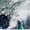
This disturbance poses a legitimate threat to become a tropical cyclone in the Bahamas or near Florida later this week.

Screen Shot 2019-07-28 at 2.22.46 PM.png
 
According to the Atlantic Tropical Cyclone Forecast (ATCF) system, we officially have invest 95L in the eastern Caribbean.

AL, 95, 2019072818, , BEST, 0, 128N, 633W, 25, 1010, DB, 34, NEQ, 0, 0, 0, 0, 1013, 120, 60, 0, 0, L, 0, , 0, 0, INVEST, M, 0, , 0, 0, 0, 0, genesis-num, 009, SPAWNINVEST, al712019 to al952019,

Link to official NHC ATCF best track:

https://ftp.nhc.noaa.gov/atcf/btk/

This disturbance poses a legitimate threat to become a tropical cyclone in the Bahamas or near Florida later this week.

View attachment 21310
Hell , it already looks better than Barry
 
The good news for the US is that the 12Z EPS doesn't have even one TS from the 50+ members hitting the Gulf with 95L over the next 10 days. About all they have are 2 TDs in the GOM that then hit FL. There's also a TD that hits SE FL. (There's one member hitting NC with a TS from the E. I don't know what that is.) Many of the remaining members of the 12Z EPS as well as 12Z GEFS and 12Z GEPS are TDs or TSs offshore the SE US recurving.

This is in contrast to the much more active EPS in advance of Barry in the GOM.

The main threat would be if the various models/ensemble members are too aggressive with their recurvatures due to too much E US troughing being assumed due to bias. Hopefully that is not the case, but there has been a subtle SW shift in the mean 12Z EPS track vs the 0Z EPS fwiw.

12Z EPS tracks link:
https://weather.us/cyclone-tracks/euro/902-w-263-n/2019072812-240.html
 
Last edited:
Although the mean is still just over 100 miles offshore SE FL, the 0Z GEFS is continuing a trend of the last 3 GEFS means of very slightly closer to FL/SE US with an ever so slightly stronger Bermuda High with each run, pushing 95L ever so slightly SW with each run. Whereas the 6Z was just E of Grand Bahama Is., the 0z is further west over the west central part of that island representing a shift of ~100 miles the last 3 runs. Is this trend going to continue? If this trend is due to a correction of a quite common bias toward too much E US troughing, then later GEFS means may very well correct even further SW and thus put SE FL in its crosshairs. We'll see. Regardless, the members are still pretty weak with mainly TDs to maybe some TSs.
 
Florida, start preparations now ! ?17BF2106-802B-4938-88D3-6EBC74553E0D.png
 
This storm is dead, DT curse ftw

One person's curse is another person's blessing.

Be that as it may, I assume you're joking since it wasn't expected to develop this early, regardless, and the various ensemble runs still suggest at least a weak area of sfc lower pressure should be in the Bahamas/FL region this weekend. And I wouldn't rule out E GOM yet due to typical model bias. Whether or not this weak low develops into a TC is a good question. I wouldn't bet on it right now but also wouldn't yet rule it out. Regardless, it may very well enhance rainfall in especially along and near the SE coast. A track into the E GOM would mean more of the SE likely would get in on the enhanced rainfall.
 
Last edited:
NHC has decreased chances to only a 10% chance of development in the next 5 days. Near 0% chance in next 48 hours.


Shower activity associated with a tropical wave over the eastern
Caribbean Sea has decreased since yesterday. Atmospheric conditions
as well as land effects should inhibit the development of this
system as it moves west-northwestward for the next several days.
This disturbance, however, could still produce an increase in
cloudiness and thunderstorms over Puerto Rico, the Greater Antilles
and portions of the Bahamas during the next few days.

* Formation chance through 48 hours...low...near 0 percent.
* Formation chance through 5 days...low...10 percent.
 
Like most, don't want a hurricane, but a TD would greatly benefit those in the Carolinas who have experienced little if any rain this summer.
 
Like most, don't want a hurricane, but a TD would greatly benefit those in the Carolinas who have experienced little if any rain this summer.

It doesn't even need to be a TD. Look what that tropical moisture provided over much of the SE US in early June and it was never a TD+.
 
I need the tropical moisture badly! I don’t care what it’s called, get it into the SE, any way we can!
 
NHC has decreased chances to only a 10% chance of development in the next 5 days. Near 0% chance in next 48 hours.


Shower activity associated with a tropical wave over the eastern
Caribbean Sea has decreased since yesterday. Atmospheric conditions
as well as land effects should inhibit the development of this
system as it moves west-northwestward for the next several days.
This disturbance, however, could still produce an increase in
cloudiness and thunderstorms over Puerto Rico, the Greater Antilles
and portions of the Bahamas during the next few days.


* Formation chance through 48 hours...low...near 0 percent.
* Formation chance through 5 days...low...10 percent.
Looking at this, as just bit of the matrix, no surprise there ...

wg8shr.GIF

wg8sht.GIF
 
NHC has finally lowered 5 day development chances for this system to near 0%.

An area of disturbed weather spreading across south Florida and the
Bahamas is forecast to move northward, producing additional locally
heavy rainfall over portions of the Florida peninsula during the
next day or two. Significant development of this system is not
expected before it merges with a front and accelerates northeastward
off the southeastern U.S. coast on Sunday.
* Formation chance through 48 hours...low...near 0 percent.
* Formation chance through 5 days...low...near 0 percent.
Making for a nice breezy, cloudy, tropical sort of day (in a good way) though ... ;)
 
Back
Top