Have at it
-
Hello, please take a minute to check out our awesome content, contributed by the wonderful members of our community. We hope you'll add your own thoughts and opinions by making a free account!
You are using an out of date browser. It may not display this or other websites correctly.
You should upgrade or use an alternative browser.
You should upgrade or use an alternative browser.
Tropical Invest 95L
- Thread starter Metwannabe
- Start date
Henry2326
Member
Henry2326
Member
Henry2326
Member
Henry2326
Member
iGRXY
Member
A tropical storm or low grade Cat 1 likely would move to the south of the DR, PR, and probably would head towards Cuba. Hopefully we can get it to enter the eastern Gulf or come up the coast because I'm all for additional rain and clouds to keep the heat away.
BHS1975
Member
A tropical storm or low grade Cat 1 likely would move to the south of the DR, PR, and probably would head towards Cuba. Hopefully we can get it to enter the eastern Gulf or come up the coast because I'm all for additional rain and clouds to keep the heat away.
Or across south FL to cool off the hot tub.
Sent from my iPhone using Tapatalk
Henry2326
Member
Henry2326
Member
Henry2326
Member
The only concern with that is the absolute boiling pot of water that the GOM is right now. If a system were to go over it, I think we would see it absolutely blow up in intensity.A tropical storm or low grade Cat 1 likely would move to the south of the DR, PR, and probably would head towards Cuba. Hopefully we can get it to enter the eastern Gulf or come up the coast because I'm all for additional rain and clouds to keep the heat away.
40/60Central Tropical Atlantic (AL95):
A small area of low pressure, located several hundred miles
west-southwest of the Cabo Verde Islands, is producing an area of
disorganized showers and thunderstorms over the central tropical
Atlantic. Although there is dry air located to the north of
the system, favorable upper-level winds are expected to allow for
gradual development during the next several days. This system
could become a tropical depression early next week, as it moves
westward across the tropical Atlantic.
* Formation chance through 48 hours...medium...40 percent.
* Formation chance through 7 days...medium...60 percent.
Henry2326
Member
If this takes roughly that path and avoids the shredder, this really could be a threat for the Gulf coast.
lexxnchloe
Member
Seems unlikely to do anything unless it goes north of the caribbean which wont happen.
50/701. Central Tropical Atlantic (AL95):
A small area of low pressure located roughly midway between the Cabo
Verde Islands and the Lesser Antilles continues to produce
disorganized showers and thunderstorms. Although environmental
conditions are only marginally conducive, slow development is
expected and this system will likely become a tropical depression
early next week while it moves westward across the tropical
Atlantic.
* Formation chance through 48 hours...medium...50 percent.
* Formation chance through 7 days...high...70 percent.
It’s still something to watch to see if it potentially goes south of the shredder and then turn towards the GOM, but that’s still a good 7-10 days out.Seems unlikely to do anything unless it goes north of the caribbean which wont happen.
Brent
Member
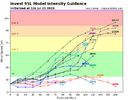
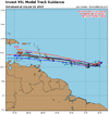
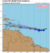
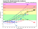
One thing we need to monitor is where the system is at D4. If it goes in the northern camp, it has a chance to avoid the hostile environment in the Carribean, but if it goes in the southern camp, it's DOA about 3 days after it enters the Caribbean. View attachment 135851
Yeah I'm still wait and see here. Theres a very high chance it dies in the Caribbean to me but you can't rule anything out for sure
Henry2326
Member
50/70


