• Hello, please take a minute to check out our awesome content, contributed by the wonderful members of our community. We hope you'll add your own thoughts and opinions by making a free account!

Tropical Hurricane Dorian

I always like to frame tropical threats as having the ball on the court. Need a system in the deep southwestern Atlantic to be a threat because once west of 75W it has to move east to miss. Of course that happens more often than not but without the ball on the court then it is never a threat.

This one looks like it has potential to be a threat.
Yup...this might be a scary one....
 
Yup...this might be a scary one....

Well scary is relative. Florence was scary early because of the projected cat 4 landfall. In the end she made level in a much tamer and not with any really special strength. What made her scary was the stall and 40 inch rainfall totals. This one could be a sheared out mess by the time it gets far enough west to be a concern.
 
Well scary is relative. Florence was scary early because of the projected cat 4 landfall. In the end she made level in a much tamer and not with any really special strength. What made her scary was the stall and 40 inch rainfall totals. This one could be a sheared out mess by the time it gets far enough west to be a concern.
I don't like either scenario...lol.....NHC didn't dance around this one.
 
How’s the pattern right now for the track? I know at this point we can’t tell where it will make landfall but we can look at the steering currents to consider some possible scenarios.
 
How’s the pattern right now for the track? I know at this point we can’t tell where it will make landfall but we can look at the steering currents to consider some possible scenarios.

Anything from the eastern Caribbean to just north of Puerto Rico/Hispaniola is fair game. The longwave pattern w/ a ridge over Atlantic Canada and a trough near to just west of the Lakes usually leads to east coast hits or far western Atlantic/last second recurves but that actually assumes we'd have a storm to begin with and it stays far enough to the north of the Greater Antilles. A track through the central Caribbean graveyard at an intensity of anything less than a bonafide major hurricane usually spells the end of small storms like this except in/around October when the low-level trade wind divergence reaches its climatological minimum. (Matthew (2016) for ex))
 
The visible loop is very impressive this morning w/ 99L, thanks to its position in the ITCZ & a CCKW it has a huge envelope of westerly winds to the south, so it won't have much issue closing off a low-level center if one were to form in the next 48 hours.

It looks like it's trying to close off very quickly. Would you be surprised to see it in a cherry state of potential by 8pm tonight if this level of organization maintains? I wouldn't
 
It looks like it's trying to close off very quickly. Would you be surprised to see it in a cherry state of potential by 8pm tonight if this level of organization maintains? I wouldn't

Recent ASCAT pass did show a closed yet broad/elongated low-mid level low so this has some work to do but I could see it becoming a tropical cyclone as early as later tonight or tomorrow morning.

GOES16_1km_vis_201908231335_3.75_17.25_-51.50_-32.25_vis1_ltng16_hgwy_warn_ascata_ascatb_weath...png
 
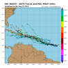
This one is rather unique in it being projected to move at no more than about 3 degrees west in longitude per day in its WNW averaged track. For the current position (central MDR) in late August, that is unusually slow. I’d say that an average late August to early Sep WNW TC track in that area is probably close to double that or about 5-6 degrees west per day while moving WNW. Look back at historical storm tracks to verify. I’d say that a slow WNW central MDR movement like this is closer to the average much later in the season, say, in early Oct. when things tend to slow down on average in that area. If I get time, I’ll look at old maps to see if I can find slower late August movers in this area and see what they ultimately did.
Any thoughts about this?
 
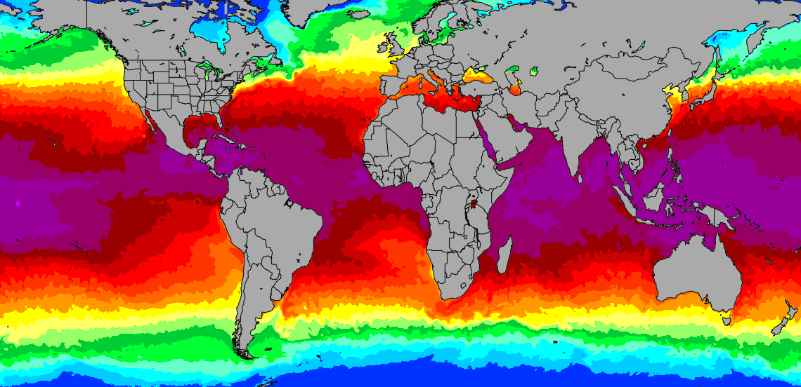
Obviously shear will play a factor but there is no worries for this one when it comes to warm water
sea-temperature.png
 
Recent microwave pass just reaffirms what we saw earlier with ascat. This invest is already on the doorstep of becoming a tropical depression. Typically you see banding features like this on microwave with tropical cyclones only or invests that are about to become one.
Tbh I think at the rate we’re going, we will see this become tropical depression five sometime early-mid day tomorrow unless 98L miraculously beats 99L to the punch. Obviously I could be wrong for reasons related to semi-subjective forecaster analyses at the nhc and small systems like this are hard to forecast.
We shall see what happens but at least we have something to track and keep ourselves temporarily preoccupied while we wait for winter to approach.

05753286-53FC-43AE-9EA0-34F1D0557C96.png
 
Back
Top