• Hello, please take a minute to check out our awesome content, contributed by the wonderful members of our community. We hope you'll add your own thoughts and opinions by making a free account!

Hurricane Debby

RAH afternoon discussion mentions possibility of the westward shift and how it could change the impact to Central NC...

After re-strengthening some offshore Wednesday and early Thursday,
there is some better agreement amongst ensembles with the inland
track of Debby. Notably, the 12Z GEFS has finally come in better
agreement with the EPS/GEPS pulling the circulation into central SC
by Thursday evening, and then into our area through Friday. However,
also of note is there seems to be a consistent westward shift
amongst ensembles in bringing the circulation into central NC a bit
further west than previously thought. This could have considerable
consequences for the spatial distribution of rainfall totals
Thursday through Saturday which is further discussed below.

Regardless of the eventual path, several potentially life-
threatening hazards will occur Thursday through Saturday before the
system transitions to extra-tropical and pulls off to our north.

As discussed above, if the more westward track occurs, this could
enhance rainfall totals over the western piedmont, and consequently
decrease totals for areas further south. The latest 18Z WPC QPF
shows this westward trend, suggesting 4 to 6 inches across much of
the Piedmont (north, central, western), and more like 2 to 4 inches
over the Sandhills/southern Coastal Plain Thursday through Friday
evening. The main takeaway here is that the QPF field from Thursday
onward could continue to be dynamic, but the flooding headlines
remain unchanged area wide.
 
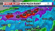
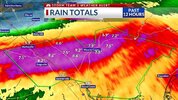
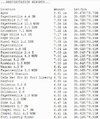
As the Debby center moved to the SE offshore finally putting us on the backside, steady mainly moderate rains resumed about 1.5 hours ago after little rain since late last night. I had been at ~8.5” for the storm before this. We’ll see how much gets added from this and more to come tonight.
 
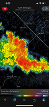
Almost choked off the dry air though its a huge hunk right in the heart of the system, which should prevent anything to crazy from happening anytime soon. Her trying to build a new center with actual storms seems a insurmountable task at this point.

1722989301407.png
 
Let’s not forget about Florence in 2018, so we know it’s definitely possible. Also I see they’ve backed that 8” line back to I-77 in the Piedmont.
That is a major west shift in rain despite the track not moving this way very much on the 5pm advisory. I am almost in the 6–8-inch zone now with the 8-12 zone touching the eastern part of my county. If this holds up, GSP will need to add counties to their flood watch.
 
That is a major west shift in rain despite the track not moving this way very much on the 5pm advisory. I am almost in the 6–8-inch zone now with the 8-12 zone touching the eastern part of my county. If this holds up, GSP will need to add counties to their flood watch.
One thing that I’ve noticed is that all of the models seem to have a very intense and wide band that sets up to the west and northwest of the center as it moves inland. Where that band pivots and dumps over is going to add up totals very quickly.
 
That is a major west shift in rain despite the track not moving this way very much on the 5pm advisory. I am almost in the 6–8-inch zone now with the 8-12 zone touching the eastern part of my county. If this holds up, GSP will need to add counties to their flood watch.

With the potential significant impacts to at least a portion of the GSP coverage area, I thought their afternoon forecast discussion left a lot to be desired.
 
The ICON and Euro came about 30-40 miles west again at 18z and the Euro slowed it down a little. I know this is not right, but the Euro had gusts to around 60mph in a couple of areas north of the Charlotte metro. I'd expect 40-45 is what actually happens though.
 
Just looking at the current satellite. Could it be possible that a new center forms closer to the gulf stream. I swear that's what it looks like to me.
 
Back
Top