ForsythSnow
Moderator
Whatever happened to the other ones, we are now at 95. Looks organized on satellite and at 30/30. Some models develop this into a a tropical storm at least so we may get our B name.
Shower activity has changed little in organization near a small
area of low pressure and tropical wave located several hundred miles
west-southwest of the Cabo Verde Islands. In addition, recent
satellite-derived wind data and visible satellite images suggest
that the system may not have a closed surface wind circulation.
Some development of this system is possible during the next day or
two while it moves westward at 10 to 15 mph over the tropical
Atlantic Ocean. Upper-level winds are expected to become less
conducive for development by this weekend when the system approaches
the Lesser Antilles.
* Formation chance through 48 hours...low...30 percent.
* Formation chance through 5 days...low...30 percent.
.jpg")
It sure did. I bet we have a storm tomorrow.Well that escalated quickly
I hope they form and give SD the 1-2 punch of rain he needs!It sure did. I bet we have a storm tomorrow.
TD Two now.Maybe (and very perhaps) I'm wrong, but it just does not look real ...
I know; I ain't often right ... LOL ...TD Two now.
")
Think it is supposed to dissipateI know; I ain't often right ... LOL ...
Still think it has a tough row to hoe in order to get a name; still thinking 2 named this month ...
Dadgumit ...It is very likely now a TS and maybe a strong one.

Dadgumit ...
Beautiful little thing on radar ...
View attachment 5419
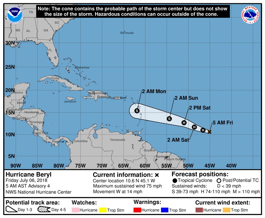
I think we have Beryl ...
Good lesson ... do not rely on me to call storms ...
Also BTW, that storm is Maria out in the W Pacific. Glad that isn't headed our way.Dadgumit ...
Beautiful little thing on radar ...
View attachment 5419
I think we have Beryl ...
Good lesson ... do not rely on me to call storms ...
That escalated quickly. Was expected to be barely a TS last advisory. I also can't see how they expect it to go from 60 to dissipated.Forecasting a hurricane briefly now at 5
That escalated quickly. Was expected to be barely a TS last advisory. I also can't see how they expect it to go from 60 to dissipated.
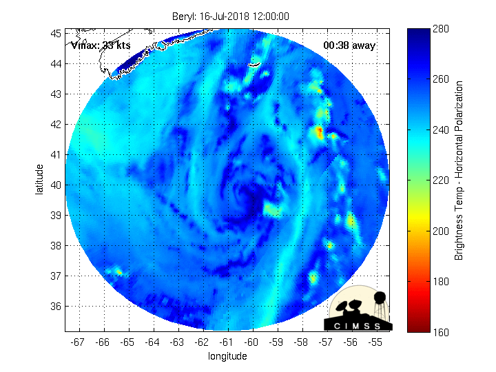
An area of showers and thunderstorms associated with the remnants
of Beryl is producing locally heavy rainfall and strong gusty winds
over the northeastern Caribbean Sea and the northern Leeward
Islands. The disturbance is expected to move west-northwestward
for the next day or so, passing over the Virgin Islands and Puerto
Rico today, and over Hispaniola tonight. Unfavorable upper-level
winds and interaction with land should prevent redevelopment during
the next day or two, but environmental conditions could become
somewhat conducive for regeneration of a tropical cyclone later this
week when the system is forecast to turn northward over the Bahamas
and the western Atlantic. Additional information on this system can
be found in High Seas Forecasts issued by the National Weather
Service.
* Formation chance through 48 hours...low...near 0 percent
* Formation chance through 5 days...medium...40 percen