From GSP:
SHORT TERM /SATURDAY NIGHT THROUGH MONDAY/...
As of 145 PM Fri: Upper
anticyclone will continue to build over the
eastern
CONUS Sunday and Monday. PWATs will remain below
climo.
Low-level
moisture flux will be weak although winds will be southerly
at times, particularly in the afternoons. Temperatures will warm
under building thicknesses and airmass modification. Dewpoints will
trend a little higher as well, although they still should mix and
have some mitigating impact on
heat index. Some Piedmont spots
nonetheless will see values in the 97-102 range each day. Still think
a few
isolated showers/storms may be able to develop diurnally over
the mountain ridges, but otherwise the
fcst remains dry thru Monday.
Pulse-storm
microburst threat would be the main concern if any storms
are able to get tall enough.
&&
.LONG TERM /MONDAY NIGHT THROUGH FRIDAY/...
As of 200 PM Fri:
Anticyclone is still
progged to retrograde and
weaken slightly Tuesday into late week but will remain the dominant
factor in our weather. Lapse rates will remain poor under the
ridge,
as one might expect. A
quasi-stationary front and zone of higher
PWAT
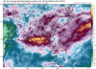
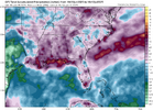
is seen on the northern periphery of the
ridge, representative of the
"ring of fire". Slight
height falls, and associated passage of a
trough thru eastern Canada Wed-Fri, lead some model runs to depict
that frontal zone sinking southward to our vicinity by Thu, and in
some cases as early as Wed, resulting in an uptick in
PoPs those
days. That said, chances are still below
climo, and confined to the
mountains until after 00z Fri. Max temps in the upper 90s for much of
the Piedmont Mon-Wed with lower 90s for mountain valleys. Very deep
mixing is expected which should tap into drier air aloft and help
dewpoints mix out a few degrees each afternoon.
Despite the fact that daily records are not currently forecast to be
tied/broken (see
climate section below), potential for a
climatologically unusual
heat wave does exist per the
ECMWF Extreme
Forecast Index rising above 0.95 for MaxT in some of our
CWA Tue and
Wed, coincident with SoT > 1. That doesn`t take into account heat
index, which is expected to top out near 105 in a few spots in the
Piedmont Tue-Thu. Min temps probably will be very high--again not
quite reaching high-min records, but contributing to a multi-day heat
event. The warm mins help the
NWS HeatRisk product reach the Major
category over most areas along/south of I-85 Mon-Thu, and Extreme in
some of the Charlotte
metro Tue-Thu. Current forecast values suggest
Heat Advisory eventually will be needed for parts of the area, but
given the duration some consideration may be given to an Extreme Heat
Watch if confidence continues to grow in impacts.
I absolutely dread, detest, loathe, and abhor weather like this.


