Stormsfury
Member
38 here and drizzling in Goose Creek. 925mb cold enough but 850mb still running about 2C41/38.6 right now on James Island.
38 here and drizzling in Goose Creek. 925mb cold enough but 850mb still running about 2C41/38.6 right now on James Island.
Precip starting to develop ITP right now. Now we just wait and see if anything frozen actually makes it to the surface over the next few hours. 925mb (-1C) and 850mb (-3C) temps are subfreezing according to SPC.HRRR putting Atlanta on flurry watch early in the AM

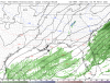
 weather.cod.edu
38 here and drizzling in Goose Creek. 925mb cold enough but 850mb still running about 2C

Our bigger storm is coming man. It can't keep holding out forever (I hope).
The 2014 localized deal here, I think you saw some not too long ago along the coast.. these nickle and dime events.. soon.. hopefully.
Yes. But there’s a reason CAE (for example) averages so little snow. It just doesn’t snow that much. Keep in mind Columbia recorded over half a decade’s worth of snow in a single storm in 2010 (the Valentine’s Day storm). But it’s been a pretty bad drought since, for sure.Does anyone think South Carolina will ever see a big snow storm again? I’m not talking northern upstate. I’m talking everyone even below the dreaded i85 line. It’s been a while.
Maybe just got to get everything time just right really need a storm to come in at night instead of during the day to maximize colder airDoes anyone think South Carolina will ever see a big snow storm again? I’m not talking northern upstate. I’m talking everyone even below the dreaded i85 line. It’s been a while.

 ?
?Starting to get some showers here as well. 36.9/36.4. Have to imagine if the temperature goes down another degree or two it will change to snow given the cold upper air in place.Half an hour ago it was raining, but it looked like there could have been some wet flakes mixed in or maybe I'm just delusional idk.?
EDIT: Temp dropped to 38/34. WB is 36.5
Not 100% sure right now but might be getting a mix of rain and some tiny snowflakes. 36.5/36Starting to get some showers here as well. 36.9/36.4. Have to imagine if the temperature goes down another degree or two it will change to snow given the cold upper air in place.
Glad you scored some snow buddy!!! You are always so positive and calm even when things are looking very gloomy winter weather wise. I like seeing people get snow who aren’t constantly declaring winter is over from December on.Measured some areas with 2 inches and some with 3 inches ... overall this was probably the wettest snow I’ve seen in a while.. stuck to literally everything in sight and you could pick it up and squish it a bit and an immediate snowball .. for this crappy winter this was an A+ event for me ... truly love seeing and tracking winter weather and it’s what got me into weather in the first place .. that’s why my inner weenie comes out a lot when tracking this type of stuff

I got 3". It looks like RDU airport received 2.5"Looks like most folks area-wide either verified the low end of my forecast map or busted low, I think air temps being in the middle 30s, just above freezing coupled w/ warm ground temps and dendrites that weren't efficient at accumulating to begin with caused most of the issues wrt snow accumulations. I'm very curious to hear about what everyone received in their backyards when the final flakes fell.