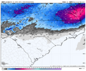
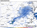
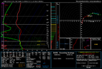
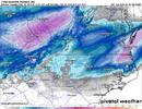
I guess Rah NWS not expecting much increase in QPF, seem to not be buying into trends of the day 
-
Hello, please take a minute to check out our awesome content, contributed by the wonderful members of our community. We hope you'll add your own thoughts and opinions by making a free account!
You are using an out of date browser. It may not display this or other websites correctly.
You should upgrade or use an alternative browser.
You should upgrade or use an alternative browser.
rburrel2
Member
I guess Rah NWS not expecting much increase in QPF, seem to not be buying into trends of the day
i think the area that's the most in question on here is prolly just ne of wake co. even then its still reasonable to me
packfan98
Moderator
Keep us updated on that in real time. It’s always an interesting case study. We’ve seen a couple of times where it’s been a factor, but I think it’s also used as a scapegoat that larger totals aren’t going to verify. There’s so many other factors that are in play.If this happens in the gulf, then everyone is screwed.
It won't happen though.
View attachment 170447
Webberweather53
Meteorologist
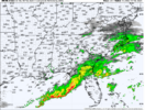
The long range HRRR is usually straight garbage, esp in these warm advection regimes
Bigedd09
Member
I mean it's not even super long range anymore thoughThe long range HRRR is usually straight garbage, esp in these warm advection regimes
I guess Rah NWS not expecting much increase in QPF, seem to not be buying into trends of the day
If Charlotte gets as much snowfall as Raleigh from this one, I'll eat my shoe.
(Just kidding since that could actually happen, LOL!)
But it's interesting because their 3-4" for Greensboro is actually quite bullish and indicates more QPF out that way than a lot of the modeling gives (GFS, SREF, NAM, etc. excepted) whereas the 1-2" for Raleigh seems pretty bearish...just must be expecting mixing for a substantial portion (majority?) of the storm. Would certainly go higher than them NE of Wake County, not sure how they don't get more snow than Greensboro.
Maybe they're betting the coastal consolidates further north swinging through Greensboro as it consolidates while also shifting the meat of the jackpot and warm noseIf Charlotte gets as much snowfall as Raleigh from this one, I'll eat my shoe.
(Just kidding since that could actually happen, LOL!)
But it's interesting because their 3-4" for Greensboro is actually quite bullish and indicates more QPF out that way than a lot of the modeling gives (GFS, SREF, NAM, etc. excepted) whereas the 1-2" for Raleigh seems pretty bearish...just must be expecting mixing for a substantial portion (majority?) of the storm.
norcarolinian
Member
Agree…. But if they think 3-4” for GSO we should be in WSW no? I’ll be surprised if the Triad metro gets more than 2” fwiwIf Charlotte gets as much snowfall as Raleigh from this one, I'll eat my shoe.
(Just kidding since that could actually happen, LOL!)
But it's interesting because their 3-4" for Greensboro is actually quite bullish and indicates more QPF out that way than a lot of the modeling gives (GFS, SREF, NAM, etc. excepted) whereas the 1-2" for Raleigh seems pretty bearish...just must be expecting mixing for a substantial portion (majority?) of the storm. Would certainly go higher than them NE of Wake County, not sure how they don't get more snow than Greensboro.
packfan98
Moderator
NBAcentel
Member
Webberweather53
Meteorologist
I mean it's not even super long range anymore though
By long range I mean anything outside of about 12-15 hours or so. It is often terrible outside of that in this kind of setup
Lowtown
Member
Seems odd that RAH has the I-40 counties under WWAs while officially forecasting 3-4" for Greensboro, for example. That's warning criteria here. They either need to lower the forecast or upgrade a tier of counties to WSW.
norcarolinian beat me to this observation. Guess we're seeing the same thing.
norcarolinian beat me to this observation. Guess we're seeing the same thing.
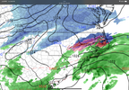
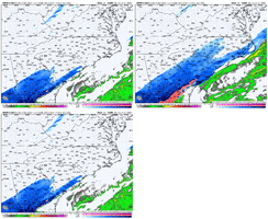
yeah won't take too much to get it to light up tomorrow morning. still an outlier for nowJust a give a reference to how cheeks the hrrr is View attachment 170449View attachment 170448
rburrel2
Member
The 36-48hr Euro/EPS/AIFS isn't going to bust radically over a large area. When these hi-res models show something radically different, it's b/c they suck and aren't designed to predict accurately at those lead times.
Cary_Snow95
Member
It’s like everyone forgets it literally will make drastic changes at hour 8 and then change again on the next runI think we tend to put to much faith in the HRRR.
You would think. I was going off the shades on RAH WFO’s Winter site.Agree…. But if they think 3-4” for GSO we should be in WSW no? I’ll be surprised if the Triad metro gets more than 2” fwiw
In other news, the “max” potential keeps on rising. Up to 8” in Durham and MBY, 15”+ for @RBR71 and Moyock, and 15-20” in Hampton Roads!
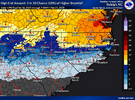
Yeah it seems off with the orientation of that line, nothing really shows Roxboro and Roanoke Rapids getting same amount.If Charlotte gets as much snowfall as Raleigh from this one, I'll eat my shoe.
(Just kidding since that could actually happen, LOL!)
But it's interesting because their 3-4" for Greensboro is actually quite bullish and indicates more QPF out that way than a lot of the modeling gives (GFS, SREF, NAM, etc. excepted) whereas the 1-2" for Raleigh seems pretty bearish...just must be expecting mixing for a substantial portion (majority?) of the storm. Would certainly go higher than them NE of Wake County, not sure how they don't get more snow than Greensboro.
I've said this before I think but these maps don't have human input as far as I'm aware. I think it might just be the 90th percentile nbm outputYou would think. I was going off the shades on RAH WFO’s Winter site.
In other news, the “max” potential keeps on rising. Up to 8” in Durham and MBY, 15”+ for @RBR71 and Moyock, and 15-20” in Hampton Roads!
View attachment 170451
packfan98
Moderator
banding possibilities have increased?You would think. I was going off the shades on RAH WFO’s Winter site.
In other news, the “max” potential keeps on rising. Up to 8” in Durham and MBY, 15”+ for @RBR71 and Moyock, and 15-20” in Hampton Roads!
View attachment 170451
packfan98
Moderator
This is prolly gonna do pretty well honestly.Weatherbell maps are working again! Here’s the latest NBM. Looks a little paltry compared to some previous runs.
View attachment 170452
Same snow hole every time on the NC/VA border. Right over my area. It's on every model it seems. We usually do okay but appears not this time.Weatherbell maps are working again! Here’s the latest NBM. Looks a little paltry compared to some previous runs.
View attachment 170452
i think the HRRR is the gold standard, and everybody should panic, now
Heck no, if I get a foot metwannabe is retired!@RBR71, dude, you’ve got a 51% chance of 8” and a 23% chance of getting a foot! Can you change beck to @metwannabe if you get a foot???
Cad Wedge NC
Member
I panicked yesterday. I am good now thanks.i think the HRRR is the gold standard, and everybody should panic, now
Pilotwx
Member
Keep an eye on Low being closer to the coast in the Gulf and Atlantic on future runs. Something to watch
Unless you're in Moyocki think the HRRR is the gold standard, and everybody should panic, now
NBAcentel
Member
I distinctly remember a storm in Feb,
Seems like it was mid to late Feb in the last 10-15 years where John Cessarich was using the rap it was showing a big snow in the 85 corridor in the upstate.
It busted badly.
We started as snow for a couple of hours before changing to rain here.
Everything melted in a few hours.
Kendra Kent went with a different model which showed the scenario that played out and won that forecast battle.
I think John never weighted that model as much afterwards!
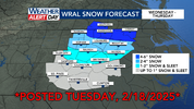
yep and WRAL just updated their forecast map, dragging the 1-2" snow/sleet line further south (and the up to 1" snow/sleet line) and pushing the 4-6" zone a bit further east. The kind of movement we want to see right now, for sure.You would think. I was going off the shades on RAH WFO’s Winter site.
In other news, the “max” potential keeps on rising. Up to 8” in Durham and MBY, 15”+ for @RBR71 and Moyock, and 15-20” in Hampton Roads!
View attachment 170451
NBAcentel
Member
Bigedd09
Member
. It seems like models that are nice with the main storm aren't nice with the squalls though hahaHRRR drops over an inch from these squalls by themselves, that’s hot. Now can it improve on the main thing…View attachment 170456
what does RBR71 stand for anyways?Heck no, if I get a foot metwannabe is retired!
Roanoke
Born
Raised
1971
??
beanskip
Member
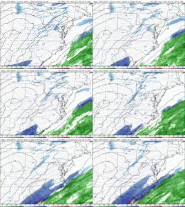
18z NAM started slow, but 12 hour map started perking up with some better QPF vs. 12z.

