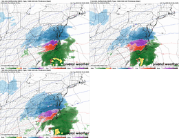
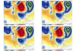
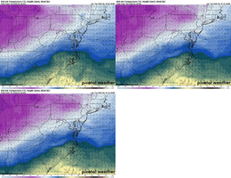
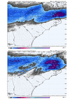
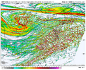
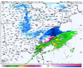
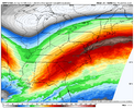
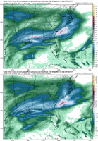
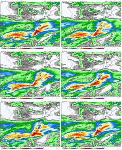
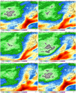
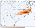
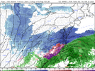
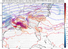
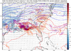
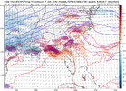
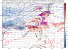
let’s go brother!Good lord, look at the back side action on the ukmet... Hope it's on to something.
@Mitch West ehh?
View attachment 170317
-
Hello, please take a minute to check out our awesome content, contributed by the wonderful members of our community. We hope you'll add your own thoughts and opinions by making a free account!
You are using an out of date browser. It may not display this or other websites correctly.
You should upgrade or use an alternative browser.
You should upgrade or use an alternative browser.
rburrel2
Member
12km NAM has almost 1/2 inch of liquid here. 3km has 0.0 liquid here. 
RDUHeatIsland
Member
Honestly looks like NAM actually backed off a little on the warm nose
And in exchange an expansive sleet stormHonestly looks like NAM actually backed off a little on the warm nose
Sent from my A600DL using Tapatalk
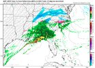
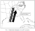
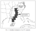
my understanding is that it has an effect when the convection is aligned generally perpendicular to the flow. honestly on reflection this isn't a "perfect" example but notice the convection is parallel to the coast. you want convection to be generally aligned with the typical SW flow coming off the gulf, which typically helps. What you risk in this case is storms remaining stationary over the gulf, forming a MCS, a cold pool, their own mesolow even... i don't think it's a death knell it just saps resources like a sucker stem on a tomato plant. and in this model depiction it may be why the foothills/upstate are so dryDoes this only have an affect when the LP is in the Gulf (Western areas) or would it also affect the system's future development as it is starting to crank off the SE coast (Eastern areas) or both in general?
WolfpackHomer91
Member
Like someone said yesterday.... dont sleep on sleet. You get 3-4" Snow and put an inch of sleet on it and coating of ICE its gonna hang around. My little 1.5 Inch SN/IP from Jan event legit hung tough for 5-6 days in shadeAnd in exchange an expansive sleet storm
Sent from my A600DL using Tapatalk
blueheronNC
Member
QPF absolutely cooking on the NAM. Raleigh at 0.8” already through 10pm tomorrow
you sure?Honestly looks like NAM actually backed off a little on the warm nose
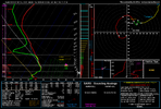
I know @griteater did a nice write up in here about soundings, thermals, snow/sleet/zr with temps through the column. IIRC even though this sounding shows sleet, seems most dendrites would make it to the surface and would still be mostly snow. Am I wrong about that? or just wishful thinking? Lol

It’s crazy how this almost always works.I think the 09z SREF plumes might be the wettest yet for RDU. Would not at all be surprised to see the 12z NAM increase QPF (and perhaps warmth).
RAH might be rethinking the WWAs after that run. Even with mixing, that is nearing QPF bomb territory so it’s a very high impact event. Of course, it’s the NAM so maybe we disregard.
NBAcentel
Member
there’s still a lot of moisture in the low to mid levels as DGZs lower on the nam after then “main show”. Might be light shallow snow showers through Thurs night
ForsythSnow
Moderator
We got pretty close to wet snow sounding here all through the NAM. 36 degrees at the surface with heavy snow through 900 makes no sense to stay at that.The soundings on the 12z NAM over CLT where there is ZR seem to be really close to sleet/wet snow soundings imo.
What do you think? @Myfrotho704_
iGRXY
Member
0.5-0.7" QPF just to our west in Georgia now on that NAM run. MBY is at 0.25". I really think we can squeeze out an additional 0.1-0.25" of QPF. The 500mb jet and WAA FGEN supports the idea of more QPF across the Western Carolinas.
interestedclimatist
Member
I like the NAM it’s more accurate than the HRRRIt’s crazy how this almost always works.
RAH might be rethinking the WWAs after that run. Even with mixing, that is nearing QPF bomb territory so it’s a very high impact event. Of course, it’s the NAM so maybe we disregard.
RDUHeatIsland
Member
Yeah, it's close to keeping Durham all snow. Had sleet on the VA border 6z. 3km looks amazing tooyou sure?
Webberweather53
Meteorologist
I know @griteater did a nice write up in here about soundings, thermals, snow/sleet/zr with temps through the column. IIRC even though this sounding shows sleet, seems most dendrites would make it to the surface and would still be mostly snow. Am I wrong about that? or just wishful thinking? Lol
View attachment 170332
There is a ton of warm advection in that sounding, that hodograph is lol.
NBAcentel
Member
Cary_Snow95
Member
Different type of storm but 12/17 showed me what wins with a column like that.We got pretty close to wet snow sounding here all through the NAM. 36 degrees at the surface with heavy snow through 900 makes no sense to stay at that.
moyock nc better pray this nam warm nose doesn't come into fruition
Worry more about warm nose than precip if you’re central/eastern nc.
Yeah I disregarded the snownado potential LolThere is a ton of warm advection in that sounding, that hodograph is lol.
12z NAM even brings a light / moderate event to DC. I swear, if they get more snow than RDU…
I figure that depiction is overdone, but it gives hope for more QPF. Certainly worries me about mixing more, though, but we gotta risk getting burnt to get the good stuff.
I figure that depiction is overdone, but it gives hope for more QPF. Certainly worries me about mixing more, though, but we gotta risk getting burnt to get the good stuff.
- Joined
- Jan 23, 2021
- Messages
- 4,602
- Reaction score
- 15,197
- Location
- Lebanon Township, Durham County NC
4" of sleet would be awesome...would be an ice skating rink outside and great sledding for the kids.@SD gets 4" of sleet this run
Yeah 3k NAM a lot snowier then the NAM, hopefully it's higher resolution is better and more accurate.3km and GFS still lining up for the most part. I still think heavier precip verifies more NW...it always does.
View attachment 170335
Theoretically, yes. In this system, there are bigger dynamics at play also though including strong upper level divergence due to being in the right entrance region of a ~200 kt jet streak favorably positioned over the Mid-Atlantic, especially in northeastern NC / southeastern VA.
- Joined
- Jan 23, 2021
- Messages
- 4,602
- Reaction score
- 15,197
- Location
- Lebanon Township, Durham County NC
I mean SREF has done the same thing so I am not that surprised
- Joined
- Jan 2, 2017
- Messages
- 1,566
- Reaction score
- 4,279
- Joined
- Jan 23, 2021
- Messages
- 4,602
- Reaction score
- 15,197
- Location
- Lebanon Township, Durham County NC
AIFS also had another increase and has all of the triangle at least at a quarter inch with more as you go east.
WolfpackHomer91
Member
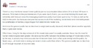
Matt East on American. He is not wrong in all honesty jmo..... this data shouldn't be available without a License or Business license where like News channels would pay for it, and NWS would have it on lock n key. Hes 100% Correct bc had you just been watching tv for info you'd never consider this a bust bc you wouldn't know. Myself included do this for fun and some of yall in here I could totally see doing it as more than a hobby, but unless you're fulltime employed by a news station or NWS it doesn't need to be available. Or atleast to the extent it is, it makes their job more difficult bc bozos post stuff like Sat runs and then come after them perosnally ect. Sorry if wrong room....but figured everyone could benefit from his post and this room has most traffic currently
NBAcentel
Member
iGRXY
Member

