-
Hello, please take a minute to check out our awesome content, contributed by the wonderful members of our community. We hope you'll add your own thoughts and opinions by making a free account!
You are using an out of date browser. It may not display this or other websites correctly.
You should upgrade or use an alternative browser.
You should upgrade or use an alternative browser.
I have a feeling there's some disagreement between the midnight shift and the morning shift at RAH who seemed to be trigger happy. Overnight discussion from Badgett suggested holding off another model cycle, morning shift obviously big fans of the NAM.I think they are waiting until after the 12z runs to decide between advisories and warnings.
EDIT: Never mind, just got the WWA, so I guess they didn’t wait. Roxboro to my north is under a WSW of course.Seems to be some disagreement between RAH and Blacksburg on warnings vs advisories for their CWA. @BIG FROSTY is closer to a warning than RDU!
interestedclimatist
Member
Don’t jinx us, knowing here the dry air will steal everything we have. Also, if they see improvement in the forecasts they will probably upgrade it.WWA advisory for Raleigh? lol. What a joke. I'd give them a 100% chance of warning criteria winter precip.
Had quite a few storms IMBY that ended up being big dogs that were just WWAs at the onset (March 2014, I’m pretty sure December 2010 in the Triad off the top of my head), and crappy storms that were WSWs at the onset, so not too worried about the distinction.
Technically, they say a Watch -> Advisory is an upgrade, not a downgrade, though I know it doesn’t feel that way.
Technically, they say a Watch -> Advisory is an upgrade, not a downgrade, though I know it doesn’t feel that way.
rburrel2
Member
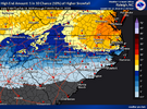
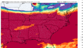
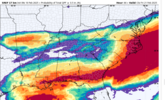
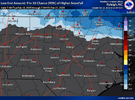
Interesting that they give literally everone a 100% chance of at least .1 of precip,(except Northern MS). But they've cut way back on the .5 inch probs. Coming much closer to reality I think, but still on the wet side of guidance. Good to see.I think the 09z SREF plumes might be the wettest yet for RDU. Would not at all be surprised to see the 12z NAM increase QPF (and perhaps warmth).
ForsythSnow
Moderator
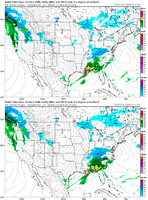
NAM looks colder out west so far for 12Z. More precip too.
Bigedd09
Member
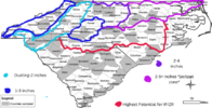
NWS seems to think greensboro to concord to southern meck may be the "jackpot" zone for areas in the western piedmont. Kinda like fros snow map
LickWx
Member
The morning crew is cool, freshman year at state I got to shadow Jonathan blaes for a couple hoursI have a feeling there's some disagreement between the midnight shift and the morning shift at RAH who seemed to be trigger happy. Overnight discussion from Badgett suggested holding off another model cycle, morning shift obviously big fans of the NAM.
Webberweather53
Meteorologist
WWA advisory for Raleigh? lol. What a joke. I'd give them a 100% chance of warning criteria winter precip.
I’d say it’s pretty fair for now given the potential for warm nose/sleet issues in the Triangle. I’d be more encouraged if this didn’t look so marginal aloft temp wise already even on the coarser global models like the EPS (which almost always underestimate the warm nose). That being said, a few inches of sleet is honestly just as is if not more impactful than 4”+ of snow.
WolfpackHomer91
Member
JMO im not a met... but especially a situation as fluid as this, its just easier imo to go WWA and extremely Low amounts then go up tomm AM once we see a radar within 100 miles of the CWA jmo. If you go WSW ppl will absolutely expect 3+ of frozen precip, No reason to do a Saturday EURO and throw that out. If youre not 100% sure just go low and WWA, hell the only ppl that will know youre even going low will be ppl in forums or weenies anyway. What general public doesnt know wont hurt themI have a feeling there's some disagreement between the midnight shift and the morning shift at RAH who seemed to be trigger happy. Overnight discussion from Badgett suggested holding off another model cycle, morning shift obviously big fans of the NAM.
Does this only have an affect when the LP is in the Gulf (Western areas) or would it also affect the system's future development as it is starting to crank off the SE coast (Eastern areas) or both in general?word to the wise if the gulf convection sets up like that then this is one of those rare times it needs to be watched for moisture transport issues (gulf stealing our moisture, in the parlance)
rburrel2
Member
JDRwxNC
Member
This system isnt as much as a lock for RDU as it seems.WWA advisory for Raleigh? lol. What a joke. I'd give them a 100% chance of warning criteria winter precip.
Bigedd09
Member
was showing that yesterday tooGood lord, look at the back side action on the ukmet... Hope it's on to something.
View attachment 170315
In other words, keep your expectations rather low and be pleasantly surprised IF it's a boom scenarioJMO im not a met... but especially a situation as fluid as this, its just easier imo to go WWA and extremely Low amounts then go up tomm AM once we see a radar within 100 miles of the CWA jmo. If you go WSW ppl will absolutely expect 3+ of frozen precip, No reason to do a Saturday EURO and throw that out. If youre not 100% sure just go low and WWA, hell the only ppl that will know youre even going low will be ppl in forums or weenies anyway. What general public doesnt know wont hurt them
Sent from my A600DL using Tapatalk
Bigedd09
Member
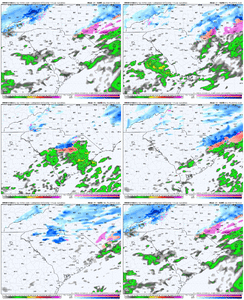
NAM definitely more juiced and colder through 21
SimeonNC
Member
Can you post the discussion? or at least link it?NWS seems to think greensboro to concord to southern meck may be the "jackpot" zone for areas in the western piedmont. Kinda like fros snow map
interestedclimatist
Member
NAM needs to save us here ngl
February 16 2013. The best I’ve seen. Almost totally unexpected. With warm surface temps it still threw down several inches here. I remember it was showing 40 on my car thermometer and puking snow. We got 2-3 inches quicklyI'm at least equally excited about the backside stuff Thursday morning. There will be winners and mostly losers, but some lucky people could get 2-4 inches from that action I think.
I'm especially excited because there's one heck of surface trough developing over the savannah river. I've seen this exact situation play out before, I can't remember what storm. But there was a tongue of warm surface air where the CAA winds coming around each side of the mountains meet up with each other along the savannah river after a storm and a stationary band did develop that morning along that feature and it gave Elberton, GA down to Greensboro, GA as much as 4 inches of snow.
I actually think it may have been the christmas 2010 storm.
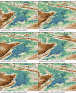
You can see in these images I posted. The RGEM is developing that band right on top of those warmest surface temps.. makes sense you'd get added lift there with both the converging surface winds and resulting tongue of warm air.
View attachment 170306View attachment 170308
View attachment 170310
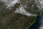
I think someone is about to get NAM’d. Not surprised after the SREF it would wetten up. Might torch us, too. Looking juicier as it moves in.
packfan98
Moderator
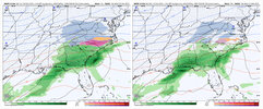
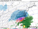
Stronger low in the gulf at hr 24 on the nam with a slightly more expansive precip field.
NBAcentel
Member
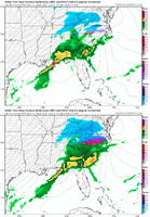
NAM is gonna be more juiced but with a stronger warm nose perhaps
Tsappfrog20
Member
The NAM is definitely more juicy at 27
Sent from my iPhone using Tapatalk
Sent from my iPhone using Tapatalk
NAM is crap though so word to the wise not too put too much hope into it.
SimeonNC
Member
Cary_Snow95
Member
On the flip side….PAINJust once I'd like to beat the streak and cash in on the 10% chance
View attachment 170323
No changes from me. I will say, sleet/zr near Wake County will be the jackpot zone for preserving snowfall longer than most locations and far greater travel issues due to sleet approaching 1” or more. If someone made a travel map I would have the worst areas from Concord to Raleigh. Lesser impacts closer to i77 with dry snow that can be evaporated by the sun.
SnowNiner
Member
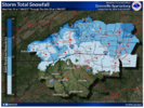
Looks like GSP has heavily weighted the SREF this morning. Unless it pulls a coup, I don't see how CLT gets over an inch. They increased amounts this morning, which I don't currently understand.
In fact, I can't remember a time where I was forecasted to get x amount of snow and actually got it. It's always under. But I digress.
In fact, I can't remember a time where I was forecasted to get x amount of snow and actually got it. It's always under. But I digress.

NBAcentel
Member
WolfpackHomer91
Member
Pops
Member
Yeah Nam is juiced!!
Cary_Snow95
Member
The 6z nam seems to be a blip
SimeonNC
Member
The soundings on the 12z NAM over CLT where there is ZR seem to be really close to sleet/wet snow soundings imo.
What do you think? @Myfrotho704_
What do you think? @Myfrotho704_
Seems a little quicker to move in, as well. Not sure if that helps or hurts us.

