Ots
-
Hello, please take a minute to check out our awesome content, contributed by the wonderful members of our community. We hope you'll add your own thoughts and opinions by making a free account!
You are using an out of date browser. It may not display this or other websites correctly.
You should upgrade or use an alternative browser.
You should upgrade or use an alternative browser.
Tropical Dexter
- Thread starter SD
- Start date
lexxnchloe
Member
lexxnchloe
Member
lexxnchloe
Member
lexxnchloe
Member
lexxnchloe
Member
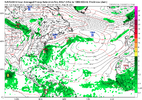
Euro does exactly this and has a wave interact with th front but it just heads west into GA and dies.
lexxnchloe
Member
lexxnchloe
Member
GFS drops the 2nd low and Dexter swiftly dissipates
Brent
Member
Should be Dexter at 11
04L DEXTER 250804 0000 34.0N 69.9W ATL 35 1006`
04L DEXTER 250804 0000 34.0N 69.9W ATL 35 1006`
NHC just released it on twitter.
The 12Z UKMET has Dexter eventually becoming a minimal 988 mb H on Thursday though that’s an outlier right now:
TROPICAL STORM DEXTER ANALYSED POSITION : 35.0N 67.5W
ATCF IDENTIFIER : AL042025
LEAD CENTRAL MAXIMUM WIND
VERIFYING TIME TIME POSITION PRESSURE (MB) SPEED (KNOTS)
-------------- ---- -------- ------------- -------------
1200UTC 04.08.2025 0 35.0N 67.5W 1005 36
0000UTC 05.08.2025 12 36.3N 65.9W 1008 35
1200UTC 05.08.2025 24 37.8N 63.9W 1010 34
0000UTC 06.08.2025 36 39.2N 62.3W 1008 43
1200UTC 06.08.2025 48 39.5N 59.8W 1007 41
0000UTC 07.08.2025 60 40.3N 56.0W 1003 39
1200UTC 07.08.2025 72 41.2N 51.3W 993 54
0000UTC 08.08.2025 84 43.2N 46.2W 988 65
1200UTC 08.08.2025 96 45.0N 42.6W 985 48
0000UTC 09.08.2025 108 46.0N 36.8W 993 40
1200UTC 09.08.2025 120 47.2N 29.8W 999 36
0000UTC 10.08.2025 132 CEASED TRACKING
BrickTamland
Member
Probably will end up being pretty good and then have a terrible ending.
Dexter has about another day or so as a tropical system. It is
currently experiencing strong vertical wind shear, which is only
expected to increase during the next 24 to 48 h. However, models
continue to predict that the interaction with the trough to north in
the next day or so should strengthen Dexter while it undergoes
extratropical transition. It should be noted that during the
extratropical phase of the forecast, there is quite a bit of spread
in the intensity guidance. Several models during the 36 to 60 h
time frame show the cyclone reaching hurricane-force. The NHC
intensity forecast has been raised to a peak of 60 kt at 48 h, very
near the corrected consensus aid, HCCA.
**There remains the
possibility that upward adjustments in the intensity forecast could
be need in future advisories.**
FORECAST POSITIONS AND MAX WINDS
INIT 06/0900Z 39.4N 59.9W 40 KT 45 MPH
12H 06/1800Z 39.8N 57.7W 45 KT 50 MPH
24H 07/0600Z 40.6N 54.1W 50 KT 60 MPH
36H 07/1800Z 41.9N 50.1W 55 KT 65 MPH...POST-TROP/EXTRATROP
48H 08/0600Z 43.2N 46.3W 60 KT 70 MPH...POST-TROP/EXTRATROP
60H 08/1800Z 44.5N 42.3W 50 KT 60 MPH...POST-TROP/EXTRATROP
72H 09/0600Z 45.2N 38.0W 45 KT 50 MPH...POST-TROP/EXTRATROP
96H 10/0600Z 46.0N 30.1W 35 KT 40 MPH...POST-TROP/EXTRATROP
120H 11/0600Z...DISSIPATED
$$
Forecaster Bucci

