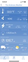
52 here near RaleighPretty impressive frontView attachment 98447
-
Hello, please take a minute to check out our awesome content, contributed by the wonderful members of our community. We hope you'll add your own thoughts and opinions by making a free account!
You are using an out of date browser. It may not display this or other websites correctly.
You should upgrade or use an alternative browser.
You should upgrade or use an alternative browser.
Pattern December to Remember
- Thread starter SD
- Start date
JHS
Member
This one fooled all of us I think. Was looking for maybe .10-.25 if I was lucky, but am up to 1.20 now with a little more to go.Models have been upping totals ever since last night to almost give a widespread area .5-1 inch for this event .. it was a sneaky pick up and I think the next coastal will be the same
Yep I started talking about it yesterday as models really wanted to give more people the goods didn’t know if it was too good to be true but had to make the observationThis one fooled all of us I think. Was looking for maybe .10-.25 if I was lucky, but am up to 1.20 now with a little more to go.
Cold ass rainy day in Raleigh low 50
bigstick10
Member
NCHighCountryWX
Member
- Joined
- Dec 28, 2016
- Messages
- 477
- Reaction score
- 1,323
NCHighCountryWX
Member
- Joined
- Dec 28, 2016
- Messages
- 477
- Reaction score
- 1,323
6z GEFS was ugly. Never got the good looking CONUS trough that the 0z had so the SE had above normal temps throughout the end of the run.
Maybe I'm missing something, but it does show an impressive long wave trough at the end of its runs, with 850mb temps below -10*C well down into Texas. It wasn't over the SE just yet, but it had to propagate eastward.
BHS1975
Member
12z will save us
Then 18z wreck 00z save 6z wreck
Sent from my iPhone using Tapatalk
Webberweather53
Meteorologist
Closer to 2 weeks than 1. They used the constructed analog MJO forecast ?
Radar has filled in nicely, down to 50/49
.47" so far. A lot more than I thought. It's been some time since I've seen an overperforming rain event.
LickWx
Member
What a great rainy day. Absolutely beautiful ! Cool temps with nice gentle rains .
Glad we torched yesterday so I could get out and do thingsWhat a great rainy day. Absolutely beautiful ! Cool temps with nice gentle rains .
NoSnowATL
Member
Rain has past my area, the sun is out 55 and breezy.
BHS1975
Member
Bout to dump.

Sent from my iPhone using Tapatalk

Sent from my iPhone using Tapatalk
Down to 53 here started at 61 at midnight


