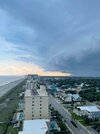
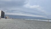
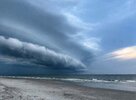
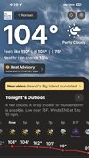
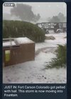
Can't rain at the house but go on vacation and boom


Builds characterI cut the grass at 3pm. Wouldn’t recommend it

I finished cutting my yard and trimming some bushes around 2:00 PM. Your advice should be heeded unless someone wants to lose five pounds of water weight sweating.I cut the grass at 3pm. Wouldn’t recommend it


I "had" to cut my grass yesterday due to it being wet Thurs/Fri due to combination of rainfall and very heavy dew. Shaded areas did not dry enough until sun "hit" those areas so had to wait til late PM (4pm) to start. Was the worse grass cutting experience I remember..I finished cutting my yard and trimming some bushes around 2:00 PM. Your advice should be heeded unless someone wants to lose five pounds of water weight sweating.

The National Weather Service in Raleigh has issued a
* Severe Thunderstorm Warning for...
Person County in central North Carolina...
Northeastern Orange County in central North Carolina...
Northern Granville County in central North Carolina...
Northwestern Durham County in central North Carolina...
* Until 200 PM EDT.
* At 119 PM EDT, a severe thunderstorm was located near Roxboro,
moving southeast at 20 mph.
HAZARD...60 mph wind gusts.
SOURCE...Radar indicated.
IMPACT...Expect damage to roofs, siding, and trees.
* Locations impacted include...
Oxford, Roxboro, Butner, Rougemont, Stem, Lake Michie, Eno River
State Park, Mayo Reservoir, Bahama, and Bethel Hill.
This includes Interstate 85 between Mile Markers 192 and 206.
PRECAUTIONARY/PREPAREDNESS ACTIONS...
For your protection move to an interior room on the lowest floor of a
building.
&&
LAT...LON 3628 7851 3625 7851 3604 7898 3630 7915
3643 7914 3654 7882
TIME...MOT...LOC 1719Z 328DEG 18KT 3639 7905
HAIL THREAT...RADAR INDICATED
MAX HAIL SIZE...<.75 IN
WIND THREAT...RADAR INDICATED
MAX WIND GUST...60 MPH

I did mine this morning. Hoping it is the last time I will have to do it until next spring.I cut the grass at 3pm. Wouldn’t recommend it


July broke a nasty streak of dry months but August is somehow right back to dry although it is very wet all around us.Line of storms literally hit a brick wall once they got towards the Triangle there.

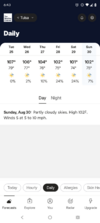


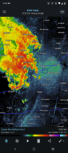
Summer is gonna fade away this year at a snails pace. CFS did show some lower heights east coast as we head in to late 1st week of September. Outside of that and day 10ish Crazy uncle model, its high temps in the 87-92 range across the south, depending where you live. Southern central plains still cooking as they typically due and are the last to start peeling off the extreme heat.

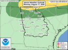

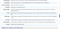

It was in the 20s at night in Early October 2000 !2000 we were 108 over Labor Day weekend and that was a solid and quick flip to winter though
We can only hope I guess. I'm running out of straws haha
Bush hogged my field yesterday. It’s been growing out over the last 4-5 years so I made an effort to save some young trees embedded within. Lots of oak, sweetgum, black cherry, pine and sumac.Finally got the grass cut yesterday (Hot and Humid!!) but it took forever because it's been raining every afternoon and it got so tall. Had to pull out the rake to pick up the clumps (and the blower to disperse the smaller ones lol).
No mas por favor, send it up SD's way!!
View attachment 197413



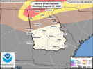
URGENT - WEATHER MESSAGE
National Weather Service Raleigh NC
221 PM EDT Mon Aug 17 2026
...HEAT ADVISORY IN EFFECT FROM 11 AM TO 8 PM EDT TUESDAY...
...HEAT ADVISORY REMAINS IN EFFECT UNTIL 8 PM EDT THIS EVENING...
* WHAT...For the first Heat Advisory, heat index values up to 107.
For the second Heat Advisory, heat index values up to 105 expected.
* WHERE...The Triangle, southern Piedmont, Sandhills, and Coastal
Plain of central North Carolina.
* WHEN...For the first Heat Advisory, until 8 PM EDT this evening.
For the second Heat Advisory, from 11 AM to 8 PM EDT Tuesday.
* IMPACTS...Hot temperatures and high humidity may cause heat
illnesses.
PRECAUTIONARY/PREPAREDNESS ACTIONS...
Drink plenty of fluids, stay in an air-conditioned room, stay out of
the sun, and check up on relatives and neighbors.
Take extra precautions when outside. Wear lightweight and loose
fitting clothing. Try to limit strenuous activities to early morning
or evening. Take action when you see symptoms of heat exhaustion and
heat stroke.
To reduce risk during outdoor work, the Occupational Safety and
Health Administration recommends scheduling frequent rest breaks in
shaded or air conditioned environments. Anyone overcome by heat
should be moved to a cool and shaded location. Heat stroke is an
emergency! Call 9 1 1.