• Hello, please take a minute to check out our awesome content, contributed by the wonderful members of our community. We hope you'll add your own thoughts and opinions by making a free account!

Pattern April Chasing ???⛈⛈⛈

Nice line downeast right now and most models not real impressed with the line later for central NC..... we shall see but I'm having doubts about too many storms around here now

Had a couple of those very tiny cells pass over me earlier and they werent severe but quite gusty with blinding rain. Heres a pic afte it moved off. The rain shaft was pretty neat looking.
 

Attachments

  • 20190426_120518.jpg
    20190426_120518.jpg
    1.1 MB · Views: 14
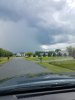
Some storms coming in from the west.

Special Weather Statement
National Weather Service Raleigh NC
245 PM EDT FRI APR 26 2019

NCZ007>010-024>026-040>042-076-261945-
Johnston NC-Lee NC-Chatham NC-Franklin NC-Vance NC-Durham NC-
Person NC-Warren NC-Wake NC-Granville NC-Orange NC-
245 PM EDT FRI APR 26 2019

...A LINE OF STRONG THUNDERSTORMS WITH STRONG WINDS WILL AFFECT
SOUTHEASTERN PERSON... WARREN...VANCE...SOUTHERN
ORANGE...GRANVILLE...NORTHERN LEE...WAKE... NORTHWESTERN
JOHNSTON...CHATHAM...DURHAM AND FRANKLIN COUNTIES UNTIL 345 PM EDT...

At 243 PM EDT, Doppler radar was tracking a line of strong
thunderstorms extending from 7 miles south of Clarksville to 7 miles
east of Seagrove. Movement was east at 15 mph.

Wind gusts up to 50 mph are possible with these storms, along with
brief torrential downpours.

Locations impacted include...
Raleigh, Durham, Cary, Chapel Hill, Henderson, Oxford, Hillsborough,
Creedmoor, Pittsboro and Louisburg.
 
Here’s another view of a developing shower with towering cumulus to my north, I needa storm chase sometime ?View attachment 19339View attachment 19340
From around May 15 until Sept 20 you could take that shot and storm chase daily from my back yard ... sea breeze front collision zone ... :eek:

... awesome pics, BTW!
 
Pretty gusty in these storms.

874a7b09b8dd1b25a75e45d6295e3ce6.jpg


Sent from my iPhone using Tapatalk
 
Some pretty good storms rolling through.

Special Weather Statement
National Weather Service Raleigh NC
358 PM EDT FRI APR 26 2019

NCZ025>027-041-042-262045-
Nash NC-Johnston NC-Franklin NC-Durham NC-Wake NC-
358 PM EDT FRI APR 26 2019

...A STRONG THUNDERSTORM WILL AFFECT SOUTHWESTERN NASH...WAKE...
NORTHERN JOHNSTON...SOUTHEASTERN DURHAM AND SOUTHWESTERN FRANKLIN
COUNTIES UNTIL 445 PM EDT...

At 358 PM EDT, Doppler radar was tracking a strong thunderstorm near
Raleigh, moving east at 45 mph.

Pea size hail and wind gusts up to 50 mph will be possible with this
storm.

Locations impacted include...
Raleigh, Durham, Cary, Wake Forest, Garner, Fuquay-Varina, Clayton,
Zebulon, Bunn and Rdu International.
 
Looks like the core is going to come really close to me. I will report back.

Edit: Meh, unimpressive. A few gusts and some decent rain, but that’s about it. The little bitty shower we had earlier was way windier.
 
Last edited:
Looks like the core is going to come really close to me. I will report back.

Edit: Meh, unimpressive. A few gusts and some decent rain, but that’s about it. The little bitty shower we had earlier was way windier.
Same here. Picked up .33 though so all good

Sent from my SM-G955U using Tapatalk
 
Last edited:
Looks like we might sneak a few showers in tomorrow evening

Sent from my SM-G955U using Tapatalk
 
These last two PMs in my area were awesome for outdoor activities with low 80s for highs and dewpoints in the 40s to low 50s along with nice breezes. It doesn’t get much better than that in late April! Hopefully we’ll sneak in some more days like this before summer.

Further to the above, today is shaping up to be another still pretty comfy day with only a few degrees warmer but with dewpoints staying well down in the 50s it appears. Also, next weekend may be similarly pleasant to the current one. But with the good comes some bad as watering will be needed again by then.
 
Looks like the high today was an impressive 87*F.

That sounds nice compared to the cold rain and temps in the 40s we got today in Detroit.
 
Yeah HRRR really had a hard time with these cells. It wants to keep it more discrete though, according to the 4z HRRR. E. Oklahoma sucks to chase in, but that could put down one or two decent ones.
 
Screen Shot 2019-04-30 at 11.39.23 AM.png
What is the feature that runs from SW Mexico to Big Bend to Wichita Falls and up through the N. Border of OK?
 
The GFS is putting mid 90s over alabama next monday ?. Don't know what the records are but i would suspect we'd be close to it. Screenshot_20190430-115255_Samsung Internet.jpg
 
As warm as the weather has been, it hasn't been as extreme or impressive as many would think. NC has the biggest departures of +2 to +4 from average.

Same goes for the areas further north that have been several bouts of snow this past April, where the worst departures are only between -2 to -4 from average in Northern MI / WI / MN.

30dTDeptUS.png
 

I saw this on Twitter and everybody was making a fuss over it. The angle is pretty cool, as well as the resolution. But tbh, I like to see trees coming up or things blowing up in my tornado vids!
 
As warm as the weather has been, it hasn't been as extreme or impressive as many would think. NC has the biggest departures of +2 to +4 from average.

Same goes for the areas further north that have been several bouts of snow this past April, where the worst departures are only between -2 to -4 from average in Northern MI / WI / MN.

View attachment 19377
But look at those departures in the Mid Atlantic. I do believe I see a red dot over Delaware which would indicate +6 to 8.
 
But look at those departures in the Mid Atlantic. I do believe I see a red dot over Delaware which would indicate +6 to 8.

True, but it's relative to average.

If their average highs are still in the 60s, then of course temps in the 70s and 80s will seem more impressive from a departure standpoint.

Not so much for our region.
 
Back
Top