• Hello, please take a minute to check out our awesome content, contributed by the wonderful members of our community. We hope you'll add your own thoughts and opinions by making a free account!

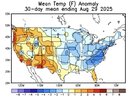
Pattern Another Angry August: Broiled, Baked, and Bone-Dry

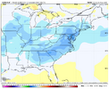
I'm not sure much of you remember this, but this was August 2004, the month before the September with many tropical systems.
This was the coolest weather in August that I know of here at the time.
Dallas, GA
View attachment 174586

Followed by much of this. I believe the one that made the loop was Ivan.


View attachment 174585

There was a massive cold front when Charley hit south of Tampa on August 13th yeah

But yeah Florida had 4 hurricanes that year

Jeanne is the loop east of the Bahamas and the last of the 4

Though Ivan did have a second round although it was nothing like the original storm (and was highly controversial even at the NHC)
 
There was a massive cold front when Charley hit south of Tampa on August 13th yeah

But yeah Florida had 4 hurricanes that year

Jeanne is the loop east of the Bahamas and the last of the 4
Charlie! Yeah, I forgot about that one. Ivan was the one that went up the east coast and then back down across Florida and made a second landfall in the gulf though wasn't it? I should have been specific, because Jeanne did an actual loop out there in the Atlantic.
 
Charlie! Yeah, I forgot about that one. Ivan was the one that went up the east coast and then back down across Florida and made a second landfall in the gulf though wasn't it? I should have been specific, because Jeanne did an actual loop out there in the Atlantic.

Yeah but it was a very weak storm and highly controversial that it was even the same storm. Even the NHC had an "animated in house debate" apparently 🤣 🤣 🤣 I still wonder to this day what that was like
 
I'm not sure much of you remember this, but this was August 2004, the month before the September with many tropical systems.
This was the coolest weather in August that I know of here at the time.
Dallas, GA
View attachment 174586

Yeah, that also jibes well with the just broken record low for August at PDK of 55.4 being in 2004 and the 8/14/2004 low of 56 at ATL (that one wasn’t a monthly record).
 
I'm not sure much of you remember this, but this was August 2004, the month before the September with many tropical systems.
This was the coolest weather in August that I know of here at the time.
Dallas, GA
View attachment 174586

Followed by much of this. I believe the one that made the loop was Ivan.


View attachment 174585
Some areas were in the upper 40s in North GA in August 2004. Mid August, not even late August !
 
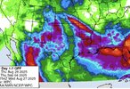
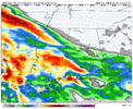
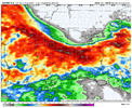
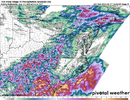
I know this system isn’t super interesting. But it’s all we got. Full cave by WPC to the Euro
View attachment 174598
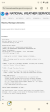
Excessive Rainfall Discussion
NWS Weather Prediction Center College Park MD
852 PM EDT Wed Aug 27 2025
Day 3
Valid 12Z Fri Aug 29 2025 - 12Z Sat Aug 30 2025

...THERE IS A MARGINAL RISK OF EXCESSIVE RAINFALL OVER A LARGE
PORTION OF THE GREAT PLAINS, THE FRONT RANGE OF THE ROCKIES, AND
ACROSS MUCH OF THE DEEP SOUTH...

20Z Update: The D3 time frame can be described as "chaotic" within
the grand scheme of the CONUS pattern and the 12z numerical suite
offered no help in discerning potential maxima placement across the
South and Central/Southern High Plains. Individual deterministic
detailed more of the variability of the pattern with maxima for the
Southeastern U.S. situated anywhere from SC to TX with the ensemble
means relatively muted thanks to the spread. High Plains from the
CO Front Range down to the TX Panhandle was a little better
defined, but still lacked consistency in the expected magnitude of
rainfall in the vicinity. Overall, the threats exist in a vacuum,
but nailing down the exact placement of the maxima is closer to
"throwing darts at a dart board" as much of the setup in the
Southern U.S. is contingent on the convective evolution the period
prior. For now, maintained the continuity in the broad MRGL
situated over the Southeast extending back up into the Northern
Rockies. As we move forward in time, an upgrade or two is certainly
plausible, most notably over the High Plains and/or Southeast
CONUS.
 
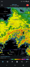
Oh look more rain this is just insane

Probably gonna threaten another cold high. Was the coldest since the 80s yesterday
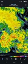
Screenshot_20250828-094138_RadarScope.png
 
Back
Top