-
Hello, please take a minute to check out our awesome content, contributed by the wonderful members of our community. We hope you'll add your own thoughts and opinions by making a free account!
You are using an out of date browser. It may not display this or other websites correctly.
You should upgrade or use an alternative browser.
You should upgrade or use an alternative browser.
Pattern Another Angry August: Broiled, Baked, and Bone-Dry
- Thread starter SD
- Start date
lexxnchloe
Member
Yep. We struggle to hit 80 for the foreseeable future here. Forecasted highs in the 70s-81-82 ish.
Breaking News: We did it/ Overcame:
Greensboro will not hit 90 degrees again for high temp until 2026.
Think we netted 33/ 90 degree days this year. Average is 29.
So long to the 90's.
My pre -August Forecast of -3BN is gonna not be cool enough when the smoke settles. Should end up around -4 to -5 territory.
We hit 90 degrees exactly on August 17th. The only day all month we will have hit 90. Not sure of the record for the earliest /last 90 degree day of summer here.
The coolest summer by 90 degree day metrics, we ever had in Gboro was 1971 with only 7 days.
Warmest was 1914 with 82 days. Must of have been all the carburetors burning fossils off the Ford T models back then.
Warmest was 1914 with 82 days. Must of have been all the carburetors burning fossils off the Ford T models back then.
Best weather town in the Southeast: They have Grits, Sweet Tea and plenty of Snow
Since 1980: Boone has only hit 90+ on 6 occasions. All time high there is 93.
Since 1980: Boone has only hit 90+ on 6 occasions. All time high there is 93.
Leaving this here 

Sent from my iPhone using Tapatalk

Sent from my iPhone using Tapatalk
Brent
Member
Wulfer
Member
This is in Fort Oglethorpe Ga. from the major flooding from 8-12-2025.
Iceagewhereartthou
Member
lexxnchloe
Member
GeorgiaGirl
Member
Looking like a pretty dreamworthy end of August temp wise.
I just get the feeling that we end up paying for that at some point.
I just get the feeling that we end up paying for that at some point.
Looking like a pretty dreamworthy end of August temp wise.
I just get the feeling that we end up paying for that at some point.
It would be nice if it would also get down here for a change. We still have had no dewpoints below the lower 70s since at least June.
8/21/25 Edit for correction: I totally missed that KSAV had hourly dewpoints as low as 62 during the afternoon of August 18th in between the morning and evening/overnight 70s. So, technically, I’m wrong despite my dewpoints often being a few degrees higher due to being closer to the coast than KSAV.
Last edited:
JHS
Member
The middle of September may very well be a lot like late July. Summer is FAR from done with us.
GeorgiaGirl
Member
It would be nice if it would also get down here for a change. We still have had no dewpoints below the lower 70s since at least June.
Tbh, during that 10-day early August stretch, I really don't think humidity dropped for us, but I was fine because the sun was gone for most of that period.
I may be crazy though. I think I can handle humidity to an extent...if it means clouds are blocking out the sun and it's in the 80s or lower.
Sun and humidity?
No.
Brent
Member
Drizzle Snizzle
Member
Same here. 2 solid months of dewpoints in the 70s with only a day or two with dewpoints in the upper 60s in early August. Many days have had dewpoints of 75+. I’m just glad there are lower dewpoints next week.It would be nice if it would also get down here for a change. We still have had no dewpoints below the lower 70s since at least June.
Summertime thunderstorms may be going bye bye early this year
Brent
Member
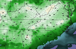
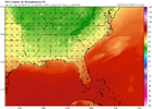
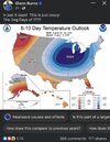
The NWS here is actually talking about some areas staying in the 60s all day next week 

I'm not even sure that's ever happened in August here
Okay there's a few but 66 is the lowest from 1950
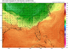
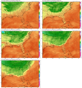
The GFS doesn't show much of a warmup either just scrolling through it and time is running out
I'm not even sure that's ever happened in August here
Okay there's a few but 66 is the lowest from 1950
The GFS doesn't show much of a warmup either just scrolling through it and time is running out
Last edited:
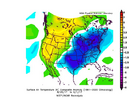
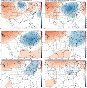
Colder in August than it will be in FebruaryA quick look at something that won't happen in January:
View attachment 174475
Congrats guys!
Summer is ovaTime is ticking on summer for sure. I bet we've had our last 100 at leastView attachment 174469
lexxnchloe
Member
I agree. The trof as always came in Aug and will last until the ridge takes charge in Nov.A quick look at something that won't happen in January:
View attachment 174475
lexxnchloe
Member
Several on here will be making a serious run at the upper 40's for lows next wed and Thurs morning. This want cut it for now, but I'm ready to smell the ole woodstove burning aroma.
I’ve been getting the first thunderstorm since Sunday (8/17) since ~6:45PM in a band coming eastward that had collided with the sea-breeze front. Rain rates have been mainly moderate but with some heavy.
Before this rain, I had already been up to a whopping 14.4” MTD!
Before this rain, I had already been up to a whopping 14.4” MTD!
Last edited:
JHS
Member
I think we are done with rain where I am for a LONG time to come. 2 more chances for pop up storms tomorrow and Sat and then those storms are done for a long time. I do not think the tropics are going to do very much either and I think the US avoids a direct hit this year. We are in for 2-3 months of very boring weather for 90% of the board.
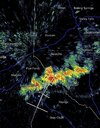
Big storm over Atlanta the last hour. Lots of street flooding downtown
Iceagewhereartthou
Member
Seeing as how all your other predictions come true I'm betting the farm on this!I think we are done with rain where I am for a LONG time to come. 2 more chances for pop up storms tomorrow and Sat and then those storms are done for a long time. I do not think the tropics are going to do very much either and I think the US avoids a direct hit this year. We are in for 2-3 months of very boring weather for 90% of the board.
The rain is still falling lightly this evening. Though a portion of the W part of the county received ~3”+ (centered on the junction of I-16 and I-95) and this necessitated a FFW, my amount so far hasn’t added to that much…probably ~0.25” so far. That gets me to an amazing ~14.65” MTD with none of that from a TC! But that’s not the end of it!
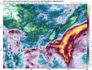
From KCHS NWS office, a flood watch has been issued for its entire area:
SHORT TERM /FRIDAY THROUGH SUNDAY/
FRIDAY AND SATURDAY: A COLD FRONT IS FORECAST TO STALL OVER THE
AREA FRIDAY MORNING AND LINGER INTO SATURDAY. WAVES OF LOW
PRESSURE SHOULD DEVELOP AND MOVE EAST ALONG THE FRONT AS SPOKES
OF VORTICITY PASS THROUGH ALOFT. THIS COUPLED WITH BUILDING
PWATS OF 2.25-2.50" AND WEAK TO MODERATE LEVELS OF INSTABILITY
WILL SUPPORT NUMEROUS TO WIDESPREAD SHOWERS/TSTMS THROUGH THE
PERIOD.
THE STEERING FLOW WILL WEAKEN WITH TIME WITH MODIFIED
SOUNDINGS SUGGESTING LONG/SKINNY CAPE PROFILES DEVELOPING FRIDAY
AFTERNOON AND LINGERING INTO SATURDAY. THIS WILL SUPPORT
CONVECTION WHERE WARM CLOUD PROCESSES WILL SUPPORT INTENSE
RAINFALL RATES, POSSIBLY >3 IN/HR AT TIMES, GIVEN THE RICH,
TROPICAL MOISTURE PLUME THAT WILL BE IN PLACE. THIS MAY LEAD TO
AREAS OF FLASH FLOODING, ESPECIALLY IN THE CORRIDOR ROUGHLY
SOUTH OF A REIDSVILLE-SPRINGFIELD-WALTERBORO-MONCKS CORNER LINE
WHERE 20CM SOIL MOISTURE VALUES ARE RUNNING IN THE >98TH
PERCENTILE AS OF THE 18 AUGUST ANALYSIS.
GIVEN THE SATURATED SOIL MOISTURE PROFILES IN PLACE AND THE
INTENSE HOURLY RAINFALL RATES THAT ARE POSSIBLE, THE RISK FOR
FLASH FLOODING WILL BE ELEVATED INTO SATURDAY EVENING,
ESPECIALLY IN THE COASTAL CORRIDOR WHERE THE EVENING HIGH TIDES
BOTH FRIDAY AND SATURDAY COULD ENHANCED THE FLOOD THREAT. A
FLOOD WATCH HAS BEEN ISSUED FROM FRIDAY MORNING THROUGH EARLY
SUNDAY EVENING. STORM TOTALS DURING THIS PERIOD WILL RANGE FROM
2-4" WITH ISOLATED AMOUNTS POSSIBLY EXCEEDING 6".
Last edited:
Brent
Member
Drizzle Snizzle
Member
I’m not sure if I would call 5 straight days of rain the best week. Give me sunshine and low humidity.Next week looking like the best summer week we've ever had
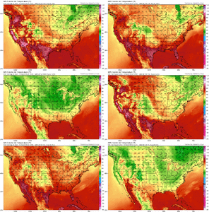
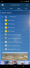
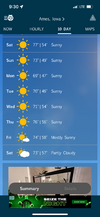
I had to go out to day 14 to even find a 90!View attachment 174488
Does anybody know what tool Weatherman Plus is using at the beginning of his video? Is that Windy.com premium or something else? It's not Windy free or Zoom Earth...and I don't think it's WeatherWise either.

