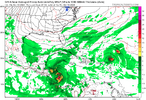
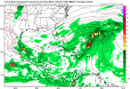
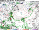
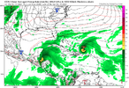
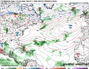
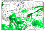
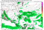
Way out in the Atlantic for now
-
Hello, please take a minute to check out our awesome content, contributed by the wonderful members of our community. We hope you'll add your own thoughts and opinions by making a free account!
You are using an out of date browser. It may not display this or other websites correctly.
You should upgrade or use an alternative browser.
You should upgrade or use an alternative browser.
Tropical 94L
- Thread starter SD
- Start date
Shaggy
Member
Has a very well-defined spin just has to survive long enough to get into better conditionsWay out in the Atlantic for now
Shaggy
Member
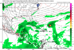
Icon came in further north by a good bit at 18z but still appears set to male the handoff to the high pressure.
The seasonal trend is for dominate high-pressure over the US and western Atl. No reason for me to doubt the hand off at his time.
The seasonal trend is for dominate high-pressure over the US and western Atl. No reason for me to doubt the hand off at his time.
lexxnchloe
Member
Brent
Member
GFS probably recurves eventually
lexxnchloe
Member
Shaggy
Member
Ensembles.are a bit further west with it but still a recurve
lexxnchloe
Member
lexxnchloe
Member
ICON gets it very close and it might do what LC says and be an East coast hybrid
View attachment 153227
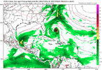
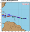
0Z UKMET: moving WSW underneath a deep high toward E Cuba:
TROPICAL DEPRESSION 94L ANALYSED POSITION : 17.3N 36.3W
ATCF IDENTIFIER : AL942024
LEAD CENTRAL MAXIMUM WIND
VERIFYING TIME TIME POSITION PRESSURE (MB) SPEED (KNOTS)
-------------- ---- -------- ------------- -------------
0000UTC 14.10.2024 0 17.3N 36.3W 1013 24
1200UTC 14.10.2024 12 17.2N 38.4W 1014 23
0000UTC 15.10.2024 24 16.7N 40.3W 1012 23
1200UTC 15.10.2024 36 16.4N 42.4W 1012 23
0000UTC 16.10.2024 48 16.6N 45.2W 1011 24
1200UTC 16.10.2024 60 16.8N 48.3W 1012 26
0000UTC 17.10.2024 72 17.7N 51.8W 1011 29
1200UTC 17.10.2024 84 18.6N 56.0W 1011 30
0000UTC 18.10.2024 96 19.9N 59.3W 1011 29
1200UTC 18.10.2024 108 21.4N 62.4W 1012 27
0000UTC 19.10.2024 120 22.3N 65.3W 1012 28
1200UTC 19.10.2024 132 22.5N 67.8W 1011 27
0000UTC 20.10.2024 144 22.2N 70.1W 1010 29
1200UTC 20.10.2024 156 21.4N 72.0W 1009 29
0000UTC 21.10.2024 168 20.8N 73.5W 1007 25
lexxnchloe
Member
lexxnchloe
Member
12Z UKMET: further S than prior runs moving WSW through E Cuba into the NW Caribbean. This is similar to the 12Z Icon hit on E Cuba while moving SW, a climatological rarity. Cuba is one of the more favored land areas for a landfall this time of year but not in that manner:
TROPICAL DEPRESSION 94L ANALYSED POSITION : 17.0N 38.5W
ATCF IDENTIFIER : AL942024
LEAD CENTRAL MAXIMUM WIND
VERIFYING TIME TIME POSITION PRESSURE (MB) SPEED (KNOTS)
-------------- ---- -------- ------------- -------------
1200UTC 14.10.2024 0 17.0N 38.5W 1014 23
0000UTC 15.10.2024 12 16.3N 40.5W 1013 23
1200UTC 15.10.2024 24 15.9N 42.1W 1012 24
0000UTC 16.10.2024 36 15.9N 44.6W 1011 24
1200UTC 16.10.2024 48 16.1N 47.8W 1012 26
0000UTC 17.10.2024 60 16.5N 51.1W 1011 27
1200UTC 17.10.2024 72 17.2N 55.1W 1012 28
0000UTC 18.10.2024 84 17.8N 58.6W 1011 26
1200UTC 18.10.2024 96 19.1N 61.6W 1011 27
0000UTC 19.10.2024 108 19.9N 64.7W 1010 28
1200UTC 19.10.2024 120 20.4N 67.9W 1009 30
0000UTC 20.10.2024 132 20.8N 71.1W 1007 31
1200UTC 20.10.2024 144 20.7N 74.0W 1006 31
0000UTC 21.10.2024 156 20.6N 75.9W 1005 31
1200UTC 21.10.2024 168 19.6N 78.1W 1005 28
Last edited:
lexxnchloe
Member
Henry2326
Member
lexxnchloe
Member
lexxnchloe
Member
Cuba, especially, needs to watch this carefully. Cuba is just about the most vulnerable country to late Oct-Nov storms. But this would be a highly unusual way of them getting hit should it verify although it would make sense based on the upper air pattern.
12Z UKMET text still has TCG/STCG for the initially baroclinic low off the E coast. Not likely to bother any land regardless:
NEW TROPICAL CYCLONE FORECAST TO DEVELOP AFTER 42 HOURS
FORECAST POSITION AT T+ 42 : 35.0N 70.9W
LEAD CENTRAL MAXIMUM WIND
VERIFYING TIME TIME POSITION PRESSURE (MB) SPEED (KNOTS)
-------------- ---- -------- ------------- -------------
1200UTC 17.10.2024 48 36.1N 70.0W 1003 45
0000UTC 18.10.2024 60 38.1N 68.7W 994 48
1200UTC 18.10.2024 72 37.8N 66.4W 1000 46
0000UTC 19.10.2024 84 35.8N 63.3W 1008 38
1200UTC 19.10.2024 96 33.3N 61.9W 1013 31
0000UTC 20.10.2024 108 CEASED TRACKING

