-
Hello, please take a minute to check out our awesome content, contributed by the wonderful members of our community. We hope you'll add your own thoughts and opinions by making a free account!
You are using an out of date browser. It may not display this or other websites correctly.
You should upgrade or use an alternative browser.
You should upgrade or use an alternative browser.
Tropical 94L - PTC to be issued later today
- Thread starter SD
- Start date
lexxnchloe
Member
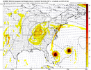
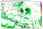
This is somethingView attachment 175037
lexxnchloe
Member
More west than this?
Of course he does. It'll be the best long island express soon
Brent
Member
This is somethingView attachment 175037
Lol I don't think I've ever seen this verify
Laura and Marco were gonna try in 2020 and then Marco just fell apart because Laura was historic
Even the NHC thought it might it got that close in time
Last edited:
GeorgiaGirl
Member
Yeah, after looking good for a few days and even trying to generate spin yesterday, 94L looks crappy right now. Will be interesting though if whether it can try to fire up convection again, wouldn’t be surprised as it’s been feisty, and don’t blame NHC for tagging it with a red.
lexxnchloe
Member
Looks like the seasonal pattern will hold. Up and out
Shaggy
Member
Sounds like it heard you and is firing a quick burst of convectionYeah, after looking good for a few days and even trying to generate spin yesterday, 94L looks crappy right now. Will be interesting though if whether it can try to fire up convection again, wouldn’t be surprised as it’s been feisty, and don’t blame NHC for tagging it with a red.
Brent
Member
The Euro definitely favors the other one dominating
Something to watch
It's very very hard probably nearly impossible for two storms in the Atlantic to co exist that close to each other
Something to watch
It's very very hard probably nearly impossible for two storms in the Atlantic to co exist that close to each other
Shaggy
Member
You have to go back a few days but I remember there was a Euro AI run that developed something south of Cuba near Jamaica and tracked it North up into the Southeast coast makes me wonder if 94l is what it picked up on and it just delayed development until much later
94L is the feature to watch according to the National Weather Service in Raleigh. KRDU mentioned it again in its discussion as something to watch for potential impacts along the East Coast as it gets organized near the Bahamas. They mentioned the uncertainty about it as far as forecast track and intensity but they are definitely paying attention to it.
Overnight models were a lot less bullish on development of 94L.
The Hurricane Hunters are scheduled to pay 94L a visit this afternoon. I doubt they will find much at this stage but at least they can sample environmental conditions around the disturbance and maybe clear up some of the uncertainty about the potential strength of this if it
develops.
develops.
Shaggy
Member
At least it's firing some convection so far today
GeorgiaGirl
Member
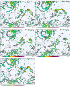
Well, that's a very bizarre ICON run.
Takes a while to develop, then Imelda feels the effects of Humberto, but instead of it being pulled straight OTS it...travels SE through the Bahamas...
Takes a while to develop, then Imelda feels the effects of Humberto, but instead of it being pulled straight OTS it...travels SE through the Bahamas...
Shaggy
Member
You would think with that high sliding off the Northeast Coast that it would at least turn it back North and Northwest for a few frames before finally kicking it out to see I think but of course the GFS does nothing with 94 l so who knowsWell, that's a very bizarre ICON run.
Takes a while to develop, then Imelda feels the effects of Humberto, but instead of it being pulled straight OTS it...travels SE through the Bahamas...
12Z UK 94L: TD just NE of C Bahamas moving ESE
NEW TROPICAL CYCLONE FORECAST TO DEVELOP AFTER 108 HOURS
FORECAST POSITION AT T+108 : 24.5N 77.2W
LEAD CENTRAL MAXIMUM WIND
VERIFYING TIME TIME POSITION PRESSURE (MB) SPEED (KNOTS)
-------------- ---- -------- ------------- -------------
0000UTC 29.09.2025 108 24.5N 77.2W 1008 28
1200UTC 29.09.2025 120 25.0N 77.0W 1008 27
0000UTC 30.09.2025 132 25.0N 77.1W 1007 27
1200UTC 30.09.2025 144 24.4N 76.6W 1006 24
0000UTC 01.10.2025 156 23.9N 75.0W 1005 25
1200UTC 01.10.2025 168 CEASED TRACKING
I'm not sure in my life ive ever typed the following but it looks like fujiwhara will keep this from hitting the EC unless models are way off and even if they are the interaction between 93 and 94l may keep the EC safe
I'm not sure in my life ive ever typed the following but it looks like fujiwhara will keep this from hitting the EC unless models are way off and even if they are the interaction between 93 and 94l may keep the EC safe
I may be wrong, but it seems something like this happened a few years ago.
The Euro showed that really well (0Z run). Of course, as suspected, the ULL in the SE continues to dampen with time and migrate north. Would have been interesting to see what scenario would have played out with TC1 and TC2 in proximity, a strong ULL over AL, and strong ridging over the Lakes and NE.I'm not sure in my life ive ever typed the following but it looks like fujiwhara will keep this from hitting the EC unless models are way off and even if they are the interaction between 93 and 94l may keep the EC safe
The upper level low will be a factor in determining where 94L will go if it should become a potential threat. The National Weather Service in Raleigh mentions it in their discussion as being something that could steer it towards the southeast coast and I saw a podcast earlier thatThe Euro showed that really well (0Z run). Of course, as suspected, the ULL in the SE continues to dampen with time and migrate north. Would have been interesting to see what scenario would have played out with TC1 and TC2 in proximity, a strong ULL over AL, and strong ridging over the Lakes and NE.
mentioned the same scenario.
lexxnchloe
Member
I suppose it could do a Ginger like track and come back west but i think this is the EURO giving us one last fun run for the season. JB is weeping again.
The 12Z EPS, like 0Z and 12Z of yesterday, actually has an uncomfortably high # of members (10+/20%+) hitting the SE US 9/28-10/4, which is earlier than the 10/5-7 12Z Euro freakish US hit.
One thing that’s a bit concerning is the forecasted MJO phase 2 by both GEFS and EPS for 9/27-10/3. As I posted about last month, phase 2 has had (whether inside or outside the circle) by a wide margin the highest % (after taking into account % of days in each phase) of Conus Jul-Sept MH hits and along with phase 8 the highest % of H hits since 1975.
GEFS:
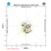
EPS:
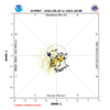
One thing that’s a bit concerning is the forecasted MJO phase 2 by both GEFS and EPS for 9/27-10/3. As I posted about last month, phase 2 has had (whether inside or outside the circle) by a wide margin the highest % (after taking into account % of days in each phase) of Conus Jul-Sept MH hits and along with phase 8 the highest % of H hits since 1975.
GEFS:

EPS:

Per AKQ, 94L could cause issues next week. That’s the one they are watching, but they said run to run consistency even with the same model is lacking. Personally, I don’t think it will be much of anything if it does form. Probably very weak if at all.
Well, it is the GFS.
This is one main reason why I think the Gulf of Mexico/America might become a hot spot for tropical activity over the next few days. Throw in lessening wind shear over the region and very warm water temperatures and you have a recipe for development for any disturbance that might form in this area.The 12Z EPS, like 0Z and 12Z of yesterday, actually has an uncomfortably high # of members (10+/20%+) hitting the SE US 9/28-10/4, which is earlier than the 10/5-7 12Z Euro freakish US hit.
One thing that’s a bit concerning is the forecasted MJO phase 2 by both GEFS and EPS for 9/27-10/3. As I posted about last month, phase 2 has had (whether inside or outside the circle) by a wide margin the highest % (after taking into account % of days in each phase) of Conus Jul-Sept MH hits and along with phase 8 the highest % of H hits since 1975.
GEFS:
View attachment 175054
EPS:
View attachment 175055
lexxnchloe
Member
The 12Z EPS, like 0Z and 12Z of yesterday, actually has an uncomfortably high # of members (10+/20%+) hitting the SE US 9/28-10/4, which is earlier than the 10/5-7 12Z Euro freakish US hit.
One thing that’s a bit concerning is the forecasted MJO phase 2 by both GEFS and EPS for 9/27-10/3. As I posted about last month, phase 2 has had (whether inside or outside the circle) by a wide margin the highest % (after taking into account % of days in each phase) of Conus Jul-Sept MH hits and along with phase 8 the highest % of H hits since 1975.
GEFS:
View attachment 175054
EPS:
View attachment 175055
Upon closer inspection, 40% (20) of 12Z EPS members affect a portion of the SE with either a TC direct landfall, a skirting of the coast, or a weak remnant. Also, a clear majority of members that weren’t steered by a Fujiwhara from Humberto were in that 40%. So, whether or not Humberto pulls 94L into it might turn out to be the crucial factor for whether or not the SE US is threatened.
Shaggy
Member
Separation is going to be critical to the future outcome. If they interact too much we know what happens. If they separate then there's room for some shenanigansUpon closer inspection, 40% (20) of 12Z EPS members affect a portion of the SE with either a TC direct landfall, a skirting of the coast, or a weak remnant. Also, a clear majority of members that weren’t steered by a Fujiwhara from Humberto were in that 40%. So, whether or not Humberto pulls 94L into it might turn out to be the crucial factor for whether or not the SE US is threatened.
Upon closer inspection, 40% (20) of 12Z EPS members affect a portion of the SE with either a TC direct landfall, a skirting of the coast, or a weak remnant. Also, a clear majority of members that weren’t steered by a Fujiwhara from Humberto were in that 40%. So, whether or not Humberto pulls 94L into it might turn out to be the crucial factor for whether or not the SE US is threatened.
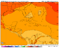
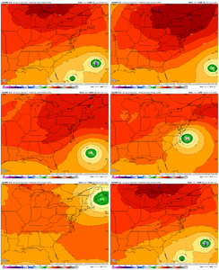
Example: 18Z Icon: no Fujiwhara and 94L gets stuck under the strengthening US Great Lakes ridge and subsequently turns NW toward C FL:
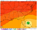
Edit: And the GEFS/EPS are forecasting this to be during the potentially dangerous phase 2.
Last edited:
Bizzaro track.
lexxnchloe
Member
12ZExample: 18Z Icon: no Fujiwhara and 94L gets stuck under the strengthening US Great Lakes ridge and subsequently turns NW toward C FL:
View attachment 175057
Edit: And the GEFS/EPS are forecasting this to be during the potentially dangerous phase 2.
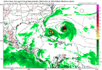
18Z
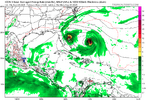
lexxnchloe
Member
GFS still a nothing burger
Shaggy
Member
It has done a good job today maintaining convection but still don't see much in the way of westerlies on its south side yet.

