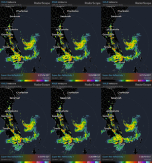
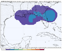
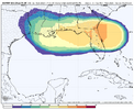
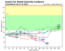
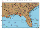
Another one
-
Hello, please take a minute to check out our awesome content, contributed by the wonderful members of our community. We hope you'll add your own thoughts and opinions by making a free account!
You are using an out of date browser. It may not display this or other websites correctly.
You should upgrade or use an alternative browser.
You should upgrade or use an alternative browser.
Tropical 93L
- Thread starter SD
- Start date
I just took a look at the water temperatures in the Gulf and when 93L gets into the Northern Gulf there will be plenty of warm water to work with if it wants to develop. The question, for me at least, is what kind of shape will it be in after it crosses Florida?
I doubt the northern solution honestly.Canadian ensemble mean brings it over Florida into gulf, GEFS mean brings it into south Georgia in 48 hours. Who are you betting on?
BHS1975
Member
May blow up before it gets to FL.I just took a look at the water temperatures in the Gulf and when 93L gets into the Northern Gulf there will be plenty of warm water to work with if it wants to develop. The question, for me at least, is what kind of shape will it be in after it crosses Florida?
Shaggy
Member
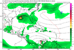
Good sniff out by the icon
lexxnchloe
Member
lexxnchloe
Member
30/40East of the Florida Peninsula into the Northeastern Gulf (AL93):
An area of low pressure located offshore of the east coast of
Florida continues to produce disorganized showers and thunderstorms
primarily south of the center. This system is forecast to move
westward across the Florida Peninsula on Tuesday and Tuesday night,
eventually moving into the northeastern Gulf by the middle part of
this week. Environmental conditions appear generally favorable for
additional development if the system remains offshore, and a
tropical depression could form as the system moves across the
northeastern and north-central Gulf by the middle to latter part of
this week.
Regardless of development, heavy rainfall could produce localized
flash flooding over portions of Florida and the north-central Gulf
coast through the middle to latter portion of this week.
* Formation chance through 48 hours...low...30 percent.
* Formation chance through 7 days...medium...40 percent
Brent
Member
Looks like it's got Louisiana written all over it
Dexter is the next name
Dexter is the next name
King Icon!
If this does develop into a hurricane before landfall, ICON gets the King prefix for a while.
I think it is still more disorganized than it may seem at a glance. BUT, nothing is set in stone. Shear should not be too strong, and the water temps are very favorable. IF it can develop a core quickly, then it could be an impactful storm. Either way, it will be a significant rain-maker for Florida and the Gulf coastal sections.
That and where ( how far north/south) it ejects off of Floridas gulf coast!I just took a look at the water temperatures in the Gulf and when 93L gets into the Northern Gulf there will be plenty of warm water to work with if it wants to develop. The question, for me at least, is what kind of shape will it be in after it crosses Florida?
Looks like it's got Louisiana written all over it
Dexter is the next name
Not gonna lie, seeing a TC move SW across Florida brings back distant memories.
Indeed, the seabreeze here strongly pinned the typical afternoon thunderstorms further inland in a long band near and just west of I-95. That’s what Andy is referring to. It’s not part of 93L, itself. As a result, today was the first day in 6 that gave me no measurable rainfall.
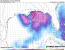
The 18Z UKMET, which shows a 1004 TC at hour 66 at the tip of the SE LA boot (see below), is 6 mb stronger than the 12Z UKMET’s 1010 mb at hour 72. The 12Z run was too weak to be classified as a TC.
View attachment 173512
Followup on UKMET:
-12Z had no TC/lowest SLP 1010 mb
-18Z had a TC/lowest SLP 1004 mb
-0Z is back to no TC/lowest SLP 1013 mb
accu35
Member
I believe once it enters the gulf models will have a more bullish to it.
I believe once it enters the gulf models will have a more bullish to it.
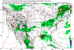
0Z Euro: pulled back slightly from the somewhat more bullish 18Z but still fairly similar to it
Latest UKMET (6Z): 1009 mb
0Z was 1013
18Z was 1004
12Z was 1010
6Z Euro a little weaker than 0Z, which was slightly weaker than the most bullish so far 18Z
6Z ICON weakest in a couple of days with only down to 1011 mb
6Z GFS, like prior GFS runs, has very little
0Z was 1013
18Z was 1004
12Z was 1010
6Z Euro a little weaker than 0Z, which was slightly weaker than the most bullish so far 18Z
6Z ICON weakest in a couple of days with only down to 1011 mb
6Z GFS, like prior GFS runs, has very little
Tropical Weather Outlook
NWS National Hurricane Center Miami FL
800 AM EDT Tue Jul 15 2025
For the North Atlantic...Caribbean Sea and the Gulf of America:
East of the Florida Peninsula into the Northeastern Gulf (AL93):
Satellite and radar data indicate that the shower and thunderstorm
activity associated with the low pressure located just offshore of
the east coast of Florida remains disorganized. This system is
forecast to move westward across the Florida Peninsula today and
then reach the northeastern Gulf by Wednesday. Environmental
conditions appear generally favorable for additional development,
and a tropical depression could form while the system moves across
the northeastern and north-central Gulf.
Regardless of development, heavy rainfall could produce localized
flash flooding over portions of Florida through mid-week. Heavy
rainfall could also cause flash flooding for portions of the
north-central Gulf Coast during the middle to latter portions of
this week.
* Formation chance through 48 hours...medium...40 percent.
* Formation chance through 7 days...medium...40 percent.
$$
Forecaster Bucci
Brent
Member
Yeah it might emerge too close to the northern gulf coast to really do much. Something to watch though
Shaggy
Member
I still see this as a decent win for the icon. The system formed and moved in thendirection it said while other models showed nothing.
Brent
Member
Probably too close to the coast to do much. I mean they might pull the trigger just because of location but it's still stuck at 40/40 in the outlook 


Brent
Member
Per this it was just inland at 12Z:
View attachment 173530
Thus, I think it’s currently more realistically at 20% rather than 40%.
Yeah I really think if they were gonna bother they would have started a PTC already. I mean it would be immediate warnings anyway
lexxnchloe
Member
The mighty 93L has struck out.
Tropical Weather Outlook
NWS National Hurricane Center Miami FL
800 PM EDT Wed Jul 16 2025
For the North Atlantic...Caribbean Sea and the Gulf of America:
1. Northeastern and north-central Gulf (AL93):
Surface and radar observations indicate that a westward-moving broad
area of low pressure continues to be located near the coast of the
western part of the Florida Panhandle. The associated shower and
thunderstorm activity remains disorganized and located south to
southwest of the center. This system is forecast to continue moving
westward across the northern portion of the Gulf tonight, and is
expected to reach the Louisiana coast by Thursday. If this system
moves far enough offshore, environmental conditions over the Gulf
appear generally favorable for additional development, and a
tropical depression could form over the next day or so before the
system moves fully inland by the end of the week.
Regardless of development, heavy rainfall could produce localized
flash flooding over portions of Florida tonight and continuing for
portions of the north-central Gulf Coast through Friday. For
additional information, please refer to products issued by the
Weather Prediction Center and your local National Weather Service
office.
* Formation chance through 48 hours...medium...40 percent.
* Formation chance through 7 days...medium...40 percent.
Forecaster Papin
They later lowered it to 30% for a few, but even they seemed too high. Finally they dropped it to 10% at 2PM today though it should probably be 0%. I consider this to be a big fail for the ICON, which of course is good news in this case.
Tropical Weather Outlook
NWS National Hurricane Center Miami FL
200 PM EDT Thu Jul 17 2025
For the North Atlantic...Caribbean Sea and the Gulf of America:
1. Northern Gulf Coast and Southeastern Louisiana (AL93):
Satellite, surface, and radar data indicate that the broad low
pressure area is moving inland over southeastern Louisiana, and
that the associated shower and thunderstorm activity remains
disorganized and located mainly to the west and southwest
of the center. Little development is expected while the center
remains near the coast this afternoon and tonight, and the system
is expected to weaken as it moves farther inland on Friday.
Regardless of development, heavy rainfall could produce localized
flash flooding over portions of the north-central Gulf Coast through
Friday. For additional information, please refer to products issued
by the Weather Prediction Center and your local National Weather
Service office.
* Formation chance through 48 hours...low...10 percent.
* Formation chance through 7 days...low...10 percent.
Forecaster Beven
Last edited:
"He's dead, Jim"

