• Hello, please take a minute to check out our awesome content, contributed by the wonderful members of our community. We hope you'll add your own thoughts and opinions by making a free account!

Tropical 92L

Before things get too fast in here just want to remind everyone that the board covers a large geographic footprint and there may be impacts spread well across the area so there at times could be discussion about how much rain in a location, what is the chance of severe weather, or other aspects away from the immediate path of any tropical system.
 
12Z UKMET: shifts back east from 0Z run’s far SE LA to MS/AL border track to new track into FL Pan for mid-grade TS followed by NNE and then NNW move in AL:

NEW TROPICAL CYCLONE FORECAST TO DEVELOP AFTER 66 HOURS
FORECAST POSITION AT T+ 66 : 22.8N 92.4W

LEAD CENTRAL MAXIMUM WIND
VERIFYING TIME TIME POSITION PRESSURE (MB) SPEED (KNOTS)
-------------- ---- -------- ------------- -------------
1200UTC 08.10.2026 72 24.0N 91.4W 1002 30
0000UTC 09.10.2026 84 25.2N 89.4W 999 34
1200UTC 09.10.2026 96 26.7N 88.0W 996 44
0000UTC 10.10.2026 108 28.7N 86.9W 995 49
1200UTC 10.10.2026 120 32.1N 86.1W 999 26
0000UTC 11.10.2026 132 34.5N 87.3W 1001 26
1200UTC 11.10.2026 144 CEASED TRACKING
 
Last edited:
Tropical Weather Outlook
NWS National Hurricane Center Miami FL
200 PM EDT Mon Oct 5 2026

For the North Atlantic...Caribbean Sea and the Gulf of America:

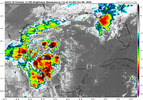
1. Southwestern Gulf of America (AL92):
A trough of low pressure over the southwestern Gulf of America is
producing disorganized showers and thunderstorms. Although
environmental conditions appear to be marginally conducive, gradual
development is becoming more likely, and a tropical depression is
expected to form during the middle portion of the week. This system
is expected to drift eastward over the next couple of days, before
it turns northward. It is too early to determine the specific
impacts to the northern Gulf Coast, but interests there should
closely monitor the progress of this system.
* Formation chance through 48 hours...medium...60 percent.
* Formation chance through 7 days...high...80 percent.
 
This might be just what the doctor ordered in conjunction with the jet stream to be the drought buster many of us have been hoping for. The late weekend timing should enhance what was a good chance of rain for many of us in the Southeast. Let's hope the wind shear does its thing and keeps hurricane conditions away from the Gulf Coast.
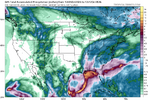
 
This might be just what the doctor ordered in conjunction with the jet stream to be the drought buster many of us have been hoping for. The late weekend timing should enhance what was a good chance of rain for many of us in the Southeast. Let's hope the wind shear does its thing and keeps hurricane conditions away from the Gulf Coast.
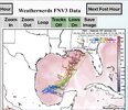
It seems that rainfall would be mostly beneficial from this storm. I'd shift the heaviest rainfall axis associated with the core eastward, deferring to the Google model. The forward speed will keep flooding risk minimal, IMO.

Inland winds will likely be higher than one would think, given the forecasted pressure gradient associated with the building CAD. Depending, of course, on how intense the storm makes landfall.
1791225441555.png
 
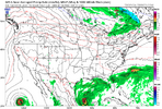
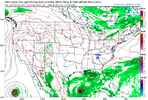
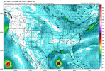
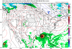
12z Google suite looks slightly weaker/less clustered

IMG_3803.jpeg
 
Back
Top