• Hello, please take a minute to check out our awesome content, contributed by the wonderful members of our community. We hope you'll add your own thoughts and opinions by making a free account!

Tropical 91L

AI/Euro might end up scoring a coup here.

Looks weaker than it did yesterday, where it was small, but more convectively active.

Would honestly be a big bust here as multiple models were honking initially.
 
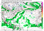
12Z Icon is the weakest in quite awhile with no closed surface low at 72 hours.
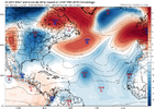
Totally gone. The backloaded season is going to be delayed. The good news is with no change in the pattern since AUG01 the powerful east coast trof will keep delivering cool, dry air. Had there been east coast threats the heat and humidity would return as well. The protective trof is easily seen here

1757087350900.png
 
Totally gone. The backloaded season is going to be delayed. The good news is with no change in the pattern since AUG01 the powerful east coast trof will keep delivering cool, dry air. Had there been east coast threats the heat and humidity would return as well. The protective trof is easily seen here

View attachment 174796
I wouldn't get too punchy with "seasons over". Plenty more lows on the way where that one came from....

ec-aifs_mslpa_atl_61.png
 
12Z JMA fwiw still has it in the MDR at 72 (1008 mb TC). So far, it is the only major 12Z op model still with it with only the Euro to go:

IMG_4525.png

Edit: For record-keeping purposes now that the rest of the run has been released, the 12Z JMA is a bit slower than the prior two. But it still has a similar idea of an early recurve with a H moving N along 60W 144-192.
 
Last edited:
And NHC out there with their arse blowing in the wind.....

I imagine they'll probably downgrade this area by a lot soon.

I'll be honest, maybe I should've just trusted my own eyes haha. I was only casually looking, but until yesterday for a brief period, I saw nothing of real interest on the actual satellite in spite of models being bullish.

I imagine that IF this ends up being a thing, it'll be because of the remnants ending up in the CAG several days from now. If there's no CAG storm acting as a flagship, this may be the quiet year that's been begged for for years.
If it does end up being that quiet year, I had a feeling early on in the season when the EPAC fired warning shots...by a developing 2 very strong TCs early in the season and manufacturing TC after TC for awhile.

Its very very hard to have both the EPAC and ATL to be very active in the same calendar year. There have been many EPAC systems traveling well west into the basin, even a couple crossing into the CPAC area of responsibility.

The ATL side has had one true "MDR" storm... Erin so far and everything else, homegrown.
The majority of the TCs have been in the subtropical region with 4 developing off the SE coast off decaying fronts
 
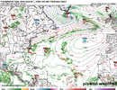
The EURO just thew a curveball

Has the dead wave turn into a 1007 low near Bermuda

View attachment 174800
Euro keeping the dream alive.....

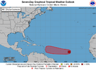
ZCZC MIATWOAT ALL
TTAA00 KNHC DDHHMM

Tropical Weather Outlook
NWS National Hurricane Center Miami FL
200 PM EDT Fri Sep 5 2025

For the North Atlantic...Caribbean Sea and the Gulf of America:

1. Tropical Atlantic (AL91):
Shower and thunderstorm activity is currently limited and
disorganized in association with a tropical wave over the central
tropical Atlantic. Although upper-level winds are generally
favorable for development, environmental dry air is likely to limit
development over the next couple of days. However, a tropical
depression could still form early next week as the system moves
westward at around 10 mph across the central tropical Atlantic. This
system is likely to be near the Lesser Antilles by the middle to
latter part of next week, and interests there should monitor its
progress.
* Formation chance through 48 hours...medium...40 percent.
* Formation chance through 7 days...high...70 percent


🤣🤣🤣🤣🤣🤣🤣🤣🤣

two_atl_7d0.png
 
Back
Top