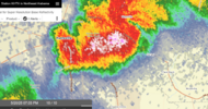
As requested
-
Hello, please take a minute to check out our awesome content, contributed by the wonderful members of our community. We hope you'll add your own thoughts and opinions by making a free account!
You are using an out of date browser. It may not display this or other websites correctly.
You should upgrade or use an alternative browser.
You should upgrade or use an alternative browser.
Severe 5/19-21 2025 Severe
- Thread starter SD
- Start date
Brent
Member
Brent
Member
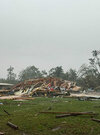
Hail storm moving in hereView attachment 172847
Overall that was pretty anti climatic otherwise. Storm mode really killed what the days of hype had been about here locally
Friday and Sunday sure panned out north of here though
Downeastnc
Member
Brent
Member
Brent
Member
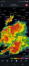
Tulsa gonna have a lot of surveys from last night wow
It really blew up east and south of here
It really blew up east and south of here
NWMSGuy
Member
Had a line of showers and thunderstorms move through around 8AM locally. It appears recovery is already underway here. 
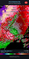
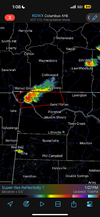
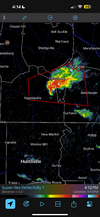
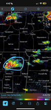
And that cell is bringing up the rear. Ripe out thereLone tornado warned cell in far NW Alabama
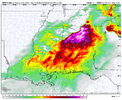
View attachment 172860
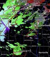
Per scanner traffic confirmed tornado on ground near Buc-ee’s near Huntsville
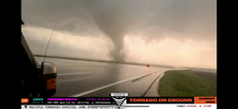
Reed just took a direct hit from a tornado west of Huntsville. Insane footage. Holy crap
Crossing Greenbrier now eastbound
ForsythSnow
Moderator
Tornado watch extended into NW and N Central GA.
Approaching MidCity now per scanner
HUNTSVILLE TOR NOW JUST NORTH OF THE CITY.
HWY 72 AND JEFF RD
HWY 72 AND JEFF RD
NEW TOR WATCH COMING FOR ALABAMA SHORTLY PER SPC
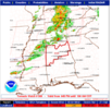
URGENT - IMMEDIATE BROADCAST REQUESTED
Tornado Watch Number 309
NWS Storm Prediction Center Norman OK
645 PM CDT Tue May 20 2025
The NWS Storm Prediction Center has issued a
* Tornado Watch for portions of
Central Alabama
* Effective this Tuesday night and Wednesday morning from 645 PM
until 100 AM CDT.
* Primary threats include...
A few tornadoes and a couple intense tornadoes possible
Scattered damaging wind gusts to 70 mph likely
Scattered large hail and isolated very large hail events to 2.5
inches in diameter possible
SUMMARY...Supercells and thunderstorm clusters will move
east-southeastward across parts of central Alabama this evening and
into the early overnight hours. A few tornadoes and occasional large
to very large hail will be possible with the more discrete
convection. An increasing threat for severe/damaging winds may exist
later this evening as thunderstorms grow upscale into a line.
The tornado watch area is approximately along and 50 statute miles
north and south of a line from 45 miles west of Tuscaloosa AL to 35
miles northeast of Anniston AL. For a complete depiction of the
watch see the associated watch outline update (WOUS64 KWNS WOU9).
PRECAUTIONARY/PREPAREDNESS ACTIONS...
REMEMBER...A Tornado Watch means conditions are favorable for
tornadoes and severe thunderstorms in and close to the watch
area. Persons in these areas should be on the lookout for
threatening weather conditions and listen for later statements
and possible warnings.
&&
OTHER WATCH INFORMATION...CONTINUE...WW 303...WW 304...WW
305...WW 306...WW 307...WW 308...
AVIATION...Tornadoes and a few severe thunderstorms with hail
surface and aloft to 2.5 inches. Extreme turbulence and surface wind
gusts to 60 knots. A few cumulonimbi with maximum tops to 500. Mean
storm motion vector 28030.
GeorgiaGirl
Member
The tornado with this storm in Alabama is back down and getting bigger.
Huntsville really dodged a massive bullet here apparently with the tornado cycling before it hit the town, from the way it sounded with it being close, the TOR-E issued was the right idea.
Edit: At least it's down per radar and is messing up trees.
Huntsville really dodged a massive bullet here apparently with the tornado cycling before it hit the town, from the way it sounded with it being close, the TOR-E issued was the right idea.
Edit: At least it's down per radar and is messing up trees.
Shaggy
Member
Reeds intercept was just crazy. Goes to show how a weaker broad tornado can have a suction vortices really crank up and get violent quickly. Lucky the dominator only got spun sideways and not rolled over
Gotta be something down around New Hope.
NOTHING PER THE NWS HUN CHAT ROOMGotta be something down around New Hope.
THATS NOT GOOD...
THE HUNTSVILLE HYTOP RADAR JUST WENT DOWN AND IS GOING TO BE DOWN THE RAMAINDER OF THE NIGHT
THE HUNTSVILLE HYTOP RADAR JUST WENT DOWN AND IS GOING TO BE DOWN THE RAMAINDER OF THE NIGHT
Really hoping this busts for those of us in and around Birmingham. Hate the overnight threats with little ones. Will be interesting to watch it unfold
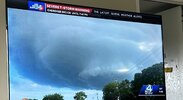
The tornado that went through Huntsville, AL around 1845 was too close for comfort.
We had about 1.5" hail here.
We had about 1.5" hail here.

