-
Hello, please take a minute to check out our awesome content, contributed by the wonderful members of our community. We hope you'll add your own thoughts and opinions by making a free account!
You are using an out of date browser. It may not display this or other websites correctly.
You should upgrade or use an alternative browser.
You should upgrade or use an alternative browser.
Severe 4/22 Severe
- Thread starter SD
- Start date

latest hrrr
View attachment 042223.mp4
View attachment 042223.mp4
6z hrrr UH
View attachment 042223.mp4
View attachment 042223.mp4
CannedHeat
Member
Just had a tornado warning in north Mecklenburg. Wasn't expecting to wake up to that.

Definitely not a non tornado threat, isolated but only takes one.6z hrrr UH
View attachment 134956
Brick Tamland
Member
WATCH COUNTY NOTIFICATION FOR WATCH 159
NATIONAL WEATHER SERVICE RALEIGH NC
1011 AM EDT SAT APR 22 2023
THE NATIONAL WEATHER SERVICE HAS ISSUED SEVERE THUNDERSTORM WATCH
159 IN EFFECT UNTIL 6 PM EDT THIS EVENING FOR THE FOLLOWING AREAS
IN NORTH CAROLINA THIS WATCH INCLUDES 21 COUNTIES
IN CENTRAL NORTH CAROLINA
CHATHAM CUMBERLAND DURHAM
EDGECOMBE FRANKLIN GRANVILLE
HALIFAX HARNETT HOKE
JOHNSTON LEE MOORE
NASH ORANGE PERSON
SAMPSON VANCE WAKE
WARREN WAYNE WILSON
THIS INCLUDES THE CITIES OF ABERDEEN, ANGIER, APEX, BUIES CREEK,
CARRBORO, CARTHAGE, CARY, CHAPEL HILL, CLAYTON, CLINTON,
CREEDMOOR, DUNN, DURHAM, ENFIELD, ERWIN, FAYETTEVILLE,
FRANKLINTON, GOLDSBORO, HENDERSON, HILLSBOROUGH, HOPE MILLS,
KITTRELL, KNIGHTDALE, LILLINGTON, LOUISBURG, NASHVILLE, NORLINA,
OXFORD, PINEHURST, PITTSBORO, PRINCEVILLE, RAEFORD, RALEIGH,
ROANOKE RAPIDS, ROCKY MOUNT, ROSEBORO, ROUGEMONT, ROXBORO,
SANFORD, SCOTLAND NECK, SELMA, SILER CITY, SMITHFIELD,
SOUTHERN PINES, SPRING HOPE, SPRING LAKE, TARBORO, WAKE FOREST,
WARRENTON, AND WILSON.
Brick Tamland
Member
From WRAL. Sounds like another situation of the early storms either weakening or strengthening storms later in the day. If the storms come through and then the sun comes out it could make it more humid and give the spark for stronger storms later. If it stays overcast and not much sun then we usually don't get the strong storms later.
Few severe thunderstorm warnings right now, but this line is actually weakening as it moves into the area. There is not much energy for these storms to work with right now. You walk outside, and it’s pretty comfortable. We need more moisture/humidity to really get strong storms going. Still on track to see the actual cold front crossing this afternoon. Will see if the atmosphere can “recover”. Will monitor it closely!
#ncwx
Last edited:

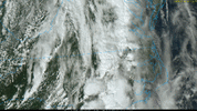
Need to get into this clearing if we are going to get anything later today
View attachment 042223.mp4
HRRR still has multiple lines today
View attachment 042223.mp4
View attachment 042223.mp4
HRRR still has multiple lines today
View attachment 042223.mp4
Brick Tamland
Member
Yeah, need to get the sun out. The rain and clouds this morning will just junk things up if we don't get some clearing.Need to get into this clearing if we are going to get anything later today
View attachment 134960
HRRR still has multiple lines today
View attachment 134961
Really want to see how that cell near ansonville behaves
ya that one is flying up. got plenty of 0-6 bulk shear to keep it aliveReally want to see how that cell near ansonville behaves
Brick Tamland
Member
Rain has stopped and the sun is trying to come out. Have to see if it's going to have enough time to create more instability.
Anything that can get going right now before it gets too crowded seems like it might end up with a shot at a tornado and higher end hail. This might be that cell for our area imoya that one is flying up. got plenty of 0-6 bulk shear to keep it alive
Anything that can get going right now before it gets too crowded seems like it might end up with a shot at a tornado and higher end hail. This might be that cell for our area imo

He’s got a lil DP boundary to ride too
Nice cell over SE NC 
Brick Tamland
Member
Not enough sun for anything here today. The usual case when we get rain in the morning.