-
Hello, please take a minute to check out our awesome content, contributed by the wonderful members of our community. We hope you'll add your own thoughts and opinions by making a free account!
You are using an out of date browser. It may not display this or other websites correctly.
You should upgrade or use an alternative browser.
You should upgrade or use an alternative browser.
Wintry 3/10-13 Winter Weather
- Thread starter SD
- Start date
- Status
- Not open for further replies.
Z
Zander98al
Guest
The heavier
The heavier the sooner and the best chance snow will stick. Heavy snow rates overcome that surface temp heatIntense QPF on the GFS, it will not snow long by the looks of it, but when/if it does then it should be heavy.
HSVweather
Member
This shows that dry slot clearly ARCC mentioned around Tuscaloosa, Hanceville area.
ATLwxfan
Member
That’s just nutty. Several individual members with a wallop for ITP Atlanta. Just trying to think if the cold gets here sooner then it’s possible I guess.
Sent from my iPhone using Tapatalk
we always get slotted in T-Town, that's why I named myself President of "Snow Hole"This shows that dry slot clearly ARCC mentioned around Tuscaloosa, Hanceville area.
DadOfJax
Member
How many times have we seen this.....heaviest snow axis keeps shifting ESE as the even draws closer. IMHO, this just shows the models inability to recognize moisture exiting prior to cold air pushing in. Its like they are always playing catch up, but never quite getting it right. We shall see.
ChattaVOL
Member
Don’t complain just let it happen

Sent from my iPhone using Tapatalk
HSVweather
Member
I’ll never forget countless 33-34 snow or rains in 05-09 when I lived there. I remember one where my thermometer had 32.9 and snow falling pretty good for most of the event.we always get slotted in T-Town, that's why I named myself President of "Snow Hole"
Honestly I would take whatever the models have for that “East” band and cut totals by 3/4 except in the higher elevations because the models are ALWAYS too slow with how fast the band moves out. Of course a 1/2” to 1” would definitely be a win for nearly everyone.That’s just nutty. Several individual members with a wallop for ITP Atlanta. Just trying to think if the cold gets here sooner then it’s possible I guess.
Sent from my iPhone using Tapatalk
Gonna cut the grass today to take care of the weeds. Gonna need a good flat turf for my dusting
ForsythSnow
Moderator
Unsure if mentioned or not but the RAP seems to be with the trends further SE into GA as well.
Z
Zander98al
Guest
You mean half a foot? ?Gonna cut the grass today to take care of the weeds. Gonna need a good flat turf for my dusting
L
Logan Is An Idiot 02
Guest
Elevated weeds melt slower. ? HahaGonna cut the grass today to take care of the weeds. Gonna need a good flat turf for my dusting
DadOfJax
Member
Been saying it.....this is not how we get decent snow in AL.Honestly I would take whatever the models have for that “East” band and cut totals by 3/4 except in the higher elevations because the models are ALWAYS too slow with how fast the band moves out. Of course a 1/2” to 1” would definitely be a win for nearly everyone.
Webberweather53
Meteorologist
Blue_Ridge_Escarpment
Member
Not a Carolina storm though lol15z Rap is what carolina folks would like View attachment 115371
Storm5
Member
Been saying it.....this is not how we get decent snow in AL.
Who cares what the setup is ?? It's damn march and it's gonna snow . No one is suggesting we get a big storm out of this . We get you're point you've repeated it 1000 times
Sent from my iPhone using Tapatalk
Flotown
Member
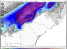
Don't care for the bullseye 36 hours out but I'll take it for now.
warmer than that, will be nearMe too...lolGonna cut the grass today to take care of the weeds. Gonna need a good flat turf for my dusting
L
Logan Is An Idiot 02
Guest
Nice to see you back Webb! Congrats on the snow
Welcome back, Webb
DadOfJax
Member
I would venture to say that most people on this forum with any weather knowledge cares what kind of setup it is. Yes it’s March, but snow is far from guaranteed with this system for much of AL. The models are suggesting it’s a big storm +2 inches. I’m glad my point is clear, and I understand you don’t like it, but it’s a weather forum….so we discuss all possibilities, not just what we want to happen. JMHO.Who cares what the setup is ?? It's damn march and it's gonna snow . No one is suggesting we get a big storm out of this . We get you're point you've repeated it 1000 times
Sent from my iPhone using Tapatalk
Storm5
Member
I would venture to say that most people on this forum with any weather knowledge cares what kind of setup it is. Yes it’s March, but snow is far from guaranteed with this system for much of AL. The models are suggesting it’s a big storm +2 inches. I’m glad my point is clear, and I understand you don’t like it, but it’s a weather forum….so we discuss all possibilities, not just what we want to happen. JMHO.
I get you're point . Your said it 1000 times . It's not that I don't like what you're saying it's that you're saying it over and over and over . We get . I'll just delete duplicate messages moving forward . Sad people have to be babysat on a weather board
Sent from my iPhone using Tapatalk
RollTide18
Member
View attachment 115367
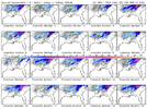
You can easily pick up on the screw zone/dry slot ARCC was referring to on the latest GEFS
Just NW or BHM
18 of 20 members showing snow for mby which is the most I’ve seen from the ensembles
in a few years, and while I highly doubt that flakes fly this south in Alabama, it is pretty cool to see.
packfan98
Moderator
Good point. Unfortunately your tone makes it seem like you are a troll.I would venture to say that most people on this forum with any weather knowledge cares what kind of setup it is. Yes it’s March, but snow is far from guaranteed with this system for much of AL. The models are suggesting it’s a big storm +2 inches. I’m glad my point is clear, and I understand you don’t like it, but it’s a weather forum….so we discuss all possibilities, not just what we want to happen. JMHO.
At this point, relative to my location in Alabama, and suffering numerous rug pulls in the past, the following scenarios are wins:
- dusting
- 1 inch or more
- flakes flying
If I get nothing, that's ok, I'm used to it. It's March baby, and I'm gonna be a weenie!!!modernweenie
modernweeniemodernweeniemodernweeniemodernweeniemodernweeniemodernweeniemodernweeniemodernweeniemodernweeniemodernweeniemodernweeniemodernweeniemodernweeniemodernweeniemodernweeniemodernweeniemodernweeniemodernweeniemodernweeniemodernweeniemodernweeniemodernweeniemodernweeniemodernweeniemodernweenie
Believe me, we know you’ve been saying it.Been saying it.....this is not how we get decent snow in AL.
coldfront22
Member
Great to see March snow. Any chance the NC foothills see some flakes.
ChattaVOL
Member
We are tracking about 2-3 degrees cooler than forecasted so far today… also heavyish mist off and on.
Sent from my iPhone using Tapatalk
Sent from my iPhone using Tapatalk
There is a thing called beating a dead horse. Nobody likes that, tbh. It's not personal against you. But even though it's a forum and we discuss all possibilities, as you say, people can still try not to be annoying.What’s sad is that you think a weather forum needs babysat because someone posts something that disagrees with the majority of what peoples want.
- Joined
- Jan 23, 2021
- Messages
- 4,595
- Reaction score
- 15,183
- Location
- Lebanon Township, Durham County NC
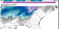
Interesting the RAP has 3" for parts of Northern and Central Alamance and Orange counties. Those are kuchera maps as well, not 10:1.
DadOfJax
Member
Got it. I out on posting in this thread.There is a thing called beating a dead horse. Nobody likes that, tbh. It's not personal against you. But even though it's a forum and we discuss all possibilities, as you say, people can still try not to be annoying.
L
Logan Is An Idiot 02
Guest
Yeah I do not buy that at allInteresting the RAP has 3" for parts of Northern and Central Alamance and Orange counties.
You don't need to be out. Nobody is asking for that.Got it. I out on posting in this thread.
iGRXY
Member
Personally I think everyone west of the apps has a solid shot at 2-5" through northern Alabama, Most of TN, and NW Georgia. Locally higher in East TN and WNC. Cold chasing moisture is nowhere nearly as big of a deal west of the apps as it is east. If anything the mountains help slow moisture down as it gets pushed up against the mountains and creates lift for additional moisture as well.
- Joined
- Jan 23, 2021
- Messages
- 4,595
- Reaction score
- 15,183
- Location
- Lebanon Township, Durham County NC
If anywhere in the piedmont has a shot at this, though, it's gonna be that area around Yanceyville/Burlington/Cedar Grove/Roxboro areas. I seriously doubt 3" but some accumulation in the mulch? maybe?Yeah I do not buy that at all
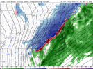
I don't think it's a bad look for the northern 3rd of AL but it could be better. Decent fgen on the cold side and almost an anafrontal look can do well for a low end dusting-2 maybe 3 type event especially in Al/Tn/northwest GA where the LL cold isn't going to be blocked by the apps. If the phasing trough were deeper with more energy focused at the base where we were really able to snap the trough negative and enhance the banded precip over Al this would have a much higher potential. I think the big bugaboo as you get down to bham is how much cold and moisture overlap you have especially with temps as warm as they are going to be as the system trending every so slightly faster and east
Z
Zander98al
Guest
Somebody in Alabama is probably going to get a half a foot of snow. Wherever that heavy band sets up in Alabama will get some really good snow. Hrrr is really persistent on the I20 corridor
- Status
- Not open for further replies.

