HSVweather
Member
00z Euro

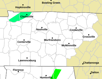
Huntsville pulled the warning for most of their countiesWarning for middle Tenn for 3-6 in...warning down to the Alabama line


No....No....No...My tulips are starting to come up....Where was this dynamic system in December for Christ's sake?Ya’ll been riding the Canadian, looks like it didn’t derail off the tracks so far.?
View attachment 115306
Even if the snow amounts end up being 0...Unfortunately for your tulips , the cold temps will probably verify...SorryNo....No....No...My tulips are starting to come up....Where was this dynamic system in December for Christ's sake?
Perhaps even a few flakes down to I-20 in Atlanta.
ATL has been effed the entire winter.
There's been plenty of chatter plus it's only 8 amLess than 18 hours away from this "snowstorm", and all is quite....people know the feeling of letdown and are on pins and needles.

This thing would be 60-70 pages normally.There's been plenty of chatter plus it's only 8 am
Your so negative but you do youThis thing would be 60-70 pages normally.
As Parker would say, Im just grounded in reality.Your so negative but you do you
The amount of pages doesn't bring more snow lol. It's late season and half the board has zero chance.This thing would be 60-70 pages normally.
Id say we have an okay chance, need one more trend southThe amount of pages doesn't bring more snow lol. It's late season and half the board has zero chance.
Sure doesn't, just shows the confidence level of those involved, and it's apparently extremely low.The amount of pages doesn't bring more snow lol. It's late season and half the board has zero chance.
Yes, and it will be gone by Sunday for most areas...Sure doesn't, just shows the confidence level of those involved, and it's apparently extremely low.
Exactly lol its the lesser amount of people side of the board that's getting effected if it was east of the apps. The board would probably have 70 pages lol. But we have fewer members west.The amount of pages doesn't bring more snow lol. It's late season and half the board has zero chance.

Legit don't know why it's showing 0 snow for eillijay Georgia. When it shows it pouring snow there for over 6 hours and quickly going into the mid 20s temp wise.12Z HRRR holding steady on snow amounts. I’m feeling confident but have to sleep too lol also family, job, life,etc
View attachment 115335
View attachment 115337
Wind gust approaching 50!
View attachment 115338
Sure doesn't, just shows the confidence level of those involved, and it's apparently extremely low.
100% !!Exactly lol its the lesser amount of people side of the board that's getting effected if it was east of the apps. The board would probably have 70 pages lol. But we have fewer members west.
I wonder why Pivotal isn't showing this type of solution for the Atl area on the 6Z GFS

Tropical Tidbits doesn’t either.I wonder why Pivotal isn't showing this type of solution for the Atl area on the 6Z GFSView attachment 115343


